
Heavy Rain, Flooding, and Chance of Severe Weather Staring Down the Southern U.S.
January 22, 2024
Posted: December 25, 2022 9:04 am


It has not been an easy winter for the city of Buffalo and its surrounding communities. A massive lake effect snow storm in November shut down the normally hardy city for days, bringing life to a halt. Unfortunately, for the storm weary city, the region is now seeing more lake effect snow fire up just in time for Christmas.
The storm in Buffalo is part of a monster system that is moving from one side of the country to another. While many people will get their wish for a White Christmas, it will certainly be a mess that could thwart some holiday plans.
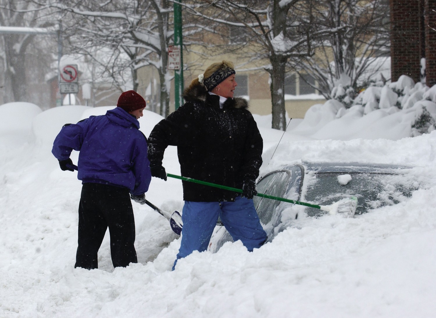
Just how bad will this storm clock in when it wraps up? Meteorologists say that the December 2022 blizzard could end up being one of the most memorable in history. By the end of the Christmas holiday weekend, the region can expect to measure 4 to 6 feet of snow. Winds hitting hurricane force level of over 74 mph will create treacherous travel conditions due to the blowing and drifting snow. This weather will undoubtedly trigger widespread power outages throughout the western half of New York state.
Because of the warmer waters in the Great Lakes this time of the year, it is not unusual for these storms to generate enormous amounts of snow. This is because water that has not yet frozen over will trigger higher amounts of wintry precipitation as the wind sweeps over the lake.
The recent snow event from the middle of November delivered a total of 81.2 inches in the Buffalo suburb of Hamburg. The home of the Buffalo Bills, Orchard Park, recorded 80 inches of snow. Unlike the earlier storm that hit the southern edge of Buffalo the hardest, this current storm will impact the areas farther to the north with greater velocity.
Forecasters are warning that blizzard conditions will likely last for over 48 hours in areas located downwind of the Great Lakes. Because of the amount of blowing snow, it may be difficult to ascertain exactly how much snow is falling.
Travel will continue to be treacherous through the long weekend. Motorists can expect snowfall rates of up to 6 inches per hour that will combine with the powerful winds to make travel impossible in some areas.
Western Michigan should be prepared for 1 to 2 feet of snow by the end of the day Sunday. Some areas of northern Lower Michigan and up through the Upper Peninsula may see 2 to 4 feet of snow by the time the system wraps up.
Local officials are warning residents that it may take days to dig out from this snow. Patience will be required in the days ahead. The good news is that a warming trend is in the long-range forecast headed into the new week. Temperatures are expected to climb in the coming days leading into the new year. If your Christmas plans were canceled because of the weather, it is looking more promising for any New Year’s activities.
Did you find this content useful? Feel free to bookmark or to post to your timeline for reference later.

January 21, 2024

January 19, 2024

January 18, 2024
