
Heavy Rain, Flooding, and Chance of Severe Weather Staring Down the Southern U.S.
January 22, 2024
Posted: November 27, 2023 10:18 am


The Great Lakes are bracing for what is forecast to be the first major lake-effect snow event of the season. A mass of cold air will filter down into the region at the tail end of the week, providing fuel for the snow machine to fire up and create the potential of dangerous travel conditions.
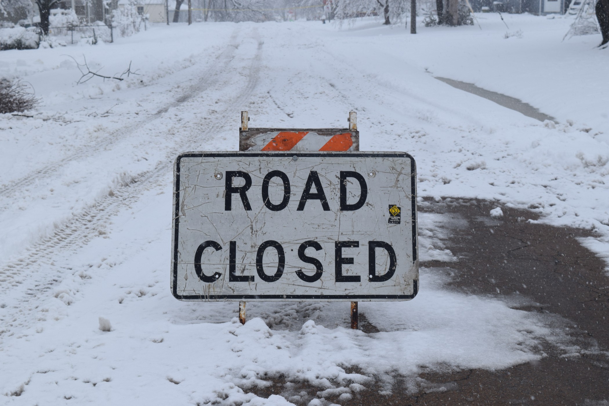
Road Closures Possible Thanks to Major Lake-Effect Snow Event
Snowfall measured in feet rather than inches could be on the horizon for portions of the Upper Midwest, the Great Lakes, and into the interior Northeast for the waning days of November. Forecasters are warning that the snow may be heavy enough to close roads for periods of time.
The lake-effect snow is expected to come together early in the week as the result of three different systems merging and forming one large storm. The first element of this conglomerate will be a storm that is forming along the Atlantic coastline. This system will move to the north on Sunday and Monday and clash with another system that is moving to the northeast over the central Plains. Lastly, a storm churning over western portions of Canada will sweep in from that direction and provide even more fuel.
This large storm will gain strength and generate gusty winds that will mix with the Arctic air coming from Canada to sweep over the open waters of the Great Lakes. This setup is the perfect storm for lake-effect snow to develop. There is also the chance of thunder and lightning triggering a rare thundersnow occurrence.
Motorists will need to pay heed to the chance of sudden snow squalls potentially hampering travel. It is not unusual for these squalls to pop up instantly and wreak havoc on the roads for drivers that are caught off guard. The gusty winds will also raise the risk of widespread power outages.
How Much Snow to Expect and Where
The bulk of the snow will fall across Interstate 90 south of Buffalo and down into Cleveland. Meteorologists are predicting that road closures may be a good possibility along Interstate 81 from Syracuse to Watertown, across Interstate 90 in the western half of New York state, and on portions of interstates 94 and 196 in Michigan.
Snow in the heaviest hit areas could climb over the one-foot benchmark. This impact zone includes northern and western areas of Michigan, the northeastern corner of Ohio, and southwestern New York state. The eastern edges of Lake Ontario in upstate New York may also see snowfall that hits one foot. Snow that lingers over the Upper Peninsula of Michigan and the Tug Hill Plateau in northern New York could experience snow of over 3 feet by the time the weather event wraps up.
Interior portions of the Northeast may also see a few inches of accumulation from this weather maker. This includes accumulating snow in Pittsburgh and Detroit beginning late Sunday and lasting through early Monday.
You can expect the chances of lake-effect snow to drop off by late Tuesday in Michigan and Indiana. However, the snow may linger into Thursday for communities located to the east.
An Alberta clipper storm moving to the southeast could also enhance these snow bands later in the week. All of these elements will translate to a snowy pattern that will remind residents that winter is indeed here to stay for the next few months.
Real Feel Readings Forecast to Drop Dramatically as a Result of Cold Winds
In addition to the snow and winds, the real feel readings will plunge to levels that are typically seen during the middle of the winter. Gusts will hit between 30 and 50 mph across the Great Lakes region, making for blustery conditions. These winds will bring the real feel readings down to about 20 degrees below the actual temperature, meaning that some locales will see temperatures that feel like the teens.
Lastly, the strong winds will raise the risk of overwash and freezing spray along the west and northwest facing shores of the Great Lakes.
Did you find this content useful? Feel free to bookmark or to post to your timeline for reference later.

January 21, 2024

January 19, 2024

January 18, 2024
