
Heavy Rain, Flooding, and Chance of Severe Weather Staring Down the Southern U.S.
January 22, 2024
Posted: May 25, 2023 3:00 pm


Nearly all of Guam is without power after Typhoon Mawar slammed into the U.S. territory on Wednesday. The strong storm has once again intensified into a super typhoon, sending the northern tier of the Philippines, Taiwan, and southern Japan preparing for a potential impact.
Here is the latest on this monster storm churning through the Pacific.
Guam is spending the day Thursday cleaning up from the mess that Mawar left behind. The typhoon’s eye brushed by the island on Wednesday at about 5 pm local time, ushering in heavy rainfall and damaging winds.
According to the Guam Power Authority, only 1,000 out of the 52,000 electric customers on the island still had power a few hours after the storm had passed.
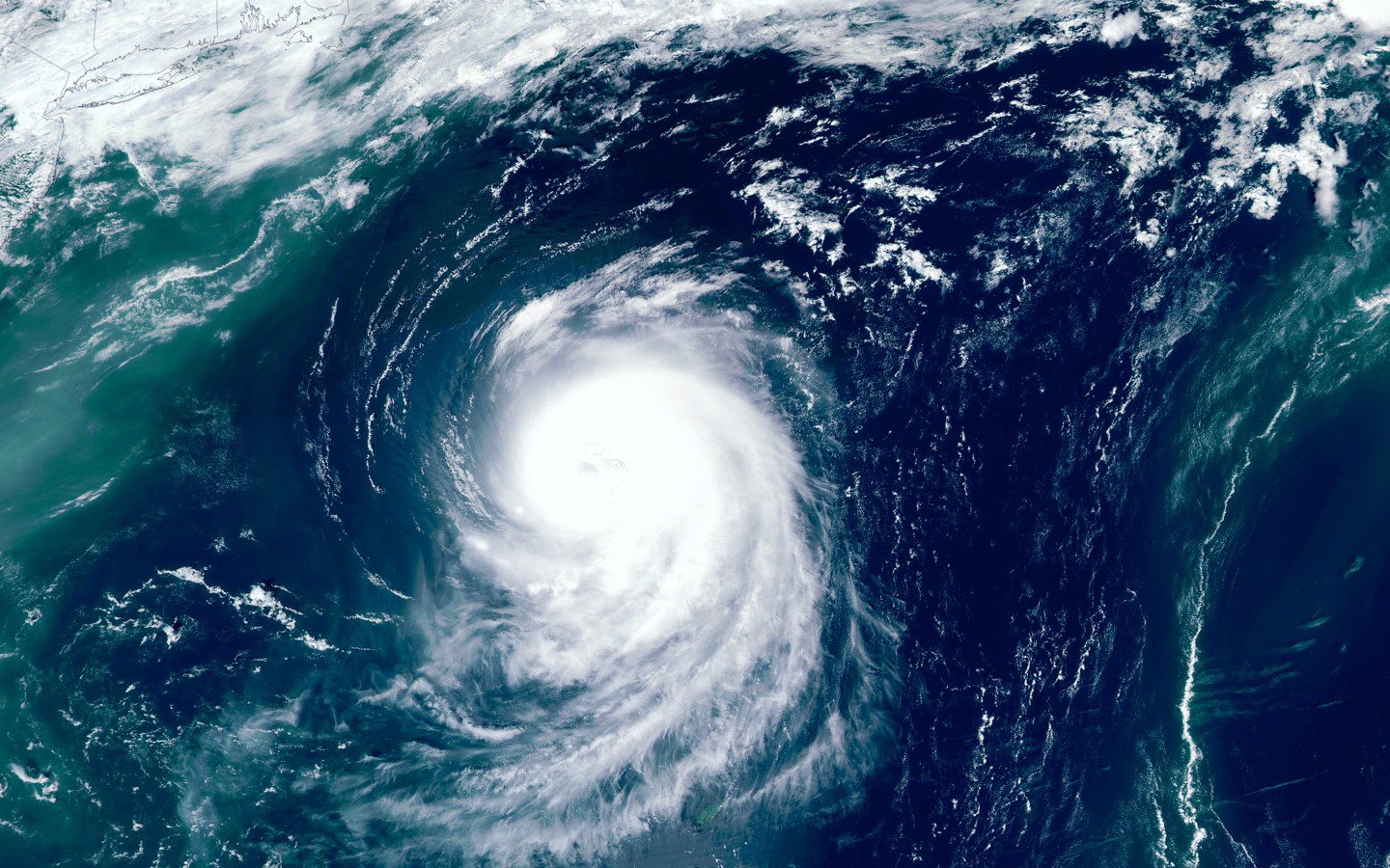
While the eye did make direct landfall on the island, it squeezed in just between Guam and the island of Rota. The northern coast of Guam saw the greatest impacts from the storm with the eyewall’s southern fringes hitting this part of the island. The center of the eyewall needs to come on shore in order for it to be considered an official landfall.
This area of Guam experienced winds ranging from 90 to 110 mph on Wednesday as the storm raged just out to sea. Roofs came off of buildings, trees came down, and vehicles were flipped upside down as the winds picked up. Fortunately, there are no confirmed fatalities as a result of the storm. There have been reports of minor injuries.

According to the Joint Typhoon Warning Center, Mawar became a super typhoon on Tuesday. The storm had weakened slightly when it passed by Guam, fluctuating between a Category 3 major hurricane and a Category 4 major hurricane as defined by the Saffir-Simpson Hurricane Wind Scale.
Mawar has now strengthened back to this highest designation of a tropical event in this corner of the world.
The National Weather Service (NWS) outpost in Guam confirmed on Wednesday that it had lost its radar capabilities due to the high winds.
Ahead of its approach to Guam, Mawar delivered drenching rainfall and damaging winds. For instance, over a foot of rain had been measured in some parts of Guam between Tuesday and Wednesday. The northern community of Dedeo recorded over 27 inches of rainfall in a period of 72 hours.
Not surprisingly, the island is now dealing with the threat of flash flooding and mudslides. Debris blocking the roads has made travel difficult across the region.
As Mawar moved away from the islands near Guam and into the warm ocean waters of the Pacific on Thursday, the storm was able to regain its super typhoon categorization. The wind speeds currently associated with Mawar translate to the equivalent of a Category 4 hurricane.
Maximum sustained winds within Mawar hit 175 mph on Thursday, good enough to become the strongest typhoon in this area of the Pacific during the month of May since Typhoon Damrey churned around in 2000.
It is forecast that Mawar will continue to intensify as it feeds on the warm waters circulating in this section of the Pacific basin. There is a good chance that the storm could hit the equivalent of a major Category 5 hurricane by the weekend.
The storm system is forecast to make a turn to the northwest by early next week. This would put the northern Philippines and Taiwan in the crosshairs. Forecasters will continue to monitor Mawar’s track in the coming days.
There is also the chance that Mawar stalls out east of these potential impact areas, triggering more issues. The Ryukyu Islands of Japan may also see some of Mawar’s impacts by the middle of next week, however, it is likely to lose its punch by that time.
Did you find this content useful? Feel free to bookmark or to post to your timeline for reference later.

January 21, 2024

January 19, 2024

January 18, 2024
