Heavy Rain, Flooding, and Chance of Severe Weather Staring Down the Southern U.S.
January 22, 2024
Posted: August 29, 2022 10:36 pm


More tropical rainfall is in store for the Gulf Coast and into Florida as a new disturbance churns. The rain will be a continuation of the stormy weekend for many areas of the Southeast and beyond.
Florida bore the brunt of the heavy rain this past weekend as stiff sea breezes encouraged potent storms across the peninsula. Daytona Beach recorded 1.95 inches of rain, making it a washout for those hoping to catch some waves over the last weekend of August. In addition, the much-anticipated Coke Zero 400 race was forced to move to Sunday from Saturday because of the inclement conditions.
It was also a messy weekend for the theme park mecca of Orlando with 0.72 of an inch of rain reported on Saturday and more moisture moving through on Sunday. The rain expanded far beyond the Sunshine State with cities in Alabama and Louisiana also seeing about an inch of new rain on Saturday.
The capital city of Mississippi has also been hit hard with heavy rain over the last few days, leading to a river flood warning in effect through Friday afternoon. Jackson Mayor Chokwe Antar Lumumba is urging residents in the impacted areas to evacuate as the Pearl River nears its crest. Although the river had originally been forecast to crest by Tuesday, the National Weather Service (NWS) is now estimating that this will happen by Monday morning.
Mississippi River Gov. Tate Reeves went so far as to declare a state of emergency on Saturday as the rain continued to fall. Officials estimate that dozens of streets throughout downtown Jackson will see water levels hit 34 feet once the river crests. The capital city of Mississippi enters the designation of a major flood stage when the water reaches 26 feet, pointing to the seriousness of this flooding event.
The heavy rain is going to stick around to start the work week with the major impact zone stretching from Louisiana to the east through Mississippi, Alabama, and into Florida. The rain will come at the hands of a stalled front positioned along the Gulf Coast that is merging with an abundance of moisture coming up from the Gulf of Mexico.
While the occasional shower or storm does not cause significant issues, the multiple rounds of storms over the last few days is raising concerns of flooding. Showers will continue to be in the forecast for the coming days, however, the amount of precipitation is expected to lessen by the end of the week as there will be less moisture to work with in the Gulf.
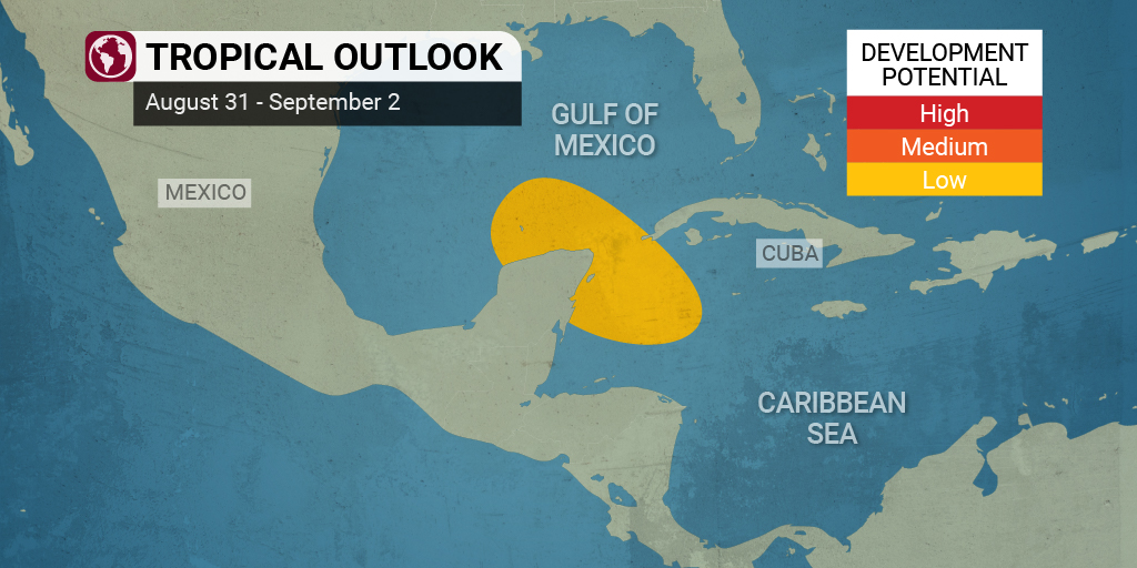
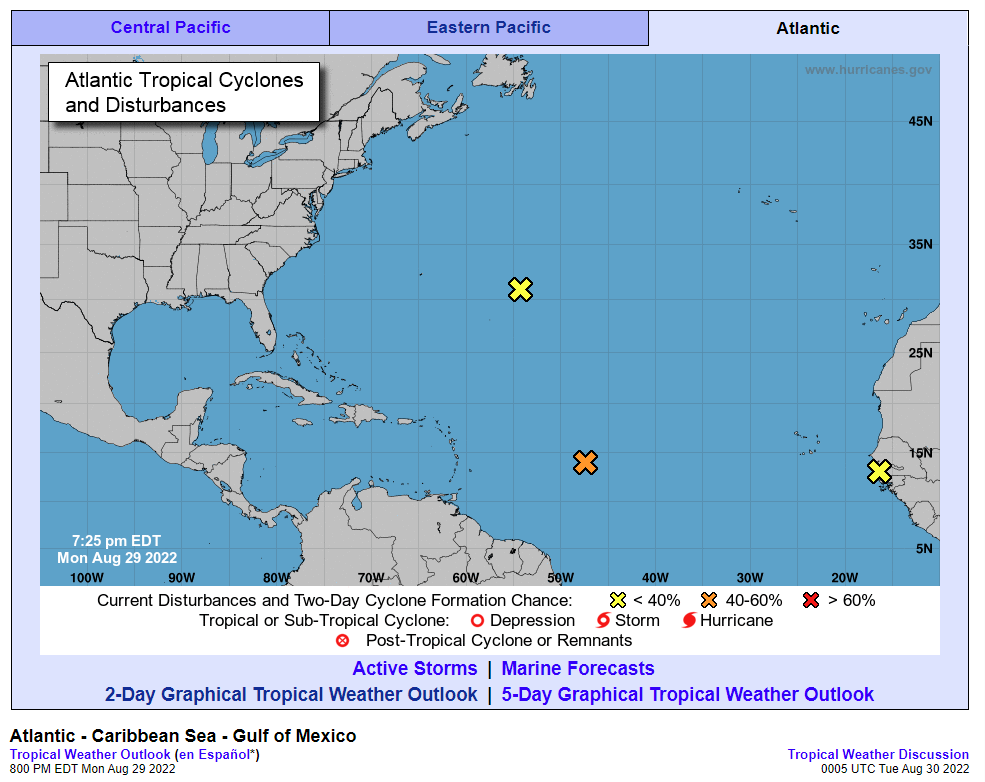
However, experts with the National Hurricane Center (NHC) are keeping their eyes on the potential of tropical development in the near future. While the tropics were quiet as of Sunday, hurricane watchers are monitoring a zone where tropical development could take root.

Forecasters are warning that a new tropical wave is likely to track across the Caribbean Sea over the next several days. The wave is forecast to meet up with a large amount of wind shear that will hinder its ability to organize and strengthen. But conditions are pointing to the wind shear falling off toward the end of the week near the Yucatan Peninsula. Should this happen, the system may have the opportunity to intensify over the northwestern corner of the Caribbean before moving into the Gulf of Mexico where it will find conditions conducive to further development.
Even if this tropical wave does not find the environmental conditions needed to intensify, it will still deliver a mass of intense tropical moisture to the Yucatan Peninsula by the end of the week. The current models show that this moisture could surge toward the U.S. for the upcoming holiday weekend.
If a tropical system does not develop into a named storm prior to Thursday, 2022 will mark the first time in 25 years that the month of August did not see a named feature. This void of named storms in August has only happened in the Atlantic basin twice in history since records began.
Although it has been remarkably quiet in the tropics since the beginning of July, forecasters are warning that now is not the time to get complacent. Experts are predicting a sharp uptick in tropical activity beginning in September at the hands of a steady surge of energy coming from Africa and moving through the Atlantic basin.
Did you find this content useful? Feel free to bookmark or to post to your timeline for reference later.

January 21, 2024

January 19, 2024

January 18, 2024