Heavy Rain, Flooding, and Chance of Severe Weather Staring Down the Southern U.S.
January 22, 2024
Posted: April 13, 2023 9:30 am


Last week at this time, forecasters were warning of a potential rare April tropical event forming in the Gulf of Mexico. While this named storm never came to fruition, the system is still going to bring heavy rain and winds to a large portion of the South through the end of the week. Here is what you need to know about the timing and intensity of this potential moisture.
The weather maker is currently spinning around in the northern portion of the Gulf of Mexico, setting its sights on the Southeast. In addition to rain and thunderstorms, the system will also bring strong winds to the region as a dip in the jet stream provides more fuel for its development.
The system does not have enough time to develop into a named tropical storm before it moves onshore. However, it will still bring a host of impacts to Florida, Georgia, and the Carolinas on Thursday and Friday.
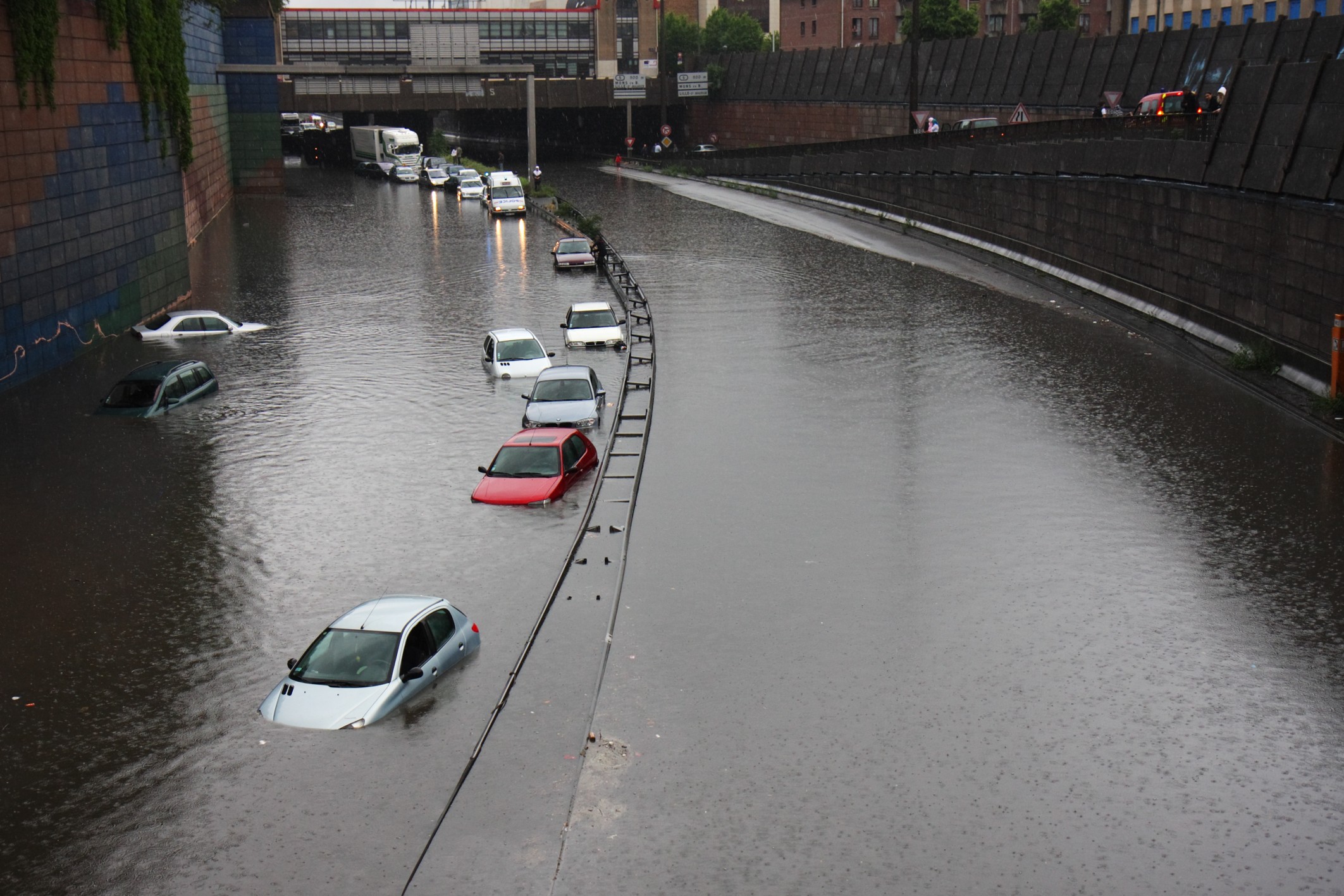
Urban areas in Florida may see flooding events due to the heavy rain. This flooding risk will eventually move into parts of Louisiana and up through the Carolinas. Flooding was an issue on Wednesday near Dania Beach, Florida, disrupting traffic on the heavily travelled Interstate 95.
The weather also triggered a ground stop at Fort Lauderdale Hollywood International Airport.
Forecasters are warning that the Sunshine State may see up to 6 inches of rain by the time the system moves out late Friday. This rain is in addition to the precipitation that fell across much of Florida on Monday and Tuesday after another front stalled out over the state.
Areas in and around Miami, Fort Lauderdale, and West Palm Beach were dealing with the potential of flooding as the sun went down on Wednesday. The panhandle of Florida stretching westward across the Gulf Coast to New Orleans also saw heavy rain and isolated urban flooding.
This flooding was the result of a soaker that moved through the region last weekend, bringing up to 3 inches of rain to some communities.
There is also the chance of potent thunderstorms igniting on Thursday for some parts of Florida, Alabama, and Georgia. These storms could potentially produce tornadoes or waterspouts.
The late week weather system will also stir up strong winds with sustained speeds of 15 to 25 mph. Do not rule out the possibility of higher gusts as well. The strong winds combined with the immense moisture will raise the risk of downed trees and power lines heading into the weekend.
In addition, winds of this magnitude will also create rough surf conditions and the chance of coastal flooding during high tide for a large portion of the Gulf Coast and the southern Atlantic coast.
The region will then experience a brief drying out period on Saturday prior to the chance of more thunderstorms firing up on Sunday.
While disruptive to traffic and life in general, the rain is good news for the drought-stricken Southeast. Heading into April, much of the coastal areas of Louisiana, Mississippi, and Alabama were under the designation of abnormally dry conditions.
The U.S Drought Monitor also said that a good portion of Florida has been placed under a category of severe drought. It is likely that the rain last week combined with this upcoming moisture will help to mitigate some of these drought concerns.
The weather impacting Florida and the Southeast to end the work week will move into the mid-Atlantic by Saturday and up through the Northeast and New England by Sunday.
The arrival of this storm will create localized heavy rain and strong winds, particularly across the coastal portion of the Northeast. The moisture will hopefully help to reduce the risk of brush fires.
The lingering moisture will then meet up with another storm that developed in the Mississippi Valley and create additional rounds of showers for the mid-Atlantic on Sunday to close out the wet weekend.
Did you find this content useful? Feel free to bookmark or to post to your timeline for reference later.

January 21, 2024

January 19, 2024

January 18, 2024