Heavy Rain, Flooding, and Chance of Severe Weather Staring Down the Southern U.S.
January 22, 2024
Posted: July 27, 2022 10:12 am


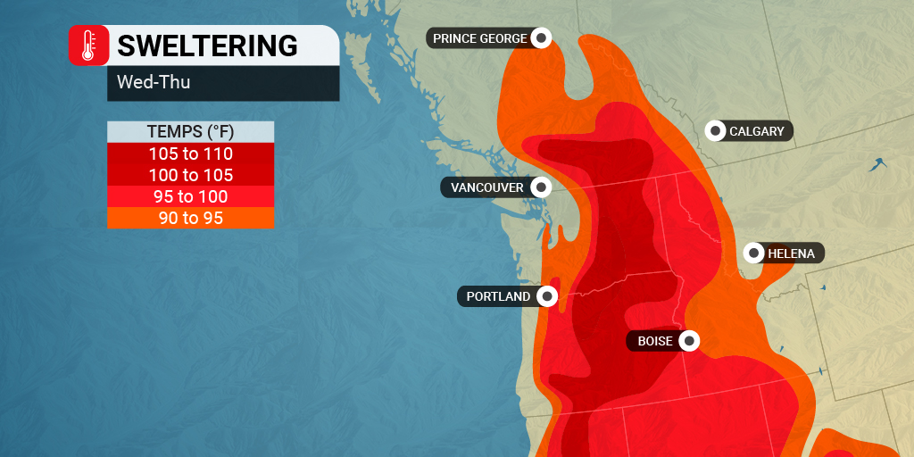
The peak of the heat wave in the Pacific Northwest is expected to hit on Wednesday and Thursday. While the temperatures will not reach the record-breaking heat that the region saw in June of 2021, it will certainly be the warmest readings of the summer so far in this corner of the country.
Although last year’s historic heat wave smashed a number of records, the current building warmth will likely last longer. This means that most residents in the region will experience between five and seven days of excessive heat. For instance, while the Seattle area saw triple digit readings for three straight days at the end of June 2021, the current heat wave is likely to deliver temperatures in the 90s for at least five days.
The 2021 heat wave delivered an all-time record high for the entire state of Washington when the mercury hit 120 in the town of Hanford on June 29. Not to be left out, Oregon also tied an all-time record high with a temperature of 119 degrees measured at Pelton Dam.
Weather experts caution that this type of long-duration heat can deliver a number of issues, particularly in areas such as the Pacific Northwest where the majority of homes do not have air conditioning. The long-duration heat also causes more issues as it lingers for those individuals that deal with respiratory issues.
In addition, the light winds that typically pair with periods of heat will make it more likely that pollutants accumulate in the air throughout major cities such as Seattle and Portland. These stagnant pollutants will compound the risk for respiratory complications.
The lack of moisture will serve as fuel for the heat. Because the ground has not been saturated in over one week, it will reflect the heat from the sun rather than working to absorb it. This will send more heat into the atmosphere, bringing the temperatures up to about 10 – 15 degrees above normal for the end of July.
Just how hot will it get? The Portland area can expect to see readings at or above 100 degrees on Wednesday and Thursday. While the city approached the triple digits earlier in the week, there is a better chance of it eclipsing this mark within the next few days.
Residents located farther down Interstate 5 in Medford, Oregon can expect to rack up more days over the century mark through the rest of the week. The city reached 107 degrees on Monday with highs up to 110 in the forecast for the next few days.
Washington has been the beneficiary of more rain than Oregon over the last few months. This moisture in the ground will help to suppress the temperatures somewhat with this heat wave, however, the Evergreen State will still be under a massive heat dome. For example, while at least two-thirds of the state of Oregon has been under a designation of a moderate drought or more, this categorization was only in effect for about 10% of Washington.
However, even with plentiful moisture in the ground in most areas of Washington, the building heat will bring the air temperature to uncomfortable levels. The heat is expected to stick around through the end of the week.
The Puget Sound area, including Seattle, will hang out in the 90s Wednesday through Friday before the temperature finally starts to drop. The capital city of Olympia will see similar readings. Keep in mind that real feel temperatures may be slightly higher.

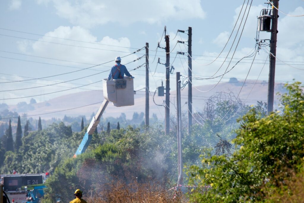
In addition to the risks that prolonged heat of this nature brings to vulnerable populations, the ongoing weather pattern will also increase the risk of wildfires throughout the region. The lack of precipitation paired with the increasing temperatures will make it more likely that fires break out heading into the peak of the wildfire season.
Some of the moisture from the monsoonal storms over the Southwest may push farther to the north, bringing the chance of thunderstorms to the Northwest. While these monsoon storms will not bring much in the area of measurable rain, they could increase the risk for lightning strikes. These strikes are often the root cause of many wildfires. The greatest chance of cloud-to-ground lightning strikes will be in Northern California through Oregon and into Idaho beginning on Wednesday afternoon.
Another storm coming in from the Pacific Ocean could also raise the threat of wildfires by the weekend. While this storm system will bring relief from the heat, it will also bring the risk of lightning and gusty winds. Both of these weather forces are known to ignite and spread fires at a rapid speed.
The mercury is forecast to drop to average levels for the beginning of August by the beginning of next week. The winds associated with the storm system inching near will also likely move the pollutants that are already gathering in the skies above some cities.
The West Coast is heading into what is typically the worst weeks of the fire season, making it important that residents stand guard.
Did you find this content useful? Feel free to bookmark or to post to your timeline for reference later!

January 21, 2024

January 19, 2024

January 18, 2024