Heavy Rain, Flooding, and Chance of Severe Weather Staring Down the Southern U.S.
January 22, 2024
Posted: September 27, 2022 9:54 am


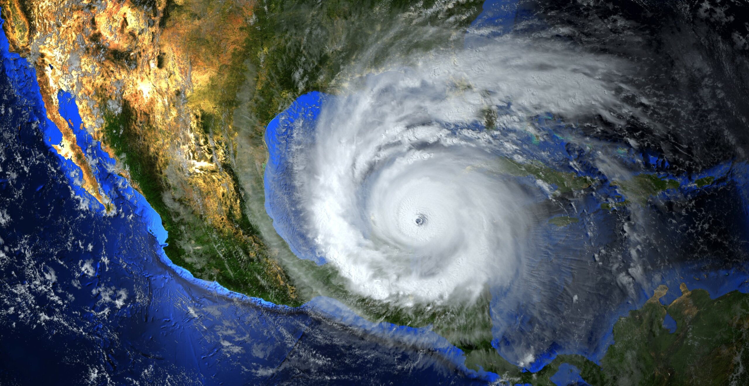
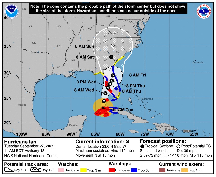
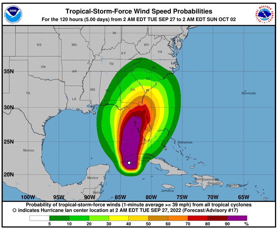
Residents along Florida’s Gulf Coast are gearing up for the arrival of Hurricane Ian. Thousands of families have been evacuated from the area in anticipation of a landfall as a major hurricane. While the projected path of Ian is somewhat atypical for tropical weather events, it is certainly not a complete anomaly. Here is a look at this unusual track and some of the famous storms that have followed this path in the past.

According to data from the National Oceanic and Atmospheric Administration (NOAA), Florida has bore the brunt of about 160 hurricanes since records were kept. Of this number, only 17 have made a hit on the western coast of the state, located north of the Florida Keys.
What is more surprising is that of those 17 recorded storms, none have journeyed up the west coast. However, Hurricane Ian may change all of that. Current forecasts show that there is a chance that the storm could move up the coast rather than the typical northeastern track.
Although records are somewhat sketchy prior to 1944, an unnamed hurricane in the year 1921 is responsible for the highest storm surge ever recorded in Tampa Bay. Records show that the hurricane sent water rising 10.5 feet in the downtown area after it hit just north of the city. The extreme storm surge destroyed most of the seawall, sending water into the buildings and bringing them down to the ground.
While that storm was certainly a monster, there were only 135,000 people living in the five-country area at that time. This compares to nearly 3.4 million residents in the year 2022.
Although the Tampa area has avoided a number of hurricane strikes over the years, it is no stranger to tropical storm direct landfalls. Tropical Storm Eta moved onshore to the north of Tampa in Cedar Key in 2020 while Tropical Storm Elsa slammed into Treasure Island in 2021.

Many Floridians will not soon forget Hurricane Irma, coming on shore in Marco Island as a Category 3 storm in 2017. This storm took the atypical north to northwest track up the western spine of the Sunshine State. The storm was blamed for over $320 million in damages in the southwest corner of the state.
12 years prior to Irma, it was Hurricane Wilma that rapidly intensified in the exceptionally warm waters of the Caribbean. Wilma went from a Category 1 storm to a Category 5 monster in just 24 hours, breaking a record in the process. Wilma first took aim at Mexico before moving across the Gulf of Mexico and slamming into the Florida coastline near Cape Romano as a Category 3 hurricane. Wilma ended up being the ninth-costliest hurricane to hit the U.S., costing over $25 billion when adjusted to 2020 dollars.
Hurricane Charley struck Florida’s west coast one year before Wilma, making landfall slightly to the west in Cape Coral as a Category 4 storm. Charley went from a Category 2 storm to a Category 4 hurricane right before landfall, catching many residents off guard.
After moving across land near the city of Fort Myers, Charlie tracked across Central Florida and then up the East Coast of the U.S. Over a dozen fatalities in the Caribbean and the U.S. were attributed to Charley with damages costing about $17 billion.
1968’s Hurricane Gladys and 1960’s Hurricane Donna also made landfall along the western coast of the Sunshine State. Gladys hit in between Tampa and the Panhandle as a Category 2 storm, eventually moving to the northeast and cutting a path to the Outer Banks of North Carolina.
While Hurricane Donna traveled in a similar trajectory once it reached Florida, it came on shore south of Cape Coral. The Category 3 storm barreled through the peninsula as a Category 2 storm before making another landfall in North Carolina. Donna then made a third landfall in Long Island, also as a Category 2 storm, after tracking up the East Coast.
According to the National Weather Service (NWS) Donna was responsible for 12 deaths in Florida. Damage estimates from this storm soared as high as $350 million.
Hurricane Easy of 1950 also took a path that sent it to a western Florida landfall. Easy made its first landfall north of Tampa near the town of Cedar Key as a Category 3 storm. The storm then went on to make a second landfall about 24 hours later in Spring Hill, approximately 60 miles south of its first landfall as a Category 2 hurricane.
After the second landfall, Easy devolved into a tropical storm that cut a path northward through Florida. Easy eventually became a tropical depression in Georgia. The storm unleashed over 38 inches of rain in a 24-hour time period in Florida, triggering $3.3 million in damages.
Did you find this content useful? Feel free to bookmark or to post to your timeline for reference later.

January 21, 2024

January 19, 2024

January 18, 2024