
Heavy Rain, Flooding, and Chance of Severe Weather Staring Down the Southern U.S.
January 22, 2024
Posted: November 3, 2022 3:04 pm


Hurricane Lisa is losing strength over Central America one day after making landfall in Belize. However, is it done delivering damage or is the storm still a threat after it emerges in the Gulf of Mexico?
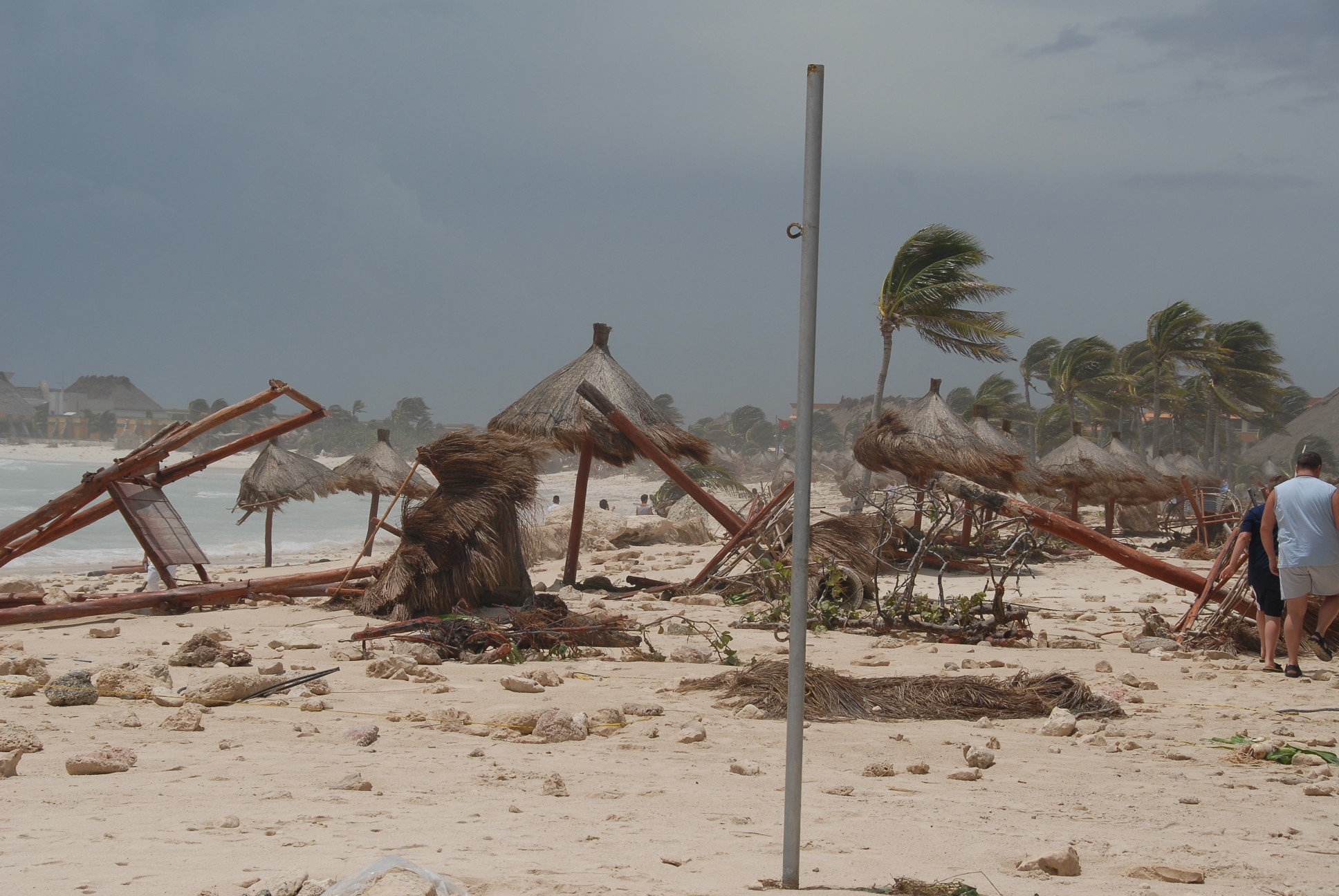
Hurricane Lisa came on to shore on Wednesday afternoon near Belize City, Belize. According to the National Hurricane Center (NHC), the Category 1 storm made landfall with maximum sustained winds of 85 mph. The eye of the storm crashed onto shore about 10 miles southwest of Belize City, moving at a speed of 12 mph.
The storm unleashed moderate flooding as it dumped heavy rain across the Central American country. Local media is reporting that some homes and businesses lost portions of sheet-metal roofs due to the strong winds associated with the storm.
By Thursday morning, Lisa had been downgraded to a tropical depression and was wreaking havoc over southern portions of Mexico. Meteorologists are warning that the storm could drop 4 to 6 inches of rain across the eastern edge of the Chiapas state and the state of Tabasco.
As of mid-day Thursday, the system was boasting maximum sustained winds of 35 mph and was spinning about 65 mph southeast of Ciudad del Carmen, located on Mexico’s Gulf coast. The storm is heading to the west at a speed of 10 mph.
Lisa is forecast to become a tropical rainstorm by later in the day. There is a slight chance that the system could really lose some steam as it moves over the high terrain of southern Mexico. If the storm slows down in speed, it is also more likely to fall apart over the rugged mountains of this region.
However, forecasters with the NHC are speculating that the storm will retain a good amount of energy and move into the Gulf of Mexico by Friday. Once it reaches the Gulf, there are a number of scenarios that the system may experience.
Should the models hold, Lisa will take a turn to the northwest at a fast clip. This would keep its major energy circulation together and allow it to survive the trip out into the Gulf of Mexico. The system would likely emerge in the southern portion of the Gulf as a tropical rainstorm.
What is left of Lisa will find unfavorable atmospheric conditions if it reaches this part of the Gulf. The disruptive wind shear is predicted to be a factor in keeping the system from strengthening again. The wind shear will likely prevent Lisa from moving farther to the north and toward land.
There is an outside chance that Lisa is able to remain a tropical rainstorm and head back toward southern Mexico. Even if this does not happen, it is likely that some of the moisture left from the feature will make its way back to southern Mexico through the weekend.
The heaviest of the rains will likely fall along the border of Mexico and the southern Bay of Campeche. Residents in this area will want to keep an eye on the system if it is able to retain its moisture and energy over the next few days.
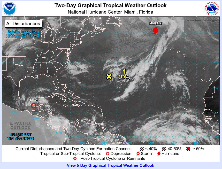
In addition to Lisa making a mess in portions of Central America, Hurricane Martin is spinning around in the north Atlantic. As of early Thursday, Martin was located about 800 miles to the west-northwest of the Azores. This island chain sits west of the coast of Portugal.
Martin is moving to the northeast at a speedy rate of 46 mph. The Category 1 storm is producing sustained winds of 85 mph as it continues to intensify. While there are no major land masses currently in its path, the storm will likely disrupt shipping lanes in the central north Atlantic. The current conditions in this part of the basin will give Martin the strength that it needs to retain its intensity of a hurricane or tropical storm over the weekend.
Did you find this content useful? Feel free to bookmark or to post to your timeline for reference later.

January 21, 2024

January 19, 2024

January 18, 2024
