Heavy Rain, Flooding, and Chance of Severe Weather Staring Down the Southern U.S.
January 22, 2024
Posted: November 10, 2022 4:05 pm


Hundreds of Thousands of Floridians in the Dark After Hurricane Nicole Landfall
Hurricane Nicole made landfall early Thursday morning as a Category 1 hurricane near Vero Beach, sending another blow to the state of Florida. Nicole came on shore at 3 am local time at North Hutchinson Island, located about 65 miles to the north of West Palm Beach. Here is where the situation with the storm stands now.
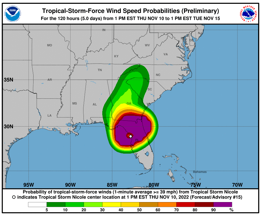
Nicole quickly lost steam once it rushed onshore. As of Thursday morning, Nicole is churning through the state as a tropical storm. Even though it did not retain its hurricane status for long, the storm is still impacting a large area of the state with heavy rain, damaging winds, and dangerous storm surge.
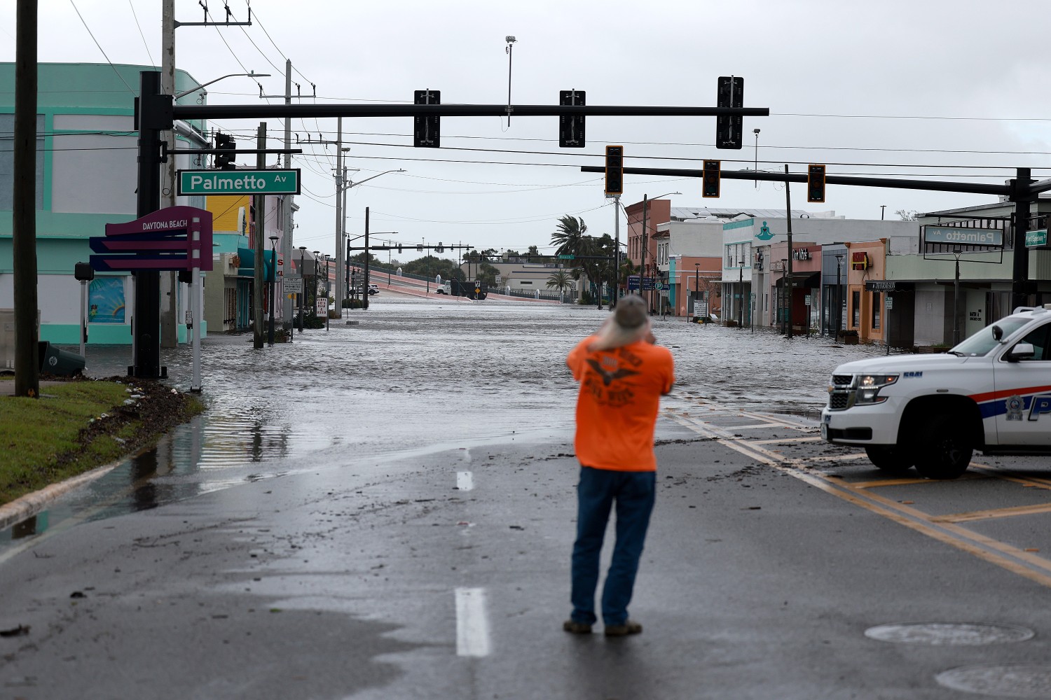
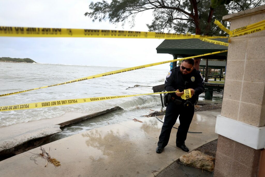
The arrival of daybreak revealed a significant amount of damage along the east coast of Florida. A number of homes collapsed into the water in Wilbur-By-The-Sea, a community located south of Daytona Beach Shores in Volusia County. The homes had already been at risk of collapse due to the erosion left by Hurricane Ian. These structures were left vulnerable to the impacts of a Category 1 storm such as Nicole because many of the protective sand dunes and sea walls collapsed during Ian’s wrath.

Wind gusts up to 100 mph left hundreds of thousands of Floridians in the dark as the storm continued its path inland. The strongest wind gusts were recorded by NASA weather stations at Kennedy Space Center in Cape Canaveral, Florida. One station reported a gust right at 100 mph.
Wind stations up and down the Space Coast recorded maximum winds in the 70s and 80s. Even areas farther inland saw strong winds, including a gust of 66 mph at Orlando Executive Airport.
Over 350,000 customers were without power throughout the Sunshine State by Thursday morning. Almost one quarter of these outages were reported in Brevard County, home to Melbourne Beach.
Despite weakening shortly after hitting land, Nicole is still packing a powerful moisture punch. Rainfall amounts were coming in at about 6.5 inches in some areas of the state. The central portions of the state, including Orlando, are getting pummeled with the heavy rain. For instance, Orlando Executive Airport had already recorded over 4 inches of rain by mid-morning with more moisture on the way.
This amount of rain raises concerns of flooding, particularly in areas that are still dealing with overly saturated grounds due to the impacts from Hurricane Ian. It has only been about six weeks since Ian slammed into the southwestern coast of Florida as a powerful Category 4 storm.

Forecasters at the National Hurricane Center (NHC) began keeping an eye on Nicole over the weekend. By Tuesday morning, the feature had grown into a large storm that stretched over 480 miles in diameter. Nicole had intensified into a tropical storm with wind speeds of 50 mph by Tuesday afternoon.
The tropical storm first hit land in the Bahamas, slamming onto the shores of Elbow Cay on the Great Abaco Island at about noon local time Wednesday. This is the same general location that experienced the destruction brought by Category 5 Hurricane Dorian in September of 2019.
Storm surge of 4 to 6 feet above average tide was reported in this part of the northern Bahamas. Tropical-storm-force winds of a general 50 mph were also reported at Leonard Thompson International Airport in Marsh Harbour.
The system was able to strengthen further as it moved off land and found warmer ocean waters in its path. Nicole reached the status of a Category 1 hurricane with winds of 75 mph by 6 pm EST Wednesday.
Because of the massive size of this storm, it took hours for the eye to come on shore in Florida after the outer edges of the eyewall moved onto the peninsula. For instance, while the leading edge of the eyewall moved on shore near Port St. Lucie at about 1 am, the official landfall did not take place until 3 am.
Meteorologists estimate that the eyewall measured up to 80 miles in diameter. This is significantly higher than the typical eyewall size of 20 – 40 miles.
Nicole will go down in the history books as only the third hurricane on record to hit Florida during the month of October. Nicole joins 1985’s Hurricane Kate and 1935’s Yankee Hurricane on this list. The storm also carries the distinction of being the latest storm in history to make landfall along the east coast of Florida.
Did you find this content useful? Feel free to bookmark or to post to your timeline for reference later.

January 21, 2024

January 19, 2024

January 18, 2024