Heavy Rain, Flooding, and Chance of Severe Weather Staring Down the Southern U.S.
January 22, 2024
Posted: October 25, 2023 8:18 am


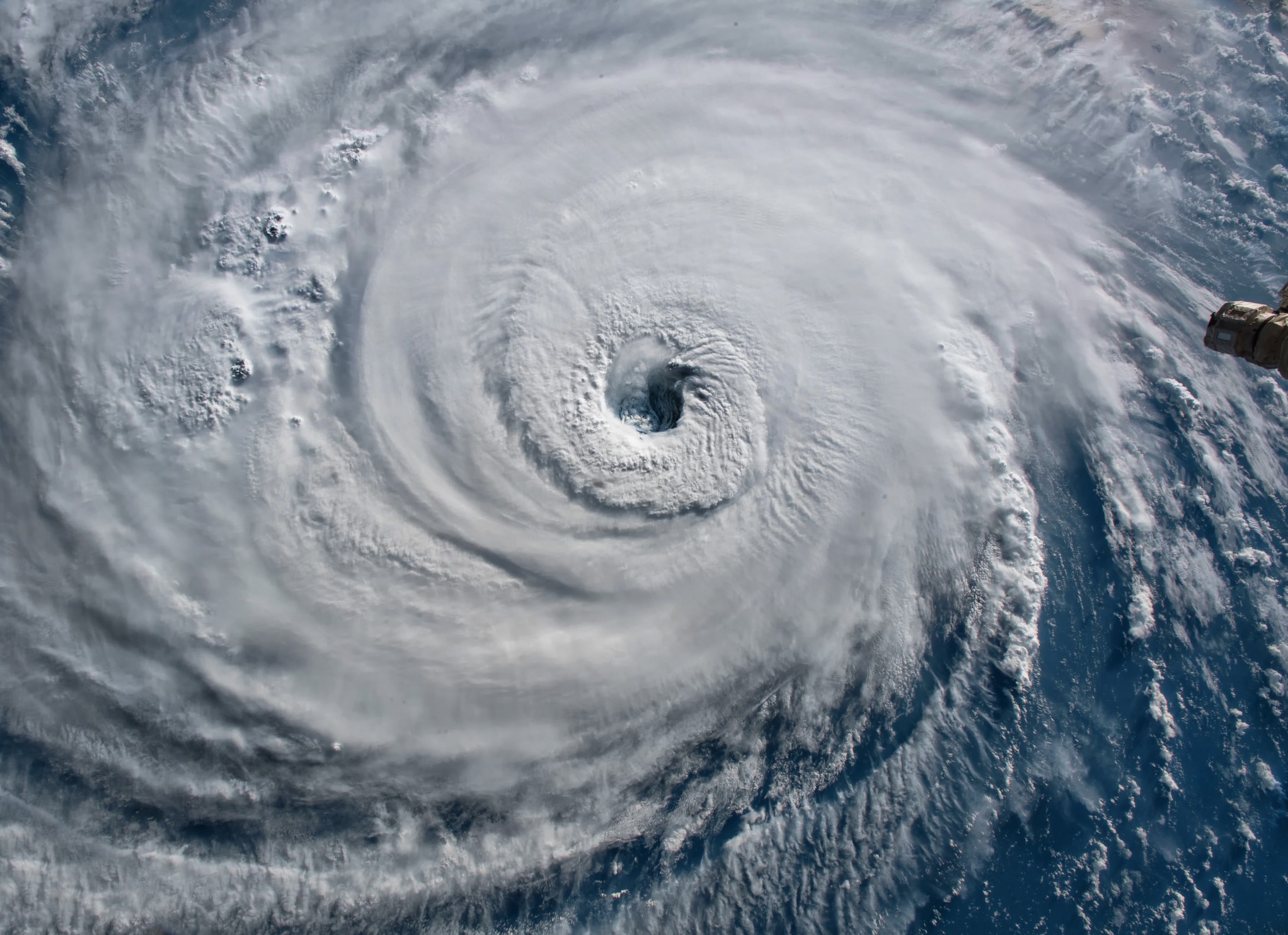
Heading toward the end of October, both the Atlantic and the East Pacific basins continue to brim with tropical activity. As Hurricane Tammy churns in the Caribbean, Hurricane Otis is on a crash course with Mexico. Here is the latest update on what is happening this week in the tropics.
Latest on Hurricane Tammy
Tammy is currently churning to the northeast of Puerto Rico as a Category 1 hurricane with maximum sustained winds clocking in at 75 mph. The forecast models predict that the storm will continue on its path to the north this week, pulling it away from the Caribbean.
The storm came to life almost one week ago and has since moved more than 1,000 miles in its journey across the Atlantic Ocean and over a portion of the Leeward Islands. Tammy dumped heavy rain across areas of St. Lucia, Barbados, and the British and U.S. Virgin Islands last weekend. Widespread rainfall amounts of 2 to 4 inches were recorded in this part of the Caribbean while Barbuda, Antigua, Guadeloupe all saw rainfall totals of 4 to 10 inches.
For instance, Le Raizet, Guadeloupe reported rainfall in the amount of 9.39 inches over the time period of Friday to Monday. Tammy also brought strong winds to the island as the conditions began to worsen on Saturday.
By the time that Tammy had pushed out of the eastern Caribbean, it had impacted over a dozen islands. While not all of the communities saw heavy rain and strong winds, the storm churned up the seas and created dangerous rip currents throughout the region.
What is Next for Tammy?
Tammy’s path in the coming days is still uncertain. The storm is predicted to maintain its hurricane status through Wednesday. An area of powerful wind shear could weaken the feature on Thursday, however, the islands of Bermuda may still see significant impacts from Tammy by the end of the week and into the weekend. This part of the Atlantic should be prepared for torrential rain, rough surf conditions, and high winds.
Bermuda is anticipating 1 – 2 inches of rain on Friday and Saturday. Wind gusts will hit speeds of 40 to 60 mph across this group of islands.
Tammy is then expected to move into the cooler waters of the Atlantic late in the weekend, disrupting its circulation and nudging it down to the status of a tropical rainstorm. Air this time, Tammy is not predicted to deliver any impacts to the mainland U.S.
Latest on Hurricane Otis
Over in the East Pacific, Hurricane Otis is forecast to become a more formidable storm than Tammy. As of late Tuesday, this storm was churning about 140 miles south-southeast of Acapulco, Mexico as a Category 2 hurricane. Otis went through a period of rapid intensification from Monday afternoon into Tuesday afternoon, jumping from a tropical storm to a Category 2 event.
Forecasters are warning that Otis is likely to transition through another period of rapid intensification, taking it to a Category 3 storm with winds as high as 129 mph. This is expected to happen prior to Otis making landfall in Mexico on Wednesday. There is also an outside chance that Otis could reach a powerful Category 4 designation before moving on shore.
This feature is likely to bring rainfall amounts of 2 – 4 inches to the coastline of Mexico. The area near landfall will see rainfall totaling 8 to 12 inches. The models predict that the crowded resort area of Acapulco will bear the brunt of this storm.
The risk of flash flooding and mudslides will be an issue as Otis moves ashore and over the mountainous terrain of Mexico.
Central America Tropical Rainstorm
In addition to Otis and Tammy, tropical weather experts have also been busy tracking a developing feature coming together in the southwestern corner of the Caribbean Sea. Tropical Depression 21 formed on Monday afternoon off the coast of Nicaragua.
While the depression barely missed making tropical storm strength prior to its landfall early Tuesday, it was still packing quite a punch when it moved across Nicaragua, Honduras, and El Salvador. The storm is forecast to keep moving to the west this week, ushering in rainfall amounts of up to 4 inches for places such as northern Costa Rica.
The storm could intensify as it moves across Central America, regaining even more strength if it makes out into the eastern Pacific still largely intact. Should this happen, the feature would take on a new name in the East Pacific.
Severe Tropical Cyclone Lola Intensifies near Pacific Islands
On the other side of the globe, Severe Cyclone Lola has reached the equivalent of a Category 3 hurricane with wind gusts topping 115 mph. Lola marks an early start to the beginning of the tropical storm season in this part of the Pacific. The feature is currently making its way toward the island of Vanuatu.
The region has issued a series of red alert warnings, cautioning that Lola could bring life-threatening weather conditions. The storm is forecast to impact Vanuatu throughout at least Wednesday before moving to the islands of Malampa, Torba, Panama, and Sanma. By Friday, New Caledonia will be experiencing the wrath of Lola.
Did you find this content useful? Feel free to bookmark or to post to your timeline for reference later.

January 21, 2024

January 19, 2024

January 18, 2024