
Heavy Rain, Flooding, and Chance of Severe Weather Staring Down the Southern U.S.
January 22, 2024
Posted: September 25, 2022 10:21 am


Tropical Storm Forecast to Evolve Into Hurricane Before Moving Into Florida
According to the latest weather data coming in from Atlantic Canada, Hurricane Fiona was one of the most intense storms to ever impact this region of the world. The storm moved to the easternmost part of Canada after wreaking havoc in Puerto Rico, the Dominican Republic, and the Turks and Caicos.
The storm got its start in Atlantic Canada on Friday, inundating Prince Edward Island, western Newfoundland, southeastern Labrador, and eastern Nova Scotia with heavy rain and hurricane-force wind gusts. Storm surges along the coastline also contributed to the flooding.

The Port aux Basques area of southwestern Newfoundland bore the brunt of the storm on Saturday morning, with several homes damaged as a result of the flooding and falling trees. Roads were washed out as the surge pushed inland. Residents in low-lying areas were under mandatory evacuation orders by Saturday morning.
Officials in parts of Nova Scotia, Cape Breton, and Victoria County declared a state of local emergency, asking people to shelter in place. Widespread power outages rolled through Nova Scotia and Prince Edward Island with over 500,000 customers affected.
Although Hurricane Fiona had once been a Category 4 storm, the cooler waters of the northern Atlantic Ocean sent it back down to a Category 2 hurricane by the time that it made landfall along the Canso Peninsula of Nova Scotia. The storm was packing sustained winds of 100 mph when it moved onshore.
Fiona was moving at a fast clip of 25 mph by the middle of the day Saturday, heading in a northward direction. The storm is forecast to continue this trajectory and speed until it eventually dissipates.
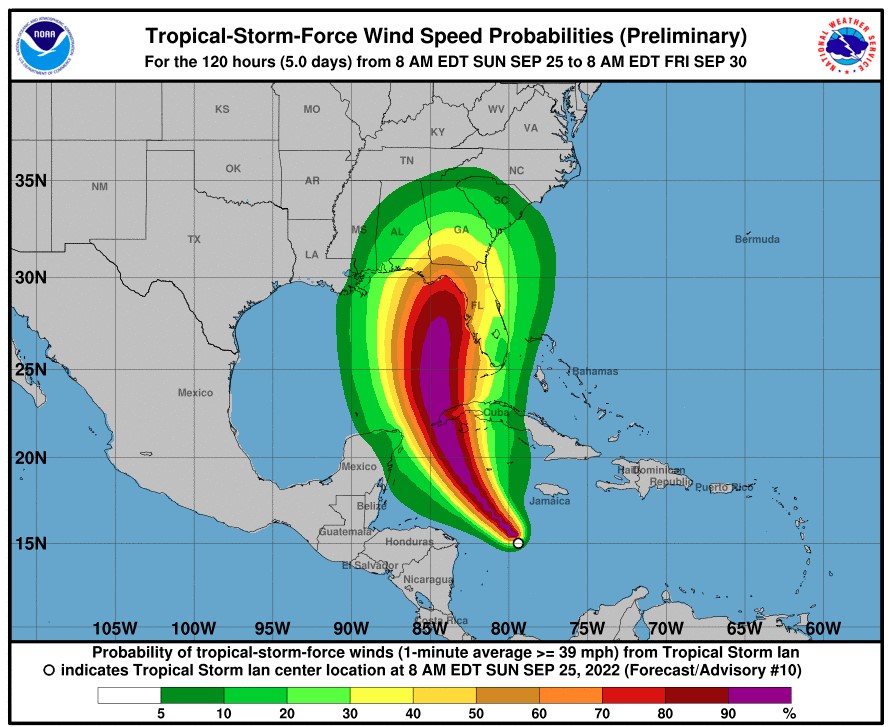
While Atlantic Canada is dealing with the aftermath of Hurricane Fiona, the state of Florida is preparing for what could be a major hurricane landfall by the middle of the week. Tropical Storm Ian formed late Friday night in the Caribbean, taking aim at the Sunshine State. Acting preemptively, Florida Gov. Ron DeSantis declared a state of emergency in anticipation of the storm’s arrival.
Although it is still too early to determine where the storm will end up and with what intensity, the current models demonstrate that Ian will make a landfall near Tampa late Wednesday or early Thursday. The state will begin seeing the impacts by Tuesday.
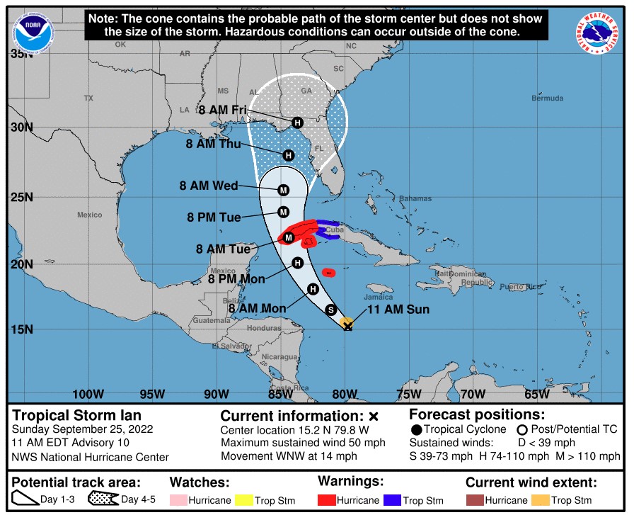
While Ian was encountering high amounts of wind shear late Saturday, forecasters with the National Hurricane Center (NHC) are predicting that the feature will strengthen when this prohibitive shear dies down. The feature is predicted to move into an area of favorable conditions by Sunday, making it possible that rapid intensification could occur. In addition to the minimal amount of wind shear, the storm will find some of the warmest ocean water in the world.
By Sunday, the storm is predicted to move across the Cayman Islands and the western half of Cuba. The Cayman Islands will be the first to see the major impacts, likely happening Sunday afternoon and into Monday. The height of the storm for Cuba is forecast for the midday Monday through Tuesday.
At this point, the NHC is predicting that Ian will make landfall in western Cuba as a major Category 3 storm. This designation translates to wind gusts of at least 120 mph.
Where Ian moves over the Gulf of Mexico will be determined by how far the jet stream dips across the U.S. in the coming days. This path will determine where the storm makes landfall in Florida.
Did you find this content useful? Feel free to bookmark or to post to your timeline for reference later.

January 21, 2024

January 19, 2024

January 18, 2024
