
Heavy Rain, Flooding, and Chance of Severe Weather Staring Down the Southern U.S.
January 22, 2024
Posted: January 31, 2023 4:41 pm


It was a dangerous day to be out on the roads across much of Texas. Unfortunately for those residents of the Lone Star State ready to get back to life as normal, the weather threat is far from over. Here is the latest on the developing winter weather.
Over 40 million Americans in a swath of land stretching from Texas and Oklahoma and as far east east as West Virginia are under some type of winter weather alert on Tuesday. The most dangerous impact of this massive weather maker is heavy icing. This ice is accumulating across parts of Texas eastward into the Tennessee River Valley.
Much of the state of Texas, including the major metropolitan areas of Dallas and Austin, had their winter weather storm warnings extended to last through 6 am local time on Thursday. This means that the winter weather is set to hang around for a bit longer. While these metropolitan areas are not forecast to see much of any snow, they will remain under the threat of freezing rain and sleet.
Roads have become impassable in many areas as the ice continues to accumulate. Bridges and overpasses are particularly dangerous. Local officials are asking residents to stay home if possible.
There were also multiple reports of lightning across the Dallas metroplex on Tuesday morning. Thundersleet was recorded in an area south of Oklahoma City during the same time period. Forecasters said that there have been over 160 lightning events in these two states since the sun rose on Tuesday.
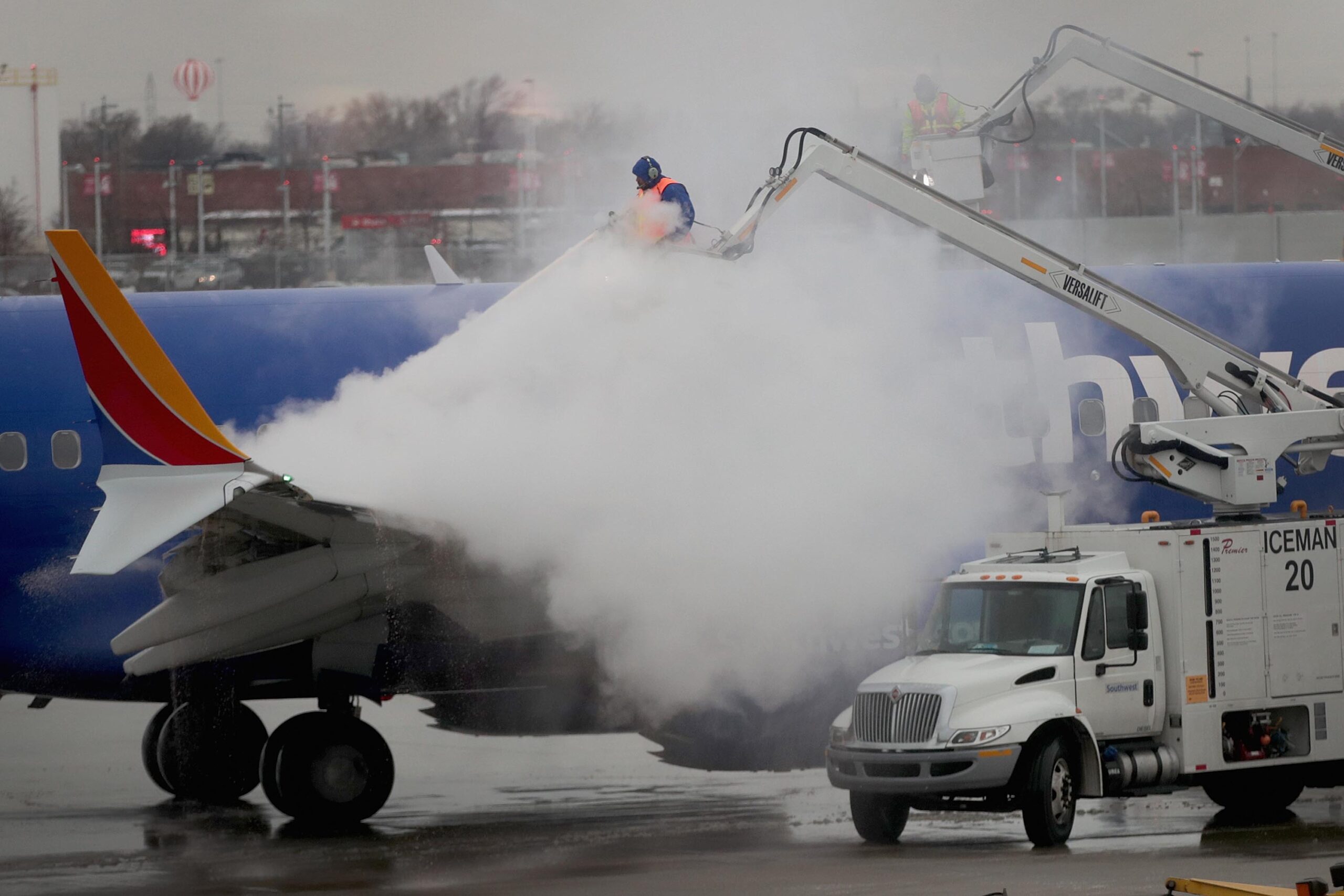
The dangerous ice is forecast to intensify throughout the day Tuesday. By mid-morning, there had already been over 1,000 flight cancellations and more than 500 delays. This number is sure to increase exponentially as the day goes on. The majority of these cancellations were at Dallas Love Field and Dallas-Fort Worth International. Other airports dealing with weather-related cancellations include those in Nashville and Austin.
This current wave of freezing rain will begin to lose intensity as it cuts across the central portions of Tennessee and Kentucky and into southern West Virginia. However, another burst of ice and freezing rain is already firing up in Texas and Oklahoma. This wave of winter weather will move into cities such as Little Rock, Memphis, and Nashville by Tuesday afternoon and evening.
Monday’s weather was a harbinger of things to come for the week. An icy mix of precipitation coated the southern Plains and beyond, triggering dangerous driving conditions. Areas around Springfield, Missouri reported well over a quarter of an inch of freezing rain. Some parts of Arkansas, Oklahoma, and Texas also saw freezing rain in this same general amount.
Not surprisingly, this winter weather wreaked havoc on the friendly skies. By the end of the day, 1,130 flights had been cancelled throughout the country with nearly 5,750 delays reported.
Fort Worth was hit especially hard with the inclement weather. Fort Worth’s Metropolitan Area EMS Authority responded to over 100 motor vehicle accidents on Monday. In addition to the car accidents, EMS crews also responded to multiple issues of hypothermia and people falling on the ice.
The wintry precipitation is not the only weather issue causing problems this week. Temperatures plummeted to start the week across the bulk of the southern Plains with the mercury dropping below freezing on Tuesday morning. Those in Oklahoma woke up to readings in the single digits in the hardest hit areas. Arkansas saw readings drop into the teens in the northern tier of the state. Other than the southern portion of the state, most of Texas is experiencing temperatures that are below the freezing mark.
Gusty winds are making the real feel temperatures even colder. The primary impact zone of the strongest winds is local along the border of Texas and Oklahoma. Some of the real feel readings in this area dropped below zero when the winds picked up in intensity to start the day.
There will be enough cold air and moisture coming up from the Gulf of Mexico to continue to fuel this large area of ice. The ice will continue to be a problem for a zone extending from the Rio Grande River into the Tennessee and Ohio valleys through at least Wednesday night.

The Dallas/Fort Worth metroplex can expect to see 0.25 of 0.50 of an inch of ice. This is more than enough to bring down trees and power lines. This area of ice will extend through Austin and to the east toward San Angelo. A secondary pocket of ice is in the forecast for parts of central Arkansas expanding into western Tennessee.
Forecasters are warning that downed trees and power lines will do more than just leave people in the dark. The damage will also likely block roads and complicate travel.
To the south of the ice line, you will find heavy rain that could trigger localized flooding. This risk of flooding will be centered across the Gulf Coast and as far as the Florida Panhandle. The heavy rain will land as far north as Tennessee and North Carolina through Thursday.
There is also the chance of severe weather for parts of the Gulf Coast and beyond. You can expect a general 1 – 3 inches of rain in an area encompassing southeastern Texas into the Carolinas. This will translate to a soggy few days for this corner of the country.
By Thursday, the blast of Arctic air impacting the northern half of the U.S. may drop far enough to support a wintry mix of precipitation in parts of Virginia. One last rush of air from the polar vortex is predicted to push through the Northeast on Friday and Saturday. Meteorologists warn that this could be the coldest readings of the winter for some major cities in this region.
The cold air will finally exit by the beginning of next week. This will usher in above normal temperatures for much of the eastern U.S.
Did you find this content useful? Feel free to bookmark or to post to your timeline for reference later.

January 21, 2024

January 19, 2024

January 18, 2024
