Heavy Rain, Flooding, and Chance of Severe Weather Staring Down the Southern U.S.
January 22, 2024
Posted: January 16, 2022 9:55 am


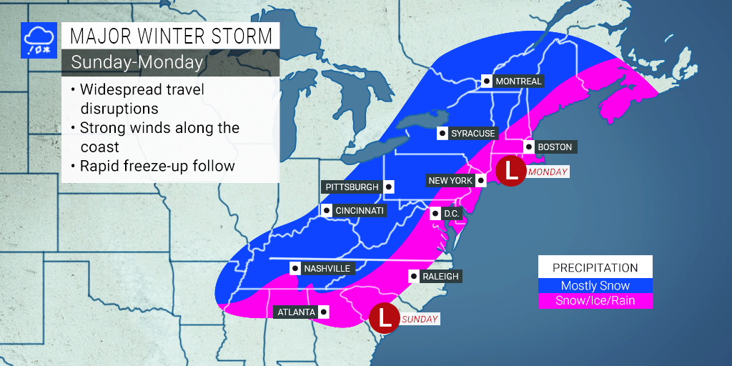
Dozens of states and over 100 million Americans are in the line of fire for a severe winter storm that is chugging slowly through the Midwest, Southeast, mid-Atlantic, and the Northeast this weekend.
The 3-day Martin Luther King Jr. holiday weekend is going to be a mess for millions of Americans in the path of a massive winter snowstorm. The system first came down from Canada on Thursday, bringing snow to the northern Plains and Upper Midwest. The snow is now bearing down on the Appalachians and the Southeast with its eyes set on the mid-Atlantic and parts of the interior Northeast before the end of the holiday weekend.
Several winter storm watches and warnings have been issued throughout the region ahead of the storm. The system is forecast to take an unusual path, heading toward the Southeast after visiting the Tennessee Valley and then making a U-turn to go back up into the mid-Atlantic and Northeast along the Eastern Seaboard to close out the weekend. The heaviest of snowfall is predicted for the spine of the Appalachian Mountains.

Multiple governors have preemptively declared a state of emergency in advance of the storm’s arrival. Virginia, North Carolina, South Carolina, and Georgia are all under these declarations.
The system is currently forecast to push up the Interstate 95 corridor after striking the Southeast. While in the Southeast, the system will pull up the warm air from the Atlantic Ocean, bringing rain to a large part of the region at the beginning of the journey to the north.
The coastal areas along the Eastern Seaboard should be ready for several hours of persistent rain late Sunday, triggering the potential of flash flooding and power outages. The barrier islands will be at risk of seeing minor to moderate coastal flooding as the full moon sets up on Monday.
Wind gusts along the coasts will also be a concern with speeds reaching up to 60 mph. The barrier islands and some of the capes will be at the highest risk of seeing these battering high winds. It is not out of the realm of the possibility that a thunderstorm or two may pop up along the coast. Thundersnow is also possible in areas to the west.
The major cities along the I-95 corridor, such as Baltimore, Philadelphia, New York City, and Boston, will see the strong possibility of a short burst of snow or ice on Sunday night. Rain will move in later, however, the wintry mix may make for slippery travel in the overnight hours heading into Monday.
The clash of warm and cold air will make it difficult to predict how the precipitation will fall along the northern and western reaches of the I-95 corridor. It is likely that the system will first start with heavy snow that moves to sleet and freezing rain before transitioning to regular rain.
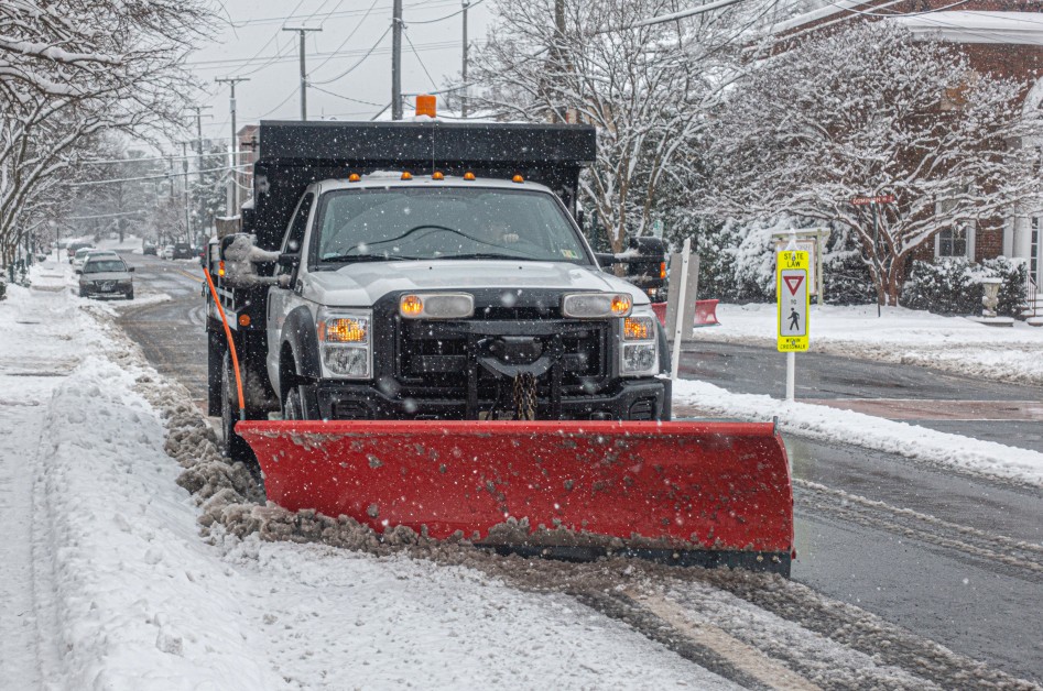
Motorists will need to be careful as roads will present as snowy to slushy to icy within a few miles of travel. Roads in northern Virginia, central Maryland, southwestern Pennsylvania, and northwestern New Jersey will see the brunt of the difficult road conditions. The sloppy travel will then move into central New England by early Monday, making for a messy morning commute for some.
The storm is expected to pick up speed by the end of the weekend as it moves to the northeast. The heaviest snow bands will only last about six hours in most areas. However, forecasters caution that the intensity of these storms will negate its speed.
The worst of the travel conditions will likely occur along interstates 81, 87, and 99. These roads travel along the spine of the Appalachians, the region expected to see the worst of the hit. Do not be surprised if sections of these roads are shut down for a time during the worst of the conditions.
Snow may fall at a rate of 1 – 3 inches per hour. The wind gusts will increase the chances of blowing and drifting snow, hampering visibility for travelers. The interstates that run east to west across the mountains will also be under the gun for risky travel as road crews face challenges keeping up with the intense snowfall. This includes portions of interstates 64, 68, 70, 76, 77, 80, 86, and 90.
The good news is that this surge of winter weather will not last long. The snow will move out of the region by Monday night. While road conditions may still remain dangerous for a time as road crews work to catch up, the incoming precipitation will wind down quickly.
The cold temperatures will stick around for a bit, leaving wet and untreated roads at risk of freezing up. Overnight low temperatures will hover in the single digits across the northern half of the Northeast with teens and lower 20s expected for the bulk of the Ohio Valley and the central portion of the Appalachians.

January 21, 2024

January 19, 2024

January 18, 2024