
Heavy Rain, Flooding, and Chance of Severe Weather Staring Down the Southern U.S.
January 22, 2024
Posted: April 1, 2023 1:46 pm


Nearly three dozen atmospheric rivers have impacted the West Coast since the end of the fall of 2022, helping the state of California to nearly erase the long-standing drought. Now that the wet season is wrapping up, the snowfall totals are coming into clearer focus. Here is a recap of this year’s record-breaking moisture totals across the Golden State.
Yet another storm hit California last week, ushering in more moisture along with damaging winds. The latest weather maker closed down portions of major highways, including the heavily traveled Interstate 80. The massive amounts of snowfall this year is obvious when traveling through the state’s higher terrains as the snow towers along the roadways.
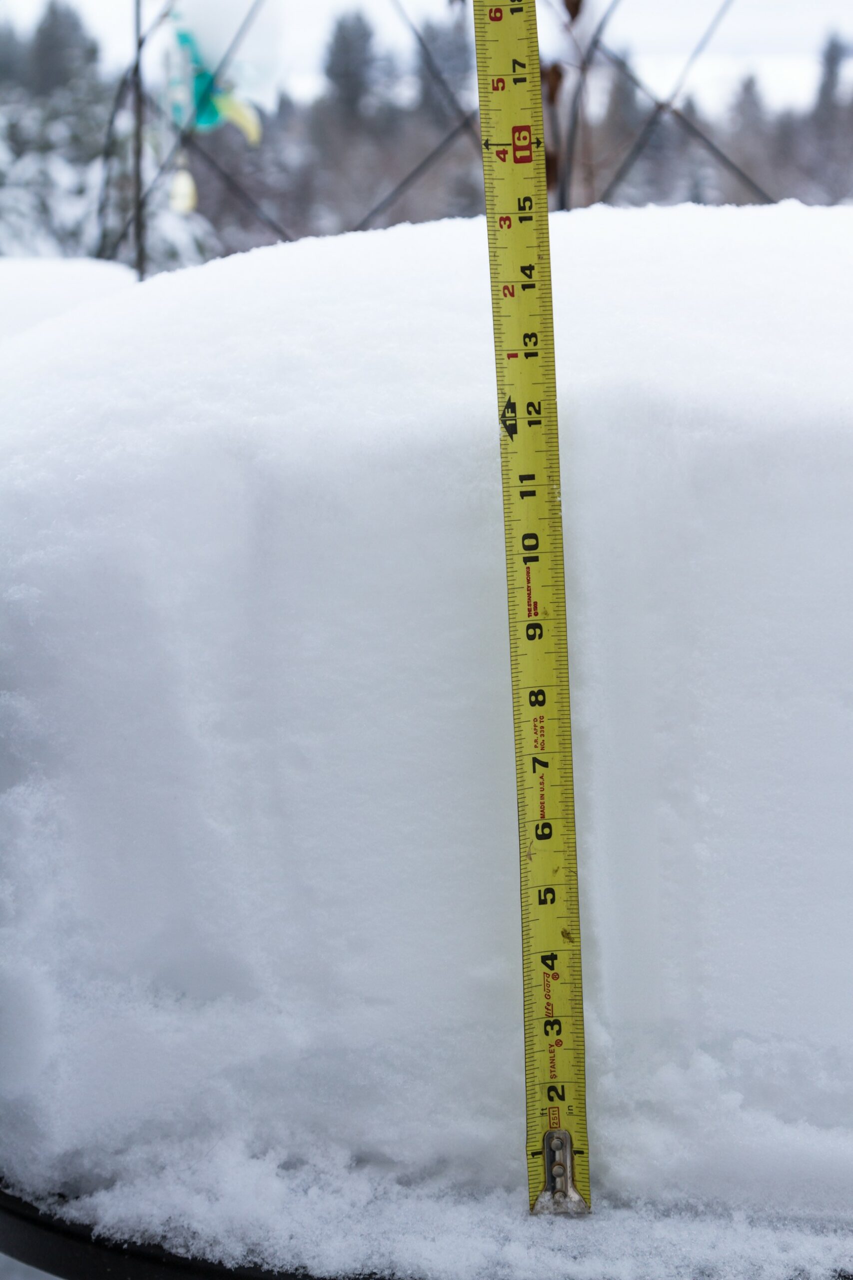
The popular ski resort area of Mammoth Mountain has been hit particularly hard by snow this year. The accumulation on Wednesday put the mountain over 695 inches of snow for the season, breaking a record that has stood for 13 years. Located in the southern Sierra Nevada, the summit has recorded 879 inches of accumulation since the beginning of October.
Although this snowfall has certainly hampered travel, it has been good news for skiers and snowboarders. Officials with Mammoth Mountain announced last week that it would remain open until at least the end of July.
Likewise, the Central Sierra Snow Laboratory (CSSL) has climbed over the 700-inch threshold after Wednesday’s additional 20.7 inches of snow. CSSL officials confirmed that the lab in Soda Springs has recorded 713.8 inches since October 1. Despite the eye-popping amount of snow at CSSL, it is still far short of the 1952 record of 812 inches at the lab.
Given these snowfall totals, it is not surprising to learn that the snowpack for the Sierra Nevada is well above normal by this point of the season. The southern third portion of the range has taken the biggest hit of snow, averaging almost 290% of snow by the end of March. Conversely, the northern third of the range is sitting at almost 190% of normal.
Although it is officially spring, the mountains are still seeing significant amounts of snowfall on a weekly basis. Some parts of the Sierra Nevada saw over 2 feet of snow this week alone.
The excessive snowpack will continue to work to further fill the state’s major reservoirs. Both Oroville and Shasta, the state’s two largest reservoirs, are now filled beyond their historical levels for the end of March.
According to the latest batch of data from the U.S. Drought Monitor, over 15% of California is now completely free of drought. The meaningful amount of precipitation this winter led California Gov. Gavin Newsom to roll back some of the state’s most stringent water conservation measures.
Northern California was under the deluge of rain to start the week, with some areas picking up 2 to 4 inches of rainfall. This latest storm also delivered strong winds and large hail. San Francisco was under the gun for large hail last Wednesday, giving the appearance of snow throughout the city.
High winds were another complication of last week’s weather. A gust of 111 mph was recorded in the northern mountainous terrain. Another rare occurrence came in the form of a tornado warning for some portions of San Diego County. This was in addition to the previous week’s tornado warning for Los Angeles County, a rarity for Southern California.
As is typical, the strong winds triggered a large number of power outages throughout the state. Because the grounds were already so saturated and loose, it did not take a lot of wind to bring down vulnerable trees.
Atmospheric rivers have not been the only type of weather event to impact the region in recent months. California has also recorded two bomb cyclones over the last few weeks, amplifying the already intense effects of the storms coming in from the Pacific Ocean. While the first of the pair of bomb cyclones hit its peak as it roared onshore, the most recent storm slightly weakened before making landfall. This helped to mute some of its impacts when compared to the previous week’s force of nature.
Did you find this content useful? Feel free to bookmark or to post to your timeline for reference later.

January 21, 2024

January 19, 2024

January 18, 2024
