Heavy Rain, Flooding, and Chance of Severe Weather Staring Down the Southern U.S.
January 22, 2024
Posted: February 25, 2022 2:34 pm


Northeast to See the Last of the Winter Weather Maker on Friday
An ice storm wreaked havoc over a large swath of the South-Central U.S. on Wednesday and Thursday, reminding residents that winter is still in full swing. This same storm system is gearing up to deliver snow to some parts of the Northeast on Friday.
A massive winter storm delivered a mixed bag of precipitation to much of the U.S. at mid-week, leaving residents cleaning up heading into the weekend. According to the National Weather Service (NWS), there were more than 200 reports of sleet and freezing rain on Wednesday and into Thursday. States impacted by the ice include Arkansas, Illinois, Indiana, Kentucky, Missouri, Oklahoma, Tennessee, and Texas. In addition to the sleet and ice, some of these areas also picked up snow.
As was forecast, central Arkansas was ground zero for the sleet during this particular storm. The hardest hit areas saw five inches of sleet pile up by mid-day Thursday. Widespread readings of three inches were also the norm in Arkansas. This amount of sleet is an event that only happens once every few years.
The mess began on Wednesday when rain began to fall as the temperature dropped below freezing. It did not take long for an icy glaze to form on power lines, roads, and trees. As the ice accumulated, power lines and tree branches fell, leading to widespread power outages.
By mid-morning Thursday, there were over 33,000 customers without power in Arkansas alone. There were an additional 10,000 people in the dark in Tennessee.
Because of the treacherous road conditions, it was difficult for crews to work to restore the power. Traffic came to a standstill in some areas as people had to abandon their vehicles and find safety.
It was a scary night for many people in the region. In addition to the rapidly accumulating ice and falling tree limbs, the sleet was also paired with thunder and lightning in some places. Reports of the thunder accompanying the sleet and ice were common in Arkansas, Texas, Oklahoma, and Missouri throughout the day Wednesday and Thursday.
The ice was reported as far south as Austin and San Antonio, bringing quite the change from the temperatures in the 80s just a day earlier.
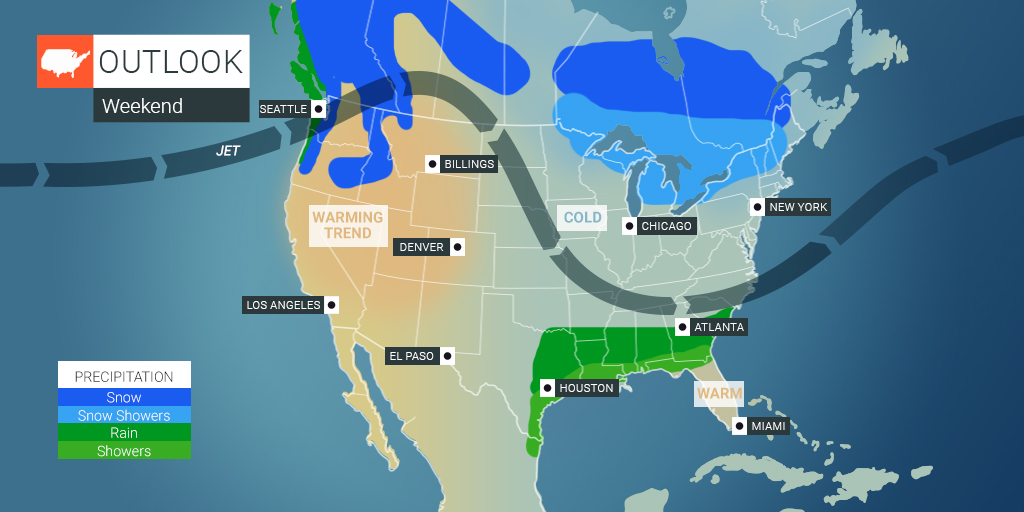
The system that delivered the icy hit to the South-Central U.S. on Wednesday and Thursday will move into the Northeast by Friday. Along the way, it will bring a mix of heavy snow and rain depending on your area.
A series of winter weather advisories and winter storm watches and warnings have been issued in advance of the storm. Some parts of New England are expecting to see snow totaling 12 – 18 inches by the time the system pushes out into the Atlantic Ocean by early Saturday.
The areas that are expected to see the most snow accumulation include northwestern Massachusetts and the southern tiers of New Hampshire and Vermont.
Forecasters are still uncertain what type of precipitation Boston can expect. While there is a chance that all of the precipitation falls as snow, Bean Town may also see some sleet or freezing rain mixed in with the white stuff. One thing that is certain is that the area will feel significantly colder than the moderate temperatures that have characterized the last few days.

January 21, 2024

January 19, 2024

January 18, 2024