
Heavy Rain, Flooding, and Chance of Severe Weather Staring Down the Southern U.S.
January 22, 2024
Posted: January 17, 2023 10:27 am


Southern California to be Spared Impacts of Last Weather Maker
Is relief finally on the way for the storm-weary state of California? This week’s forecast promises to bring drier weather to the Golden State. Read on for all the details.
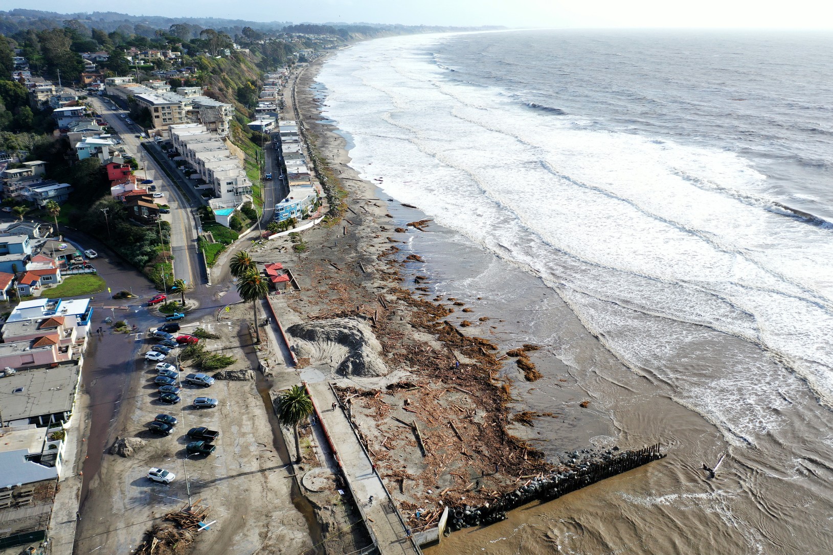
It has been a tumultuous few weeks for Californians. While the lower elevations have been at the mercy of flooding rainfall, the mountainous terrain has been hammered with snow thanks to a train of storms that has moved onshore with regularity from the Pacific Ocean. All of this is about to change as an area of high pressure moves in over the state, making way for drier conditions.
The last of the expected storms for a while moved into coastal California on Sunday, bringing in yet more moisture to the water-logged region. This stormy pattern is forecast to hang around through Monday across the West Coast. More heavy rainfall is in the cards for the coastal regions while the higher elevations of the Sierra Nevada can expect more snowfall accumulation.
Unlike the previous storms that have largely remained anchored over California, this last punch is forecast to move farther inland. This movement will bring the rain and snow to a large part of Nevada, Utah, and Arizona. By late in the day Monday, the moisture may. make it as far east as western Colorado and well into New Mexico.

The good news for the western U.S. is that the constant barrage of storms is predicted to weaken by Tuesday, giving the region a chance to dry out and catch its breath. While there may be one more quick-moving storm to impact parts of central and northern California by the middle of the week, it should be short-lived and relatively weak compared to the weather of the last several weeks.
This mid-week storm will usher in rain and snow to the coastal areas of Washington and Oregon before dipping farther to the south. This differs from the previous weather makers that made a direct strike on California. As a result, California will escape the worst of the impacts because the atmospheric river has dissipated over this part of the country.
While this next weather maker is not going to bring the amount of moisture that the previous rounds did, it will not take much additional precipitation to increase the risk of flooding, landslides, and mudslides. This is because the ground is unable to handle the addition of new moisture after all that it has taken on over the last few weeks. Without the ability to absorb the moisture into the ground, the risk of immediate runoff will trigger a greater threat of loose topsoil creating mudslides or landslides.
The mid-week disturbance is not predicted to impact Southern California, keeping cities such as Los Angeles and San Diego dry for the foreseeable future.
The jet stream is forecast to migrate to the north by the end of the week. This will allow high pressure to strengthen off the coast and move in across the West Coast. The ridge of high pressure will work to prevent any developing storms in the Pacific to make their way onto land. Forecasters are hopeful that this will give the region an extended period of time to dry out.
The long-range forecast is calling for a more seasonable weather pattern for California and most of the rest of the West Coast through the end of January and into early February. Only time will tell when the storm machine will fire up again in the Pacific.
Did you find this content useful? Feel free to bookmark or to post to your timeline for reference later.

January 21, 2024

January 19, 2024

January 18, 2024
