
Heavy Rain, Flooding, and Chance of Severe Weather Staring Down the Southern U.S.
January 22, 2024
Posted: October 11, 2023 8:22 am


The same weather maker that is starting to bring snow to the higher terrains of the Rocky Mountains and thunderstorms to the central Plains is going to continue chugging to the east this week, setting its sights on the Midwest and the Northeast. Here is what you need to know about this impactful storm system.
Storm System Ejects Out of Rockies With Large Amount of Moisture
After sending flakes flying across portions of the Rockies, this powerful storm system is going to push into a warmer air mass when it hits eastern Nebraska and the northeastern corner of Kansas. The clash of the cold air with the warmer air already in place will set the stage for the development of severe weather. This risk will eventually move into northern Missouri and southern Iowa by the end of the day Thursday.
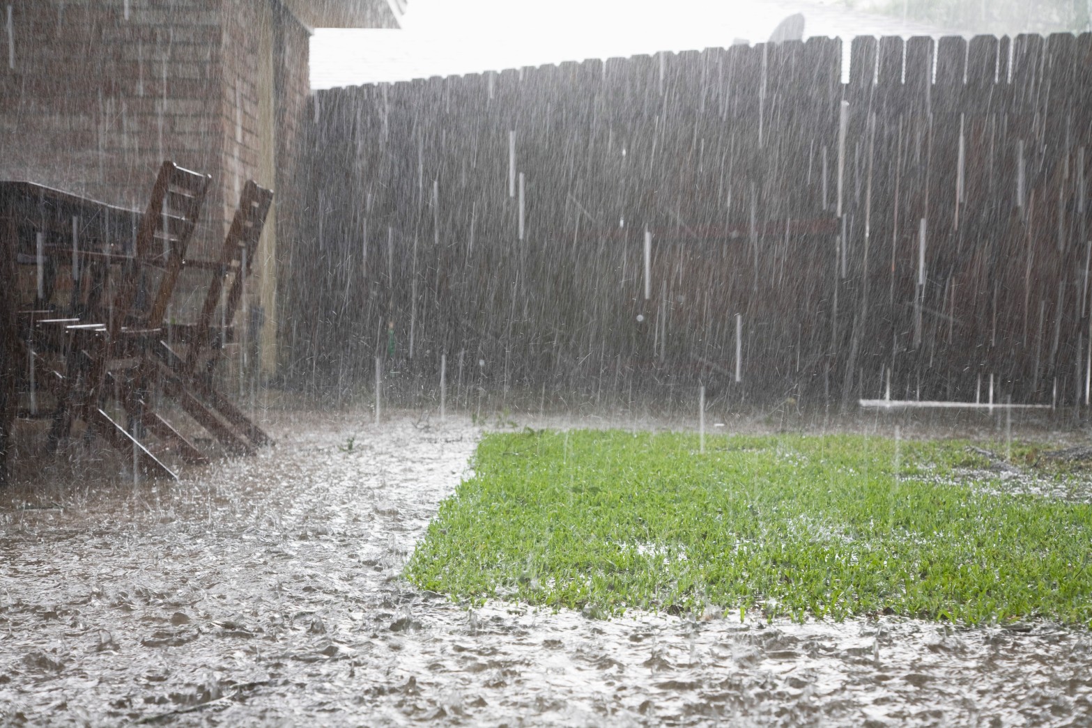
This far-reaching storm system will bring a good amount of rain to the area located north of the center of circulation, namely north of Interstate 80 and across portions of Interstate 90. The rain will linger for up to three days in the hardest hit areas. You can expect a general 2 – 4 inches of rain in this primary impact zone.
Cities that may be impacted by the heavy rain include Chicago, Minneapolis, and Milwaukee. The amount of rain may be enough to create travel delays both in the air and on the roads. Localized flooding may also be a concern if the heavy rain works with the recently fallen leaves to block storm drains.
Moisture Beneficial for Drought and Low Water Levels in Major Rivers
But not all of the news is bad. A large portion of the eastern Dakotas, Nebraska, Kansas, Iowa, Kentucky, Ohio, and Michigan are under the designation of some level of drought, according to the U.S. Drought Monitor. Some parts of this zone are experiencing pockets of exceptional drought, the highest category assigned by the monitoring service.
Many of the region’s rivers and its tributaries are also dealing with low water levels. Forecasters are predicting that the Mississippi, Ohio, and Missouri rivers will all benefit from this storm system, seeing a boost in their water levels in the days following the departure of this wet weather.
The bad news is that a good amount of the rain will be quickly absorbed by the dry ground, leading to less runoff than one would expect with moisture of this magnitude. This means that any increase in river levels will be wiped away quickly.
The greatest risk of severe thunderstorms will be in areas located to the south and the east of the storm’s primary track. These storms are most likely to erupt late Thursday and last through Saturday. The storm cells will be responsible for a variety of impacts, including locally heavy rains and gusty winds.

Northeast in for Another Soaker of a Weekend
It has been challenging for many residents of the Northeast to get out and enjoy their favorite fall activities on the weekend. The last several weekends have seen persistent rain and stormy conditions in this region. Unfortunately, that trend is set to continue this upcoming weekend as the storm system advances from the Midwest into the Northeast.
The moisture will pick up in the eastern Great Lakes and across the central Appalachians beginning on Friday. This rain will reach the mid-Atlantic, the Northeast, and southwestern New England on Saturday.
Should rain fall in New York City this weekend, it will be the sixth weekend in a row that the Big Apple has picked up significant rainfall on a weekend day. The city has recorded 14.74 inches of rain since the beginning of September. This number is well over the historical average of 5.62 inches during the same time period.
The Northeast will also be under the threat of flash flooding, especially in poor drainage areas and where leaves may be blocking storm drains. This is also a good time to clear out the leaves from your home’s rain gutters.
Patchy fog and areas of low clouds could also complicate travel plans. Be sure to check your flight status if you are using some of the region’s major airports in New York City, Philadelphia, and Boston.
Breezy conditions will make it feel chillier than the actual temperature indicates. For example, a large part of the Northeast can expect real feel readings to top out in the 40s and 50s when the rain and winds pick up.
Sunday will be the best day to potentially catch a break from the rain. The moisture is going to move out to sea by the end of the weekend, possibly salvaging the latter parts of the day.
Northern portions of New England may avoid the worst of the rain thanks to a wedge of dry air currently anchored over this part of the U.S. This means that it could be ideal conditions to head out and check the changing leaves in Maine, New Hampshire, and Vermont. However, there is still the chance that the storm system could take a turn to the north when it hits the coastal areas of the Northeast, bringing a surge of moisture up into the far reaches of New England. Stay tuned as this forecast develops with greater precision in the coming days.
Did you find this content useful? Feel free to bookmark or to post to your timeline for reference later.

January 21, 2024

January 19, 2024

January 18, 2024
