
Heavy Rain, Flooding, and Chance of Severe Weather Staring Down the Southern U.S.
January 22, 2024
Posted: February 12, 2023 2:32 am


A Weakening La Niña Pattern Could Usher in Significant Weather Impacts
While the Northeast and the Midwest are forecast to be dealing with lingering snow showers as the meteorological spring kicks off on March 1, the drought-stricken West Coast will welcome the additional moisture. Here is a look at the extended spring forecast for the western half of the country.
It was a wet start to the new year for the West Coast after a train of storms moved through the region from the Pacific Ocean. While this immense moisture caused a slew of headaches, it was good news for the region’s drought situation. Forecasters are predicting that this higher than average amount of moisture will bring about additional relief for those still dealing with the drought.
The ongoing drought is already experiencing relief thanks to the recent storms. According to the U.S. Drought Monitor, the highest level of drought has been almost negated in the West with the next highest designation seeing a substantial reduction.
Despite the substantial relief, the western third of the country is still under a widespread drought. Local officials are warning that water use restrictions may remain in place through the coming months.
The good news in the long-range forecast is that more storms are predicted to move in from the Pacific well into the spring season. However, the bulk of these storms will likely bring the biggest impacts to the Pacific Northeast rather than drought-stricken California and the Southwest.
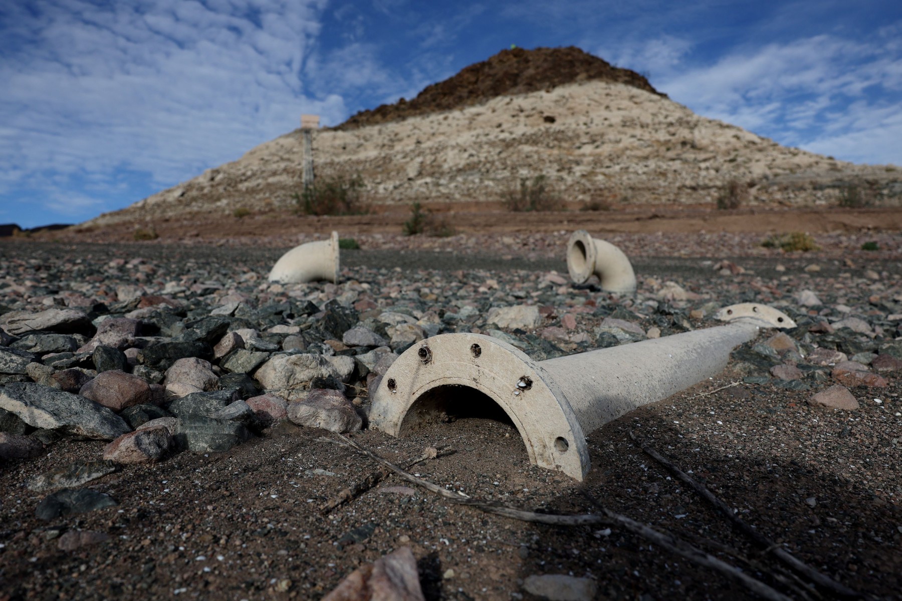
Although much of the attention has been focused on the drought situation in California, the Desert Southwest has also been grappling with exceptionally dry weather over the last several months. Last year, the water levels in Lake Mead straddling Arizona and Nevada plummeted to its lowest level ever recorded. The receding waters revealed a number of interesting artifacts as well as human remains, grabbing the news headlines and shining a spotlight on the worsening drought.
Recent moisture has helped to fill this reservoir and improve the water use prospects in the months ahead. Like Lake Mead, Lake Powell in Arizona and Utah also gets its water from the Colorado River basin. Both reservoirs have seen dramatic improvement this winter, however, climatologists warn that the relief may not be long-term.
The snowmelt expected this spring will not be adequate enough to fill Lake Mead and Lake Powell to capacity. This snowmelt is the most significant source of water for the rivers and streams that feed into these two important reservoirs. Although there is a good amount of snowpack currently sitting in the surrounding mountains, it will take a few winters with high amounts of precipitation to completely erase the drought and bring water levels back to normal levels in the region’s reservoirs.

In addition to seeing slight relief from the drought, the Southwest is forecast to see rapidly rising temperatures by mid-April. It will feel more like summer in some cities in the Desert Southwest by the middle of spring.
It may take a bit longer for the warmer temperatures to hit the Pacific Northwest and Northern California. This delay can be blamed on grounds that have been overly saturated from the constant barrage of winter storms. Wet ground typically inhibits the warming temperatures.
The West has been under the impacts of a La Niña climate pattern for the last three years. However, forecasters are predicting that this pattern will start to weaken by this summer. Rising water temperatures in the eastern equatorial Pacific are likely to bring an end to this pattern and create what is called a neutral state by climatologists. If this warming of the ocean waters continues, it is likely that the El Niño pattern will become the dominant influencing factor.
Climatologists caution that the models are still shaky in their predictions about when the La Niña pattern will fade away. The models will become more reliable by May or June, providing more accurate long-range forecasting data. While there is a chance that La Niña could quickly transition to the opposing El Niño pattern by the end of 2023, it could also be a slower change.
Should El Niño become the dominant climate pattern, the bulk of the moisture coming from the Pacific will focus on California and the southern half of the U.S. This pervasive pattern would also translate to a less intense Atlantic hurricane season thanks to the higher incidence of disruptive winds to break up tropical features.
Did you find this content useful? Feel free to bookmark or to post to your timeline for reference later.

January 21, 2024

January 19, 2024

January 18, 2024
