
Heavy Rain, Flooding, and Chance of Severe Weather Staring Down the Southern U.S.
January 22, 2024
Posted: August 8, 2022 10:49 am


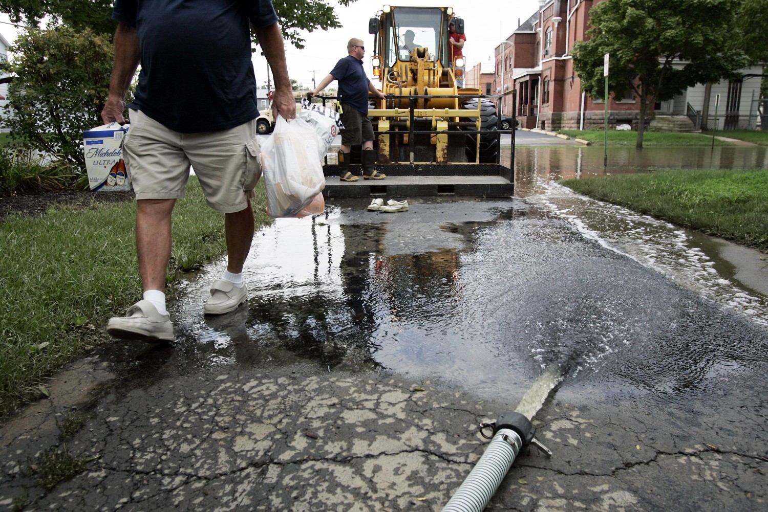
Image: J.D. Pooley/Getty Images News via Getty Images
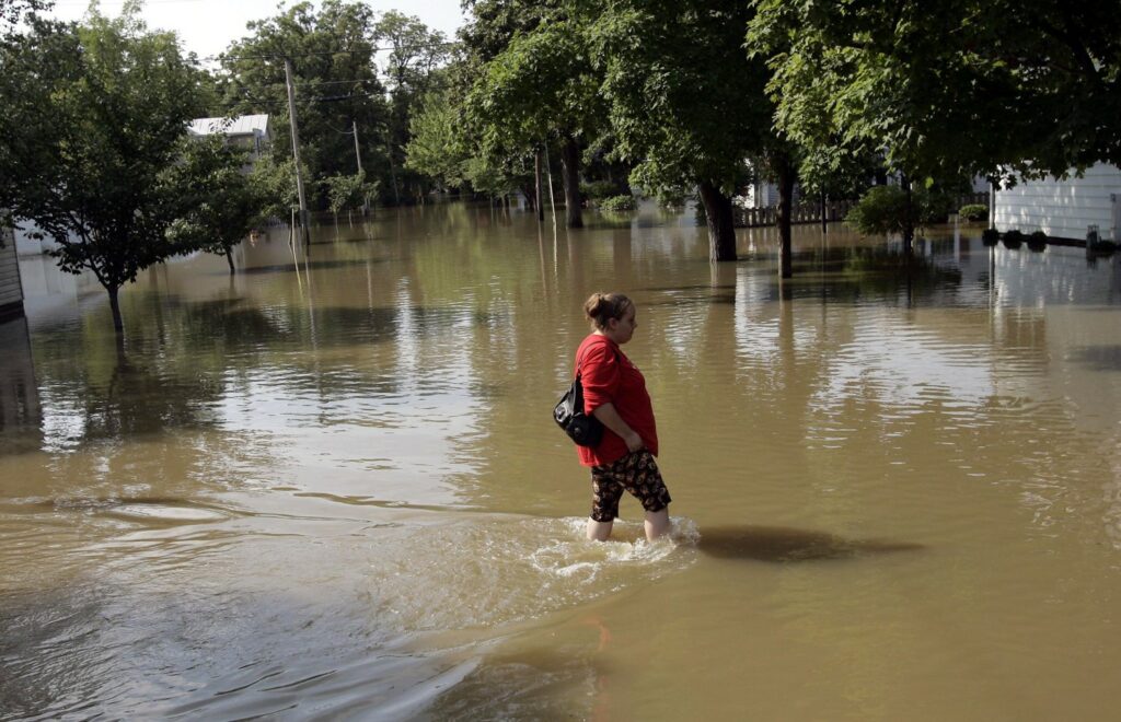
Mother Nature is not doing any favors for the flood-ravaged Ohio and Tennessee valleys. Residents are still cleaning up from a series of heavy rainfall events, including historic flooding that claimed the lives of at least 37 people in eastern Kentucky. More rain is in the forecast for the upcoming week.
Sunday brought a day of widespread flood watches for areas of eastern Kentucky stretching through southeastern Ohio and into West Virginia. The flooding downpours are being blamed on a slow-moving frontal boundary that is mixing with a large amount of moisture. These two factors are expected to deliver a new round of flooding threats to parts of the central Appalachians as well as some areas of the Ohio and Tennessee valleys.
The persistent rainfall is forecast to pick up early this week as the frontal boundary continues to move to the south and collide with the warm and moist air coming up from the Gulf of Mexico. The front is forecast to crawl through the Piedmont region through at least Thursday morning. Although there will be breaks of sunshine and large dry pockets of air, residents in the impacted region will need to stay abreast of changing conditions. Forecasters are warning residents to expect road closures off and on throughout the week.
As the last few weeks have shown this part of the country, flash flooding can be triggered in an instant. Of particular danger of the position of this front is that it is going to be positioned over some portions of mountainous terrains. This type of terrain funnels the rain into one location, increasing the risk of flooding as rivers, streams, and creeks reach their capacity.
In addition, the flooding risk will be high because so much of the ground in this region is already fully saturated. This means that the soil will not be able to take on as much water before it begins to flood.
Because of the previous flooding events, FEMA and other recovery groups are already in the region. President Joe Biden declared a federal emergency for the impacted area, freeing up more funding and assistance in cleaning up the damage.
The Piedmont region is not the only part of the U.S. that has been dealing with historic flooding. Late last week, it was Death Valley that sustained flood damage thanks to a series of heavy rainstorms that brought almost a year’s worth of precipitation to Death Valley National Park. The Friday flooding trapped about 1,000 visitors and staff while damaging dozens of vehicles.
The heavy rain inundated the Furnace Creek area of the park, known as the hottest place on earth. The annual rainfall for Death Valley National Park measures about 1.90 inches, however, the park only sees about .10 inches in the month of August. Friday’s flash flooding event came at the hands of 1.46 inches, smashing the previous record for that date in history of 1.10 inches back in 1936.
According to park officials, approximately 60 vehicles were buried in debris as the floodwaters came rushing in. Officials were forced to close all roads within the park to protect visitors and staff. This included the major highway of State Route 190, stretching from Olancha to Death Valley Junction. There were no injuries reported.
By Saturday afternoon, the majority of the stranded visitors had been evacuated out of the park.
The flooding in Death Valley came as the result of the typical monsoonal moisture associated with this time of the year. While the weekend was mostly dry for the Southeast, the monsoonal storms are forecast to pick up again early in the work week.
The moisture is expected to track to the north beginning Monday, bringing along the chance of rain showers and thunderstorms for parts of Arizona, Nevada, Southern California, New Mexico, and Utah.
Normally dry places such as Phoenix and Albuquerque can expect to see a surge of humid air in the coming days. This will bring the real feel temperature even higher, making it downright miserable at times.
Most residents will welcome the monsoonal storms as the bulk of the Southwest is under some designation of a drought. For example, over 90% of Arizona is under a drought designation.
Although the usual monsoonal moisture tends to stay away from the coastal areas of California, forecasters are predicting that some places throughout the state may see some of this rain surge to the west. This could bring a chance of rare August rain to cities such as Los Angeles and San Diego.
Did you find this content useful? Feel free to bookmark or to post to your timeline for reference later.

January 21, 2024

January 19, 2024

January 18, 2024
