
Heavy Rain, Flooding, and Chance of Severe Weather Staring Down the Southern U.S.
January 22, 2024
Posted: September 12, 2023 3:49 pm


The end of the astronomical summer will bring another round of heavy rain showers and storms to the Northeast, similar to the weather pattern that has distinguished the season for this part of the county. Another influx of moisture will bring renewed risks of flash flooding to the Northeast and beyond. Here is what you need to know.
Soggy Weather Pattern Continues for New England and Northeast
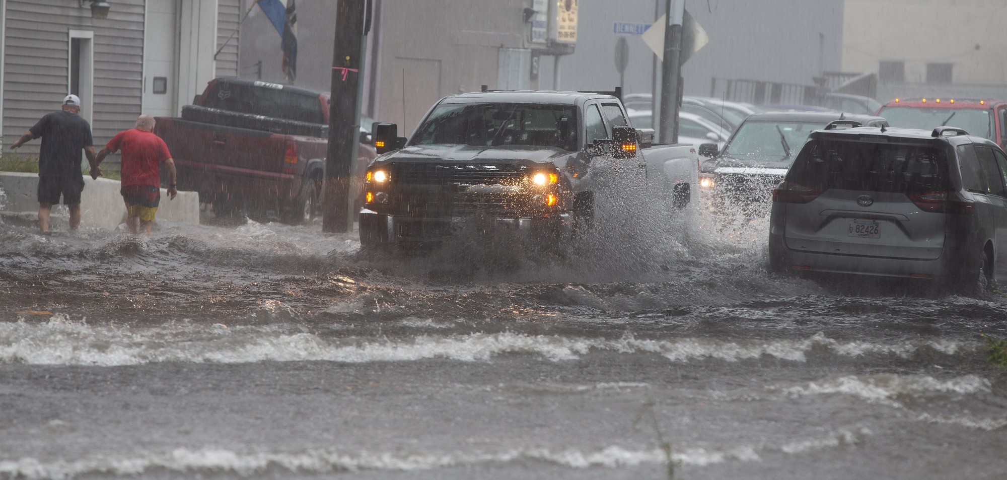
It has been an exceptionally wet summer for the Northeast and New England. A large portion of New England has seen rainfall amounts up to twice the historical average since June 1. Monday’s downpours triggered localized flash flooding in an area stretching from New Jersey to New Hampshire.
Nearly 5 inches of rain fell in Fitchburg, Massachusetts on Monday afternoon and evening, trapping motorists in their cars and creating sinkholes. The city of Leominster also recorded heavy rainfall in a shorter period of time, prompting officials to declare a state of emergency.
Leominster Mayor Dean Mazzarella said Tuesday morning that local officials had to use hovercrafts and boats to evacuate stranded residents on Monday night. Several nursing homes and a hospital were left without power because of the floodwaters rushing through the downtown area.

Located to the northwest of Boston, Leominster is home to about 44,000 people. The mayor confirmed that the city recorded about 11 inches of rain in a period of seven hours late Monday. The Barrett Park Pond Dam was put on code red as authorities warned that it could break. Area schools were closed on Tuesday so that they could be used as emergency shelters.
While Leominster will get a break from the rain on Tuesday, more moisture is in the forecast beginning late Wednesday and continuing through Thursday.
New York City also got in on this heavy rain, recording nearly an inch of rain in one hour on Monday evening in Central Park. This amount of precipitation quickly overwhelmed some of the streets, complicating the evening rush hour.
Monday’s rain event was a continuation of the soggy weekend. For instance, Scranton, Pennsylvania saw about 4 inches of rain fall over a period of just a few hours. The flash flooding is being blamed for a death of a woman in Lackawanna County, Pennsylvania who drowned trying to get out of her vehicle.
Wednesday’s Forecast Calls for More Rain and Chance of Severe Weather
Although Tuesday will be relatively calm, another round of moisture is headed toward the region on Wednesday thanks to the arrival of a cool front. The rain will fire up along the busy Interstate 95 corridor from New England and down into the mid-Atlantic.
Showers and locally severe thunderstorms are forecast to arrive ahead of the front beginning in Ohio and western Pennsylvania before moving into western portions of New York, West Virginia, Maryland, and Virginia. This weather maker could get going as early as Tuesday night in this region.
By Wednesday morning, the storms and heavy rain will impact parts of central Pennsylvania and into New York state. Philadelphia could be in store for a rocky morning commute as the storms fire up in this corner of the Keystone State. These storm cells are predicted to usher in strong winds and heavy downpours capable of triggering flash flooding.
The normal heating of the afternoon hours will produce widespread rain showers and storms throughout much of the mid-Atlantic and into the southern portions of New England later in the day Wednesday. Forecasters are warning that these storms could be enough to cause travel delays both on the ground and in the air. Airport ground stops could create significant backups in the region’s major airline hubs.
Heavy Rain, Threat of Tornadoes, and Cooler Temperatures All in the Cards
The current forecast is calling for 1 to 3 inches of rain in just a few hours. Rain of this magnitude is a precursor for flash flooding in small streams and across roadways. This is particularly true because of the typical low evaporation rates during this time of the year.
Tornadoes are another risk that the region will be facing on Wednesday afternoon and evening. The greatest threat of these twisters will be in a zone from New York’s Hudson Valley up through Connecticut and into central Massachusetts.
Cooler temperatures will push in behind the rain showers. The temperatures will drop significantly across the Midwest on Thursday and Friday before pushing eastward. The difference in the overnight lows will be the most noticeable with some parts of the Appalachians seeing readings fall into the 40s by the end of the week. The cities along the Interstate 95 corridor are likely to see overnight lows in the mid 50s and low 60s.
Impacts of Hurricane Lee on Forecast
There is also a great likelihood that eastern New England and the mid-Atlantic coast could see the impacts of Hurricane Lee by the end of the week and into the weekend. While the U.S. is not expected to see a direct hit from this major hurricane, the size of the feature could result in rain, storm surge, and high winds hitting New England.
The current forecast models indicate that Lee will make landfall in Nova Scotia in Atlantic Canada. However, eastern Massachusetts and eastern Maine could see significant impacts from this storm in the form of torrential rain and strong wind gusts. Be sure to keep an eye on the track of this storm as it continues its journey to the north in the Atlantic Ocean.
Did you find this content useful? Feel free to bookmark or to post to your timeline for reference later.

January 21, 2024

January 19, 2024

January 18, 2024
