
Heavy Rain, Flooding, and Chance of Severe Weather Staring Down the Southern U.S.
January 22, 2024
Posted: January 3, 2023 2:56 pm


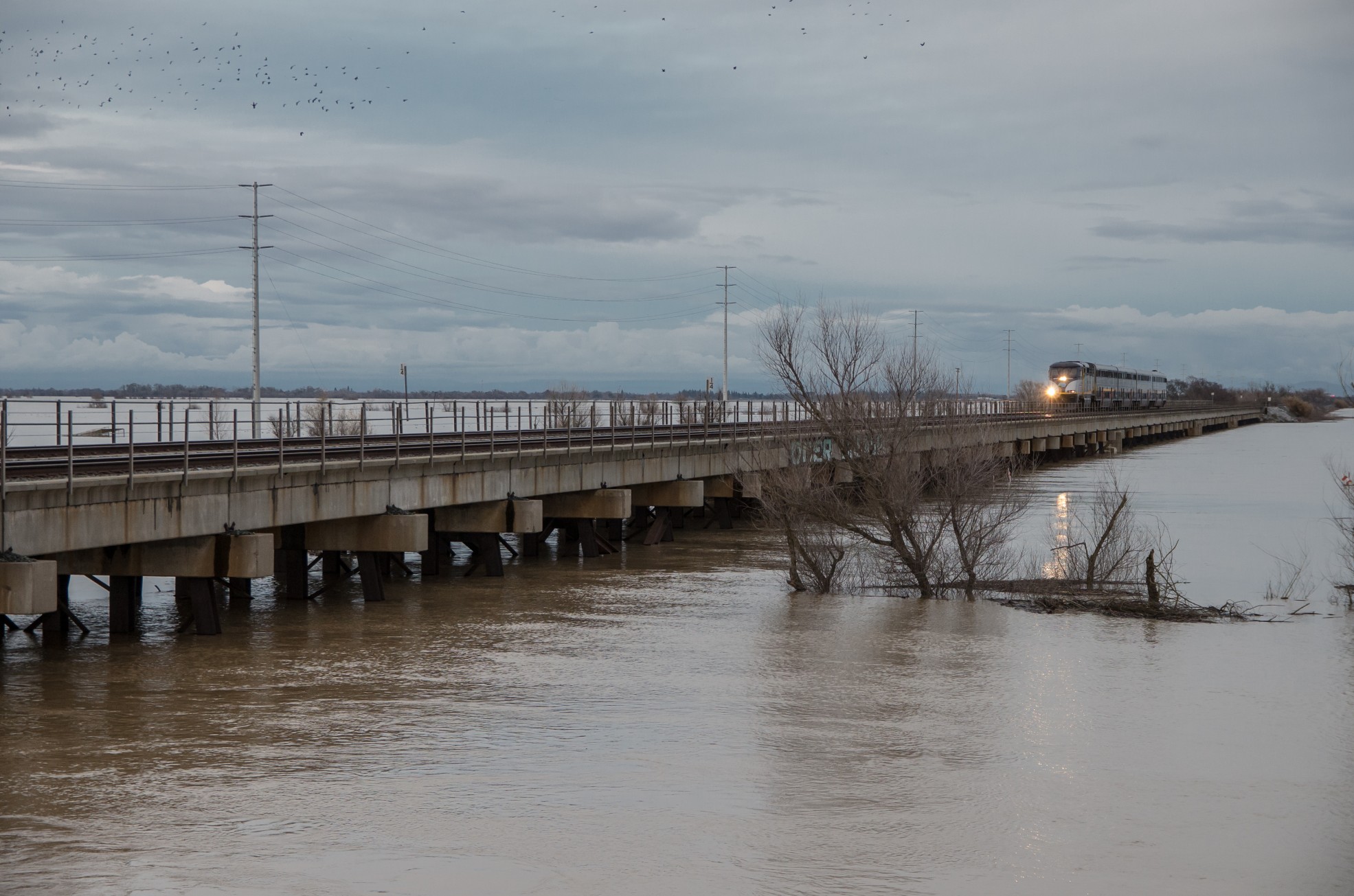
California cannot catch a break as storms from the Pacific Ocean continue to roll through the Golden State, bringing more rain and snow to the region. Another atmospheric river is set to drop more moisture by the middle of the week, triggering flooding and mudslides across terrain that is already overly saturated.
Rain began falling on Monday afternoon at the Rose Bowl in Southern California, signaling the arrival of another storm system. While the moisture associated with this early week storm will be lighter compared to what the New Year’s weekend brought, even more precipitation is in the forecast for later in the week.
Forecasters are warning that even a small amount of rain could cause flooding issues because of the saturated grounds. Many streams are in danger of overflowing, resulting in minor urban flooding.
A more powerful storm is already churning over the Pacific Ocean, forecast to come onshore over Northern California late Tuesday night. This particular storm will likely pack more moisture than what the Monday storm brought to the state. The storm is also expected to stall out over California from Wednesday into Thursday, making it more likely that flooding may occur.
You can expect 2 to 4 inches of rain to fall in the San Francisco Bay Area and across the west-facing mountains of this part of the state. This moisture is predicted to move as far south as Santa Barbara, hammering the central coast in the process. This stretch of coastline may see 4 to 8 inches of rain.
Southern California will also be in the crosshairs of the moisture with about 2 inches on tap for Los Angeles and slightly less in the area extending down into San Diego. However, there is also the chance that the atmospheric river moves farther south, bringing a greater chance of flash flooding and mudslides to a more populated area.
California motorists will want to pay special attention to road conditions, particularly in the northern and central portions of the state. The heavy rainfall will likely create ponding on roadways, especially on low-lying stretches of highways. In addition, the strong winds associated with this storm may bring down trees and send debris across roadways.
The storm system will also bring snow to the higher elevations. Snow is forecast to total about 6 – 12 inches across the Sierra Nevada. As is typical with storms of this nature, the risk of avalanches will also increase as the wintry precipitation moves into the region.
Forecasters are predicting that this persistent line of storms will continue into next week. However, a change in the jet stream by the middle of the month will prevent the mass amounts of moisture from reaching California in the weeks ahead. The most potent storms are forecast to remain anchored over the Pacific Northwest, sparing coastal California the precipitation that it has been dealing with over the last few weeks.
Regardless of how much moisture falls in the coming days, the state of California is already in a better position when it comes to relief from the ongoing drought. The rain of the last few weeks has filled many of the state’s most important reservoirs. In fact, some of the reservoirs in the central and northern portions of the state may reach full capacity over the next several weeks as runoff from the mountains continues.
Did you find this content useful? Feel free to bookmark or to post to your timeline for reference later.

January 21, 2024

January 19, 2024

January 18, 2024
