Heavy Rain, Flooding, and Chance of Severe Weather Staring Down the Southern U.S.
January 22, 2024
Posted: April 28, 2023 11:02 am


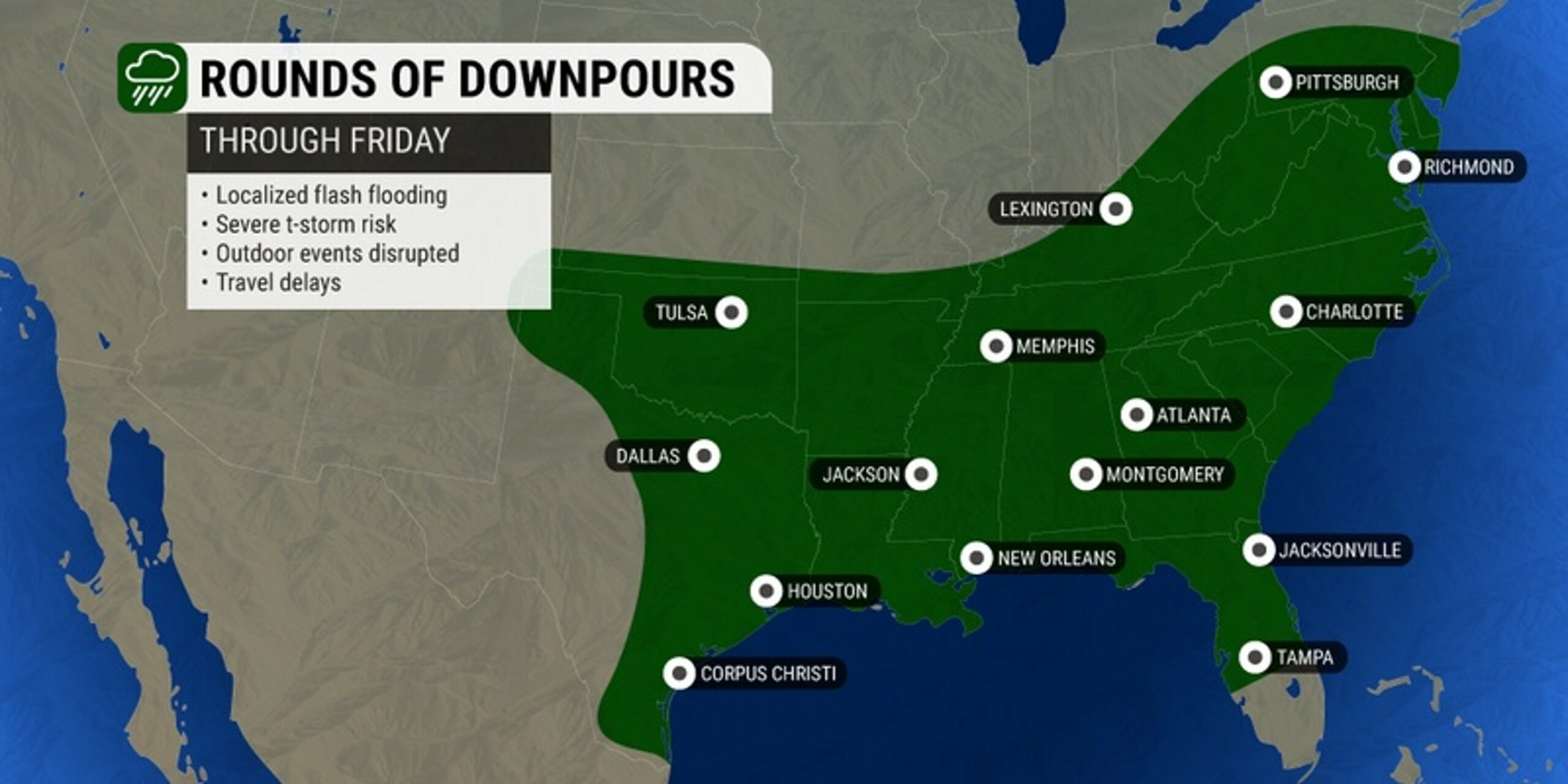
The rash of severe weather is forecast to continue through the weekend for much of the eastern half of the U.S., fresh on the heels of a rough few days in the South.
A multi-day storm system has brought large hail, lightning strikes, damaging winds, and more to an area stretching from Texas through Florida over the last few days.
Three people were injured from lightning strikes over the last few days as a result of the severe weather. The storm system produced at least two small tornadoes and hail that measured the size of grapefruit.
While much of the southern U.S. saw the impacts of this storm system, Florida and Texas were hit particularly hard on Wednesday and Thursday.
According to the National Weather Service (NWS), at least 130 hail reports were filed in the two states over a period of just 24 hours. Waco, Texas reported hail measuring 4.5 inches in diameters while the town of Anthony, Florida saw hail that was as large as 2.5 inches across.
The storm system also produced damaging winds, including gusts of up to 85 mph about 35 miles north of West Palm Beach. The town of Buna, Texas recorded gusts over 75 mph. The winds were to blame for vehicle accidents in both Texas and Florida.
More severe weather is in the cards for the South on Friday. A new storm system has rushed down from the Rockies, providing the energy needed for more thunderstorm development in the southern half of the country.
These storms are in addition to a different wave of severe weather expected to impact the East Coast to close out the work week.
The central Plains states will see the first of the severe weather fire up on Friday before the storm cells push into the Southeast just in time to ruin outdoor plans for the weekend. The middle of the Interstate 35 corridor in the nation’s heartland will once again be under the threat of storms on Friday afternoon and evening.
These impacts will include the full gamut of severe weather, including large hail, heavy rain that triggers flash flooding, potentially dangerous lightning strikes, strong winds, and isolated tornadoes.
Central Texas will be in the bullseye for the severe storms, putting the populated metro areas of Dallas, San Antonio, and Austin at risk.
These storms will push to the east on Saturday and Sunday, ushering in rain and raw weather for the South. Forecasters are still uncertain as to when the severe weather will fire up in each area.
Many of these communities across the Gulf Coast and the Southeast have spent several days this week dealing with severe storms.
The latest predictions put the Gulf Coast states under the highest risk of severe weather on Saturday afternoon and evening.
This impact zone includes the cities of New Orleans, Biloxi, and Mobile. The impacts may stretch as far east as the Florida Panhandle, putting a damper on beach plans along the famed Emerald Cost.
The worst of the weather is forecast to move up the East Coast on Sunday. Be sure to check back here for the latest predictions for this part of the Atlantic Seaboard as the forecast becomes more clear.
Did you find this content useful? Feel free to bookmark or to post to your timeline for reference later.

January 21, 2024

January 19, 2024

January 18, 2024