
Heavy Rain, Flooding, and Chance of Severe Weather Staring Down the Southern U.S.
January 22, 2024
Posted: July 23, 2023 7:12 am


It has been a roller coaster of a summer for the Northeast as the region has seen mass flooding events and rapidly fluctuating temperatures. Now the area is set to see some of the warmest temperatures readings of the summer by the end of next week. Here is a snapshot of the forecast this coming week for the Northeast.
While the building heat may be a hindrance to some people, the weather pattern will also bring forth a much-anticipated surge of dry conditions. This is good news for a part of the country that is still cleaning up from the widespread flooding events of the last few weeks.
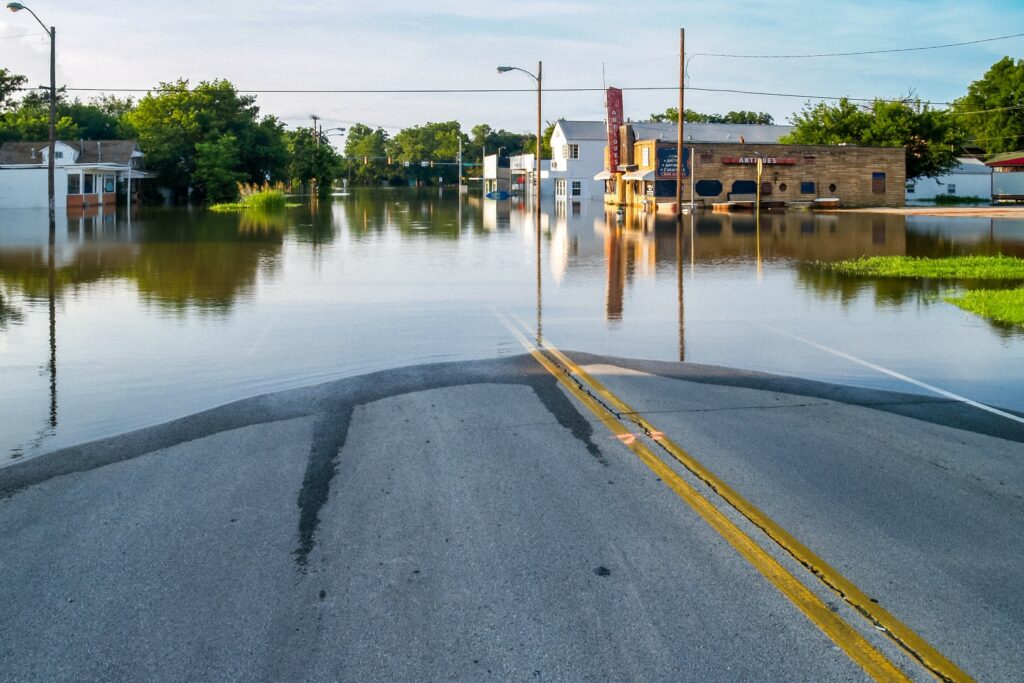
The flooding was triggered by a series of slow-moving storms that brought in moisture from both the Atlantic Ocean and the Gulf of Mexico to inundate the region with heavy rain. This rainy period was quite the contrast to the overly dry conditions of May and the first part of June.
Rainfall that hit up to four times the seasonal average for July went a long way in erasing some of the drought conditions that had pervaded the Northeast to start the season.
The persistent parade of storms has also suppressed daytime highs throughout the area, keeping the mercury at below the historical average for the bulk of July. For instance, daily highs have been trending 0.5 to 1.5 degrees below normal since the beginning of June.
This weather pattern is a direct contrast to the opposite corner of the nation that has been seeing record-breaking temperatures take hold and not let go.
Residents of the Northeast will begin to see the change in the weather pattern by Sunday. The rain that has been impacting the region will finally dissipate, ushering in drier conditions and warmer temperatures. This pattern will become more prevalent as the week continues. In addition to the drier weather, residents may also notice falling humidity levels.
Forecasters are warning that the region may see some stray thunderstorms to start the work week before the heat and dry weather becomes the dominant pattern in the second half of the week. Any severe weather on Monday and Tuesday will be localized in nature. The northern half of the area is most likely to see the early week storms and heavy rain.
You will find daily highs hovering in the 80s to begin the week in the Northeast. These readings will fall within the average range for the end of July. However, the mercury will start an upward trajectory over the next several days, bringing readings up into the 90s for most of the region. In fact, some cities may see their highest readings of the Sumer so far.
It has been an unusually cool summer for many of the most populated cities up and down the Interstate 95 corridor. For example, New York City has topped out at 93 degrees for a high, a reading it hit on July 5. The hottest it has been in Washington, D.C. is 94 degrees on June 2 and again on July 13.
That all may change by the end of the week as the heat that has been the storyline over the western half of the U.S. moves into the northern Plains and eventually makes its way across the Midwest, the Great Lakes, and over to the East Coast.
Some areas in the eastern U.S. could see the mercury reach the upper 90s and possibly the triple digits by the time the work week comes to a close and the weekend begins. For instance, New York City is forecast to reach 95 degrees by Friday. Washington, D.C. could finally crack the century mark by Friday or Saturday.
This impending blast of heat is not likely to hang on for long. Forecasters are predicting that the long-range forecast will bring another cooler pattern to the U.S. by the start of August, a time of the year that typically sees the hottest temperatures. This new cold front will also bring back the chance of unsettled weather in the form of persistent rain and potentially severe storms.
Did you find this content useful? Feel free to bookmark or to post to your timeline for reference later.

January 21, 2024

January 19, 2024

January 18, 2024
