Heavy Rain, Flooding, and Chance of Severe Weather Staring Down the Southern U.S.
January 22, 2024
Posted: June 30, 2022 12:07 pm


July will arrive right on time in the Northeast as the mercury is expected to soar just as the calendar flips to the new month.
It was a cooler start to the week in the Northeast thanks to a cold front that moved through late Sunday and Monday, bringing the overall temperatures down across the area. In fact, some spots saw the overnight lows drop into the 40s on Monday and Tuesday night as the front settled into place.
However, the temperatures are back on an upward trajectory more indicative of the usual weather patterns for this time of the year. A high pressure system is moving back to the area, sending both the mercury and the humidity readings up.
The temperatures will remain fairly seasonable on Thursday, giving residents one last day to potentially get in some yard work before the heat ratchets it up another notch on Friday. While the temperatures will definitely be higher on Thursday when compared to Wednesday, the absence of high humidity will keep conditions more comfortable than in the days ahead.
Thursday’s top readings will be in areas such as Washington, D.C. with the potential of 90-degree weather making a return. However, readings will remain in the mid-70s for the northern reaches of New England and through upstate New York.

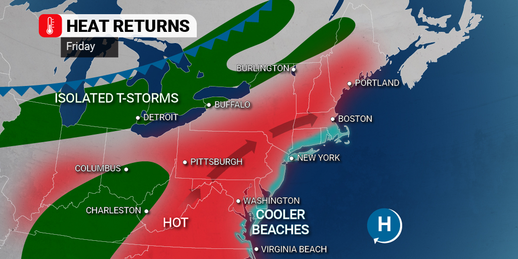
The arrival of July on Friday will also bring the re-emergence of heat and humidity up and down the Interstate 95 corridor. Daily high temperatures will exceed 90 degrees in many places. For instance, New York City will see a forecast high of 92 degrees with mostly sunny skies. It will be in the low 90s as far north as Boston.
Even the cooler areas of New England will still see the mercury top out in the mid-80s. For instance, Augusta, Maine will see a high of about 87 degrees with partly cloudy conditions.
The humidity levels will also be on the upswing by Friday, leaving some areas with a real feel temperature that breaks the century mark. This includes populated areas such as Baltimore and Washington, D.C. It will be a good day to plan activities in an air conditioned space.
Those heading out on the road to get a head start on the holiday weekend will want to make sure their air conditioning in the vehicle is working and that you are stocked with the proper coolant fluids. You do not want to get stuck in a remote area in this type of heat.
While the Northeast will be largely free of precipitation on Friday, thunderstorms may begin to fire up during the afternoon and evening hours across the Great Lakes and into the central Appalachians. Cities such as Detroit will begin the day with sunny skies with clouds and the chance of rain building up later in the day.
Likewise, places such as Charleston, West Virginia may see scattered storms develop later on Friday with the stormy conditions becoming more widespread later in the weekend.
By Saturday, this chance of storms will be positioned in an area stretching from the Appalachians to the Atlantic coastal areas. Storms that pop up on Saturday could bring heavy rains and gusty winds.
The front associated with the storms will dial back the heat and humidity a bit, however, it also means that some people may be in store for a soggy holiday weekend. Similarly, if the front slows its speed, the storms and rain may hang around on Sunday with the greatest chance of this happening through the mid-Atlantic states.
Because fronts of this nature do not generally track far to the south during this time of the year, there is a higher possibility that it stalls out across the mid-Atlantic. This could translate to rain in the forecast on Monday for spots such as West Virginia, Maryland, Virginia, and the southern tier of Delaware.
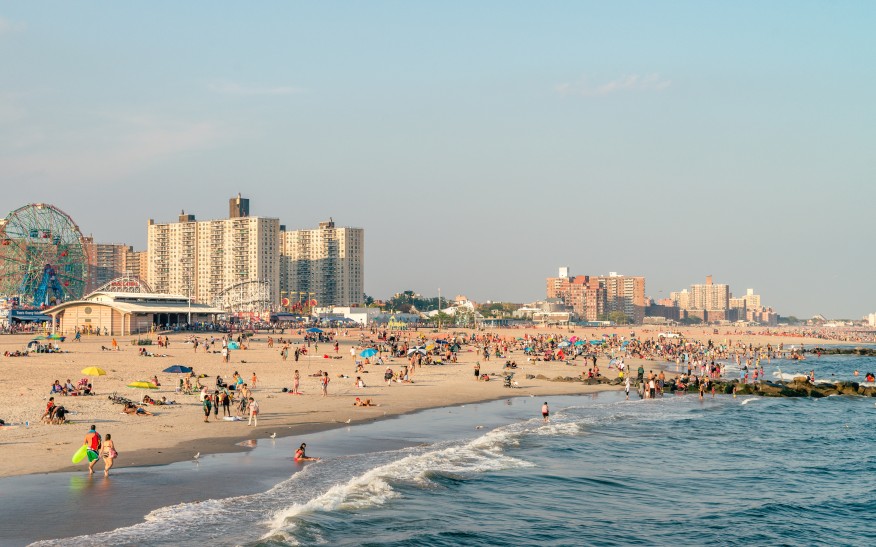
Be sure to check your local forecast if you live in this area and have outdoor plans on the Fourth of July. Having a backup plan will not be a bad idea if your holiday activities include a trip to the beach or a backyard barbecue.
Looking ahead, another front is forecast to push down from the north by the middle of next week. This front has the potential of pushing the current front to the south, ushering in drier conditions back to the area.
Sharing is caring! Did you find this content useful? Feel free to bookmark or to post to your timeline for reference later!

January 21, 2024

January 19, 2024

January 18, 2024