
Heavy Rain, Flooding, and Chance of Severe Weather Staring Down the Southern U.S.
January 22, 2024
Posted: July 9, 2023 11:33 am


Meteorologists are warning residents of the Northeast that flash flooding is going to be a concern heading into early next week thanks to a forecast that calls for heavy rain. More than 6 inches of rain may fall between Sunday and Tuesday over a large area of the Northeast. Here is a detailed look at this forecast.
You will want to stay abreast of the changing weather conditions over the next few days if you live in the Northeast. A surge of tropical moisture is bringing the chance of torrential rain stretching from Pennsylvania and up into Maine. The weather maker is going to bring up moisture from both the Gulf of Mexico and the Atlantic Ocean as it moves at a snail’s pace across the Northeast.
The system will make a turn to the northeast by the end of the week, bringing a significant amount of moisture to the mid-Atlantic, the Northeast, and New England. This is a corner of the country that experienced heavy rain to end the work week. A mudslide in Killington, Vermont resulted in the closure of a portion of U.S. Route 4 thanks to the heavy rain. There was also flash flooding reported throughout parts of the nation’s capital and its environs on Friday.
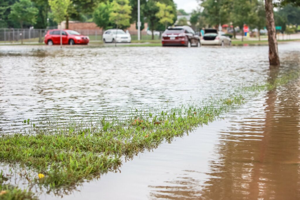
An abundance of moisture circulating in the atmosphere will set the stage for the persistent rain. Forecasters are predicting that rainfall rates could hit up to 2 inches per hour in the worst hit areas. This magnitude of rain will likely overwhelm some urban drainage systems, triggering flash flooding and creating travel difficulties.
The heaviest rain will slam into Washington, D.C. and Philadelphia late afternoon and into the evening hours. New York City will see the greatest amount of rainfall in the overnight hours and into Monday morning. This prediction could translate to a messy commute for residents of the Big Apple and beyond.
People in Boston will likely see the worst conditions hit just in time for the Monday afternoon commute. These downpours could linger into Tuesday morning depending on how quickly the system moves through.
You can expect widespread rainfall amounts of 2 – 4 inches for much of the Northeast. This forecast would equal close to the historical average for the entire month of July.
The higher terrains of upstate New York, Pennsylvania, and New England will be under the gun for a greater amount of moisture as the rain comes into contact with the mountains. This is because the moisture-rich air that rams up against the mountains tends to rise in an upward trajectory, supporting the development of more clouds and rain.
As a result, forecasters are predicting a higher chance of mudslides across Vermont’s Green Mountains. This mountain rain also saw a good amount of rainfall to end the week, putting the ground in a more vulnerable position for mudslides.
This storm system will also bring the chance of severe weather. The storms will first erupt in the mid-Atlantic on Sunday afternoon. These storms could usher in the chance of strong wind gusts, flooding downpours, and isolated tornadoes. Areas that experienced heavy rain at the end of the week will be more at risk of power outages because of saturated and weak grounds.
The rain is expected to let up from west to east throughout Monday and Tuesday as the storm system continues moving to the north and the east. As the storm exits into the sea, the interior Northeast will also see a reduction in the humidity levels. However, do not count on the lower humidity and cooler temperatures to linger. Warmer weather and higher humidity levels are on tap for the end of the week.
Did you find this content useful? Feel free to bookmark or to post to your timeline for reference later.

January 21, 2024

January 19, 2024

January 18, 2024
