
Heavy Rain, Flooding, and Chance of Severe Weather Staring Down the Southern U.S.
January 22, 2024
Posted: July 7, 2023 2:02 pm


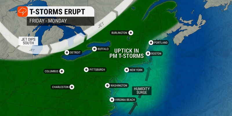
A steady rain is headed for the Northeast late this weekend and into the early parts of next week. Some areas may pick up several inches of rain, triggering flooding concerns and travel issues. Here is what you need to know heading into the weekend.
While things have been heating up and drying out in the Northeast to end the week, forecasters are warning that another round of immense moisture is on the way for this corner of the U.S. This moisture may be enough to create flooding concerns while impacting travel during the busy summer season.
The widespread temperature readings in the 80s and 90s are set to continue through at least Saturday for many areas of the Northeast. The sunshine has been pushing the real feel temperature even higher in recent days. This measurement takes into account a number of weather impacts, including the heat of the sun, humidity levels, and wind speeds to create a more accurate picture of how it feels when spending time outside.
The heavy rain is forecast to remain out of the Northeast through most of the day Saturday. However, increasing clouds could help to provide slight relief from the heat to the region on Friday afternoon and Saturday afternoon.
Friday’s most likely area of impact for storm activity will be to the west and north of Interstate 95 and across the Appalachians. This zone includes both Baltimore and Washington, D.C. By Friday evening, the storms may drift into Philadelphia and New York City. These storms could produce strong winds and torrential rain across north-central and northeastern Pennsylvania and across to central portions of New York state.
The hot weather is predicted to move out of the region later on Saturday. This day’s greatest severe weather threat will be across northern and western portions of New England and down into eastern New York state.
A ripple in the jet stream will encourage rain to fall over some areas of the middle Mississippi River Valley and into the Ohio and Tennessee valleys on Saturday. The ripple will also support the formation of locally severe storms over the country’s mid-section.
Travelers will want to keep an eye on conditions in the Northeast on Sunday. The storms are forecast to turn to the northeast early Sunday, bringing up additional moisture from the Atlantic Ocean and the Gulf of Mexico. This mass of moisture will serve as fuel for the impending storms.
The stretch along the Interstate 95 corridor from Washington, D.C. through Philadelphia will see the heaviest rain late Sunday afternoon and into the evening hours. The worst of the conditions will likely strike after nightfall on Sunday in New York City and its environs.
You can expect rainfall amounts of up to 2 inches per hour as the storm progresses from the southern tier of the Appalachians and into the mid-Atlantic and northward. By sunrise Monday, the bulk of the moisture will be moving through New England. The heaviest hit areas may record up to 6 inches of rain out of this weather maker by the time that it dissipates.
The Monday morning drive could be a mess for motorists in New York’s Hudson Valley and up through central New England. Boston could be spared the worst of the impacts, however, the track and timing of this storm system could change in the coming days. This is a feature that you will want to keep tabs on if you live in this part of the country.
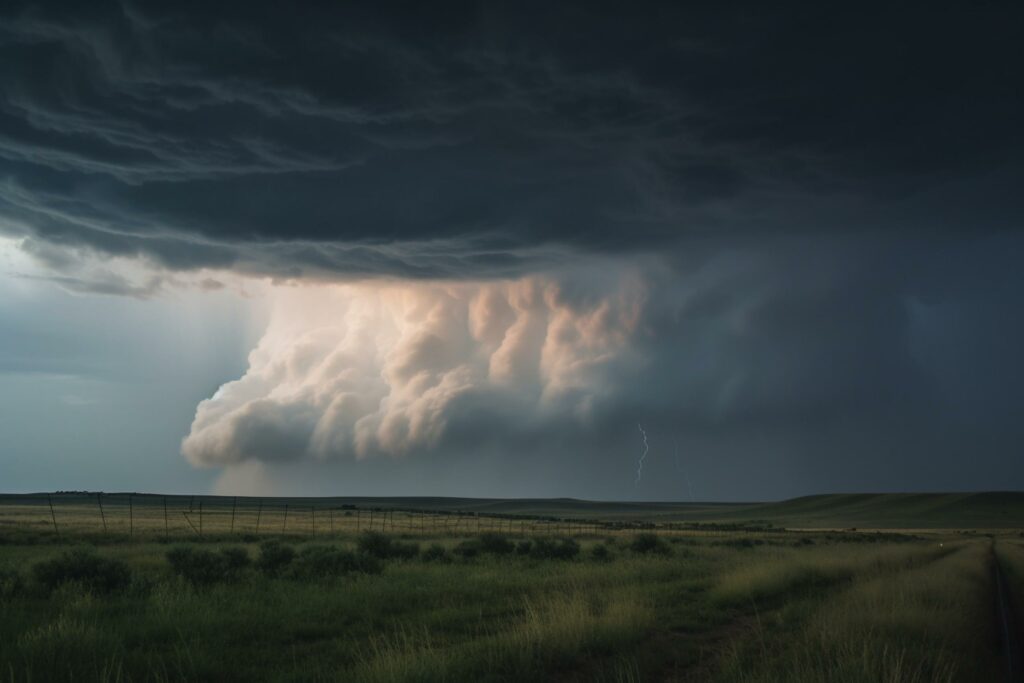
The leading edge of the storm system could pack frequent lightning strikes and strong winds. These impacts will be most prevalent Sunday afternoon and evening. This is when sporadic power outages are most likely to occur.
The warm air ahead of the system will help to support storm development. However, the wind speeds will likely die down once the sun sets.
The arrival of the moisture will help to trim the heat with temperatures landing about 10 degrees lower on average on Sunday when compared to Saturday. This will translate to high temperatures in the Northeast early next week falling into the upper 70s and mid 80s, below the norm for this part of July.
The large swath of moist air will support the formation of more locally heavy rains and thunderstorms throughout much of next week. Stay tuned to the forecast as the details become more clear.
Despite the immense moisture circulating in the eastern U.S., forecasters are warning that the smoke from the Canadian wildfires could still make a return to the region. A massive storm is predicted to take root in Canada, moving in a counterclockwise motion and serving to send the thick smoke to the north-central U.S.
The smoke will likely make an appearance at the tail end of the weekend and into next week. Some of the smoke and haze may drift into the Appalachians, the Great Lakes, the Ohio Valley, and the Northeast.
Did you find this content useful? Feel free to bookmark or to post to your timeline for reference later.

January 21, 2024

January 19, 2024

January 18, 2024
