
Heavy Rain, Flooding, and Chance of Severe Weather Staring Down the Southern U.S.
January 22, 2024
Posted: November 3, 2021 10:12 am


Twisters Develop as a Result of Contrasting Atmospheric Conditions
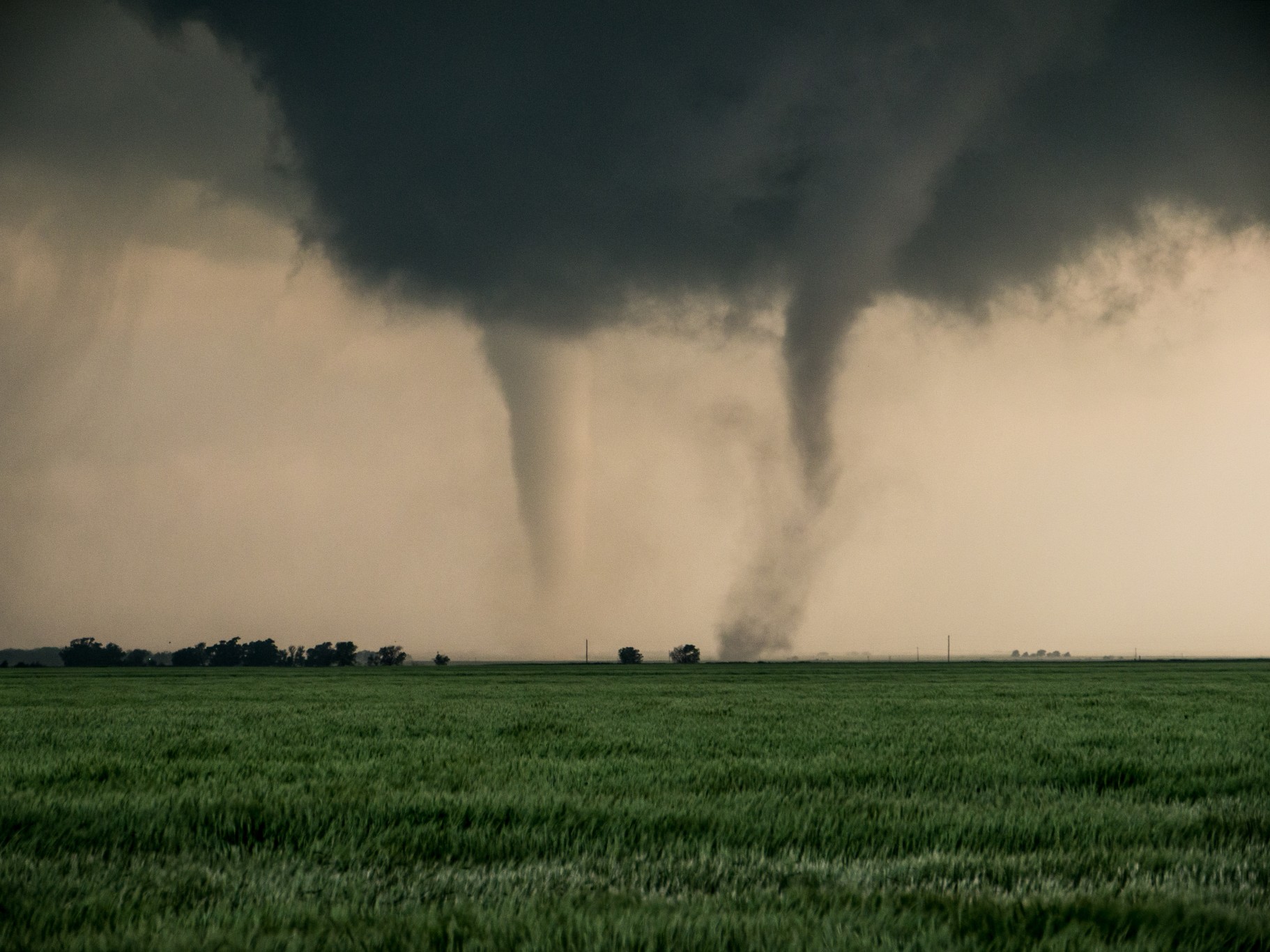
If it seemed as if there were more tornadoes than usual last October, it is because there were. According to the Storm Prediction Center (SPC), October 2021 came in second place on the list of Octobers with the highest amount of tornadic activity.
The SPC said that there were 139 reported tornadoes in October in the US. Of these reported tornadoes, 119 of them were officially confirmed. These numbers land 2021 behind October of 2018, a month that delivered 123 confirmed tornadoes. 2021 edged out the year 2001 with 117 confirmed twisters.
Not surprisingly, October of 2021 also delivered more outbreaks of severe weather than usual. This undoubtedly spawned a higher incidence of tornadic activity.
The hardest-hit state in October was Oklahoma. According to the National Weather Service (NWS), Oklahoma recorded a total of 31 tornadoes last month. This beats the record of 27 set back in 1998. October is the fifth most active month for twisters in Oklahoma, behind only March, April, May, and June.
October 10 was a particularly busy day for tornadoes with 17 striking the state on that date alone. The strongest tornado of the month also hit on that day when an EF2 touched down near Anadarko.
While more than 100 confirmed tornadoes during October may seem like a big number, it is actually not out of the ordinary for the tenth month of the year to see this level of activity. Just as the drastic change in the seasons triggers more severe weather outbreaks in the spring, the same weather transition can also lead to more tornadoes in the fall. This secondary peak of severe weather as the weather changes from warm to cool is more common than most people may realize.
While tornadoes in October are certainly not out of the realm of possibility, the year 2021 was definitely an outlier when it came to the sheer number of these twisters. There were a few different weather factors that played into this increase.
Even though the calendar officially changed to fall in September, many areas of the US stayed warmer than average. There were a number of daily high record temperatures recorded in a large swath of land stretching across the Upper Plans and into the Great Lakes. Because this warmth held on longer than usual, it set up the perfect conditions for cold fronts to clash with the stagnant warm air. As a result, more severe weather and tornadoes were able to develop.
A surge of warmer than average water in the Pacific Ocean also contributed to the development of more tornadoes. This area of warm sea-surface temperatures positioned itself north of the Hawaiian islands before growing beyond this region. As it warmed up, storms near the Gulf of Alaska in the Northeast Pacific Ocean cooled these northern waters.
The clash of these warm and cool pools of water caused high pressure to form in the south at the same time low pressure was forming in the north. What was left in the middle turned into strong winds in the upper levels of the atmosphere. As these winds picked up speed, the jet stream became more powerful, sending energy across the Rockies and into the Plains states.
The unstable air delivered ripe conditions for tornadic development throughout the Plains, the Midwest, and into the Tennessee and Ohio valleys.

January 21, 2024

January 19, 2024

January 18, 2024
