
Heavy Rain, Flooding, and Chance of Severe Weather Staring Down the Southern U.S.
January 22, 2024
Posted: July 29, 2023 5:59 am


The North American monsoon season is finally getting underway, bringing in moisture from Mexico into the Southwest. This moisture is already helping to slightly trim the record heat that has gripped this corner of the country throughout July.
But the bit of relief to the heat will come at the cost of the potential of thunderstorms and frequent lightning strikes. Here is what you can expect in the coming days in the Desert Southwest.
It was a record-breaking month for much of Arizona and beyond as a massive heat dome set up over the region. A delay in the arrival of the annual monsoon moisture helped to keep the temperatures elevated for an extended period of time.
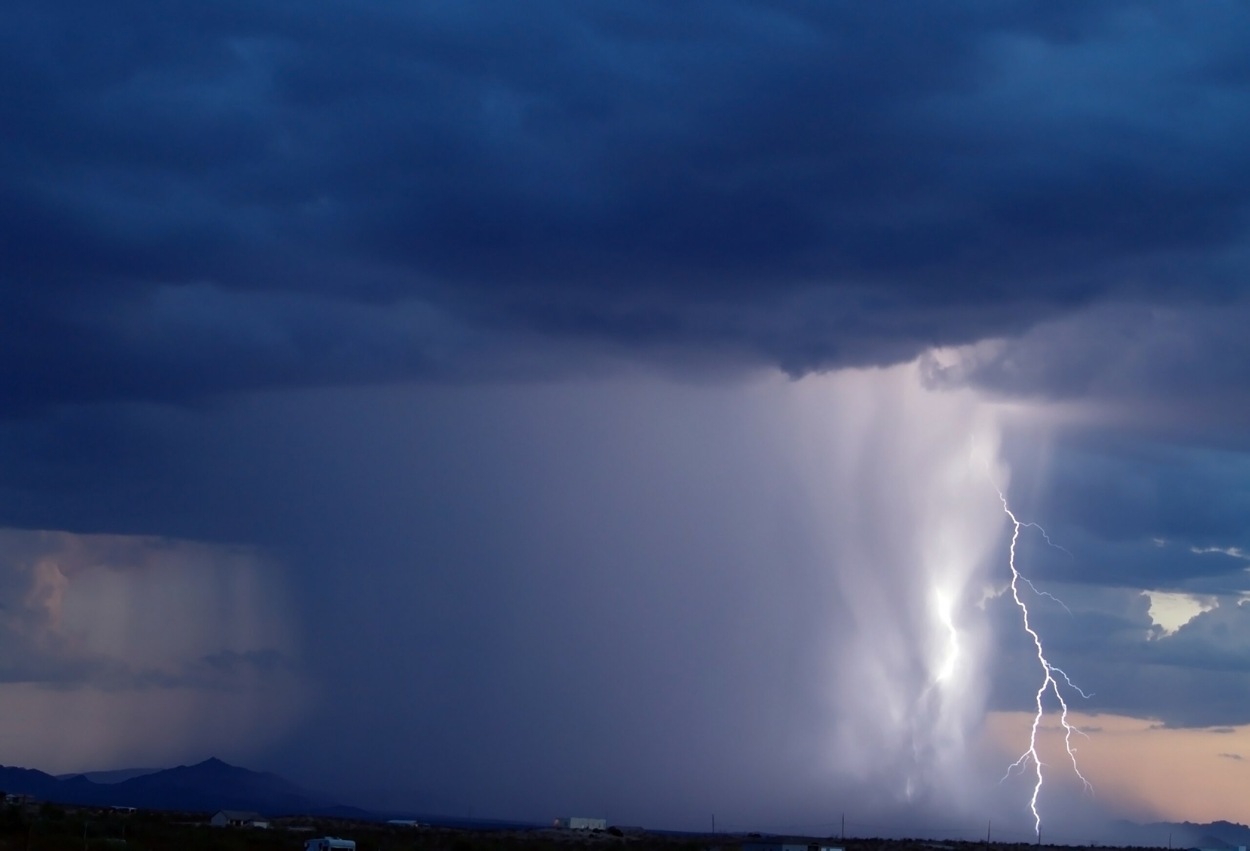
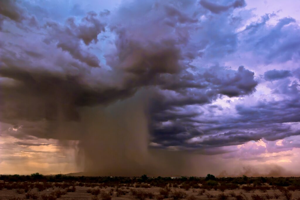
While it certainly will not be “cool” by any standards, the return of this moisture will help to bring about some relief in the form of scattered rain showers and increasing cloud cover. However, the monsoon rains will also raise the risk of dust storms and frequent lightning strikes, making the arrival a mixed blessing.
The mercury is already coming down in the Phoenix metropolitan area. Low temperatures on Thursday morning fell below 90 degrees for the first time since July 9, marking a new record of 16 straight days above this threshold. The arrival of what meteorologists refer to as a gust front brought the temperature down to a balmy 88 degrees.
This time frame also set a record for the highest overnight low temperature ever recorded when the mercury bottomed out at just 97 degrees on July 19. Another steak may come to an end this weekend if the high temperature drops below 110 degrees.
The Valley of the Sun has not seen a day below this reading as a high since June 30, shattering a record that has been in place since the summer of 1974. The current forecast predicts that Phoenix will not hit 110 degrees on Monday.
You will find spotty thunderstorms across this part of Arizona into the weekend. The storm action is forecast to become more widespread by the beginning of the week. A shift of the heat dome to the east will work to allow the moisture to seep into the Southwest.
While the cooler temperatures will be a welcome relief for the area, the storms will also bring their own sets of hazards. Monsoon storms are distinguished by the frequent lightning strikes. Unfortunately, these strikes will increase the risk of fire danger because the ground is so dry from a lack of moisture.
In addition, the storms may also drive up the wind speeds, creating the possibility of dangerous dust storms. These dust storms are known to come on quickly seemingly out of nowhere, lowering visibility on the roads and triggering flight disruptions. This weather impact was felt on Wednesday in both Phoenix and Tucson as the storms brought in wind gusts up to 70 mph.
The monsoon moisture will not be limited to Arizona. This precipitation will move into parts of Southern California on Sunday and Monday, bringing the chance of much-needed rain to the deserts of the Golden State and across the foothills surrounding Los Angeles and San Diego.
By late Monday, the storms may extend into the Sierra Nevada, delivering moisture to the higher terrains of this area of California and Nevada.
Las Vegas may also finally see measurable rain. It was the middle of June the last time that Sin City saw any meaningful precipitation. Next week’s forecast is calling for the chance of rain in Las Vegas as well as slightly cooler temperature readings. For instance, the high temperature may dip below 100 degrees on Tuesday with lows falling into the low 80s.
Other areas that may see some of the monsoon moisture include portions of New Mexico, Utah, Colorado, and Idaho. A drop in temperatures will accompany this moisture as clouds begin to move in with greater frequency.
Although the weather will still be hot by any standard, temperatures in the interior part of the Southwest will likely hover around the average for this time of the year. The long-range forecast does not call for another spike in the mercury until later in August.
The record heat in Arizona has threatened one of the state’s most recognizable natural features, the saguaro cactus tree. The searing heat has paired with the lack of moisture to stress the saguaro population. It is difficult for botanists to determine when these cactuses are under stress as the rotting typically happens from the inside out, not always visible to the naked eye.
Cactus trees perform their essential life functions at night after the sun goes down. For example, this is when they open their pores and take in the crucial carbon dioxide that they need to survive during the daytime hours.
However, the record high overnight lows as of late have prevented this to happen as nature has intended, dehydrating the trees and putting them at a greater risk of insect infestations and other types of infections.
The impact of the heat on the state’s saguaro population has been the greatest in the Phoenix metropolitan area. This has been attributed to the urban island heating effect felt in larger cities.
Did you find this content useful? Feel free to bookmark or to post to your timeline for reference later.

January 21, 2024

January 19, 2024

January 18, 2024
