Heavy Rain, Flooding, and Chance of Severe Weather Staring Down the Southern U.S.
January 22, 2024
Posted: May 17, 2023 9:30 am


The heat is finally letting up in the Pacific Northwest, however, relief will be slight in this part of the country not accustomed to seeing temperatures soar this high in the middle of May. Here is a look at the forecast for the Northwest.
Records have been falling all over the place in the Northwest as the mercury hits readings more typical of the dog days of summer. While some parts of the coastal Northwest are forecast to see a bit of relief this week, the unseasonable warmth will only move to other portions of the region.
The Pacific Northwest first experienced the abnormal heat at the end of last week. Portland saw its first 90-degree reading of the season on Friday with the temperatures climbing even higher over the weekend. This is a part of the U.S. that typically does not see this type of weather until July or August.
Yet the Rose City set new daily high records for four days straight. As a result, the city set a record for the most consecutive days at 90 degrees or above for the month of May. Prior to this stretch, you have to go back to 1987 to find consecutive days in May at this benchmark.
Although Seattle did not ever crack the 90-degree barrier, it came close with readings of 89 degrees on Sunday and 88 degrees on Monday. The Emerald City set four straight daily high records on Friday through Monday.

While the above average warmth is predicted to stick around in the Northwest through Thursday, it will not be as intense as it has been the last few days.
The exception to that would be in areas of western Oregon that could see more readings around 90 degrees as heat builds again on Thursday. This includes the Portland metro area.
The heat will begin to back off in the coastal areas of the Northwest by the end of the work week. Temperatures will be back in the 70s by Thursday in Seattle. However, it is important to note that these readings are still about 10 degrees above normal for this time of the year.
Temperatures will not drop into the mid 60s for a high in Seattle until at least Sunday. This day will also be the first chance of meaningful precipitation. Portland will remain in the low 70s through the weekend.
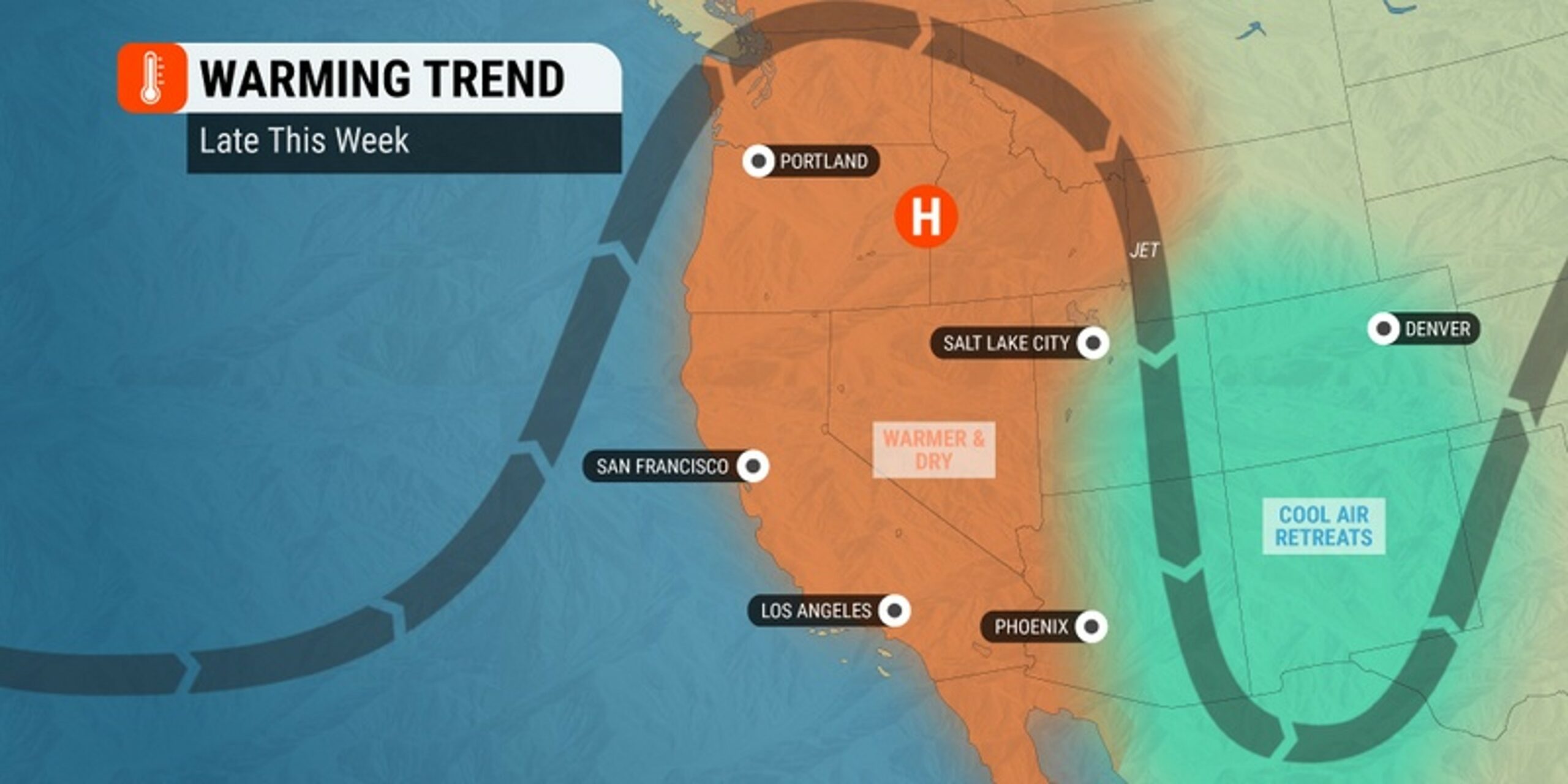
The cooler weather will come at the hands of a large storm system that is currently churning over the Pacific Ocean. This system will usher in cooler marine air near the coast, eventually creeping into the more populated areas of the region.
While Seattle and Portland enjoy a bit of a respite from the heat, this warmth will be making a move into the interior portions of the Northwest.
The incoming storm system from the Pacific will shove the area of high pressure currently anchored over the region to the east. The arrival of this high pressure to the inland areas will encourage warmth to build.
Cities that are expected to see the impending heat include Boise, Idaho. This part of the state could see readings that hit the daily record of 90 degrees on Friday. Readings in this range are about 15 degrees above the seasonal norm for Boise. In fact, Boise has not yet reached this barrier yet in May.
The heat will also expand into interior portions of Oregon. The resort town of Bend is forecast to hover in the mid 80s on Thursday, Friday, and Saturday. These readings translate to a whopping 20 degrees above average for the mountain town.
The chillier marine air will track farther inland by early next week, sending the temperatures to levels more typical of the end of May.
Did you find this content useful? Feel free to bookmark or to post to your timeline for reference later.

January 21, 2024

January 19, 2024

January 18, 2024