
Heavy Rain, Flooding, and Chance of Severe Weather Staring Down the Southern U.S.
January 22, 2024
Posted: May 21, 2022 3:44 am


It could be a hazy weekend throughout the Gulf Coast and Florida due to the arrival of a dust cloud coming all the way from Africa.
The first Saharan dust cloud of 2022 is forecast to move over Florida and the Gulf Coast states this weekend, delivering hazy conditions and a variety of health hazards to vulnerable Americans in its path. Known as a Saharan Air Layer (SAL), this massive plume of dust is expected to continue its migration across the Caribbean Sea in the coming days.
The cloud of dust typically makes its journey across the pond between the months of May and August with its impacts reaching as far as the nation’s heartland. In addition to raising air pollution levels, the dust may also create health dangers.
The dust first began to impact the Caribbean on Thursday with forecasts predicting that it will move through the Gulf of Mexico before hitting the Gulf Coast. While it is not certain, the dust cloud is projected to affect Florida, the Gulf states, and the south-central U.S. through the weekend and into Monday. There is also still a chance that the dust may dissipate with time and not cause noticeable changes in the air quality.
According to the European Copernicus Atmosphere Monitoring Service (CAMS) model, the plume of dust may also shift farther to the east in the coming days. Should this happen, it would send the bulk of the dust away from the Gulf Coast, primarily impacting the eastern half of Florida.
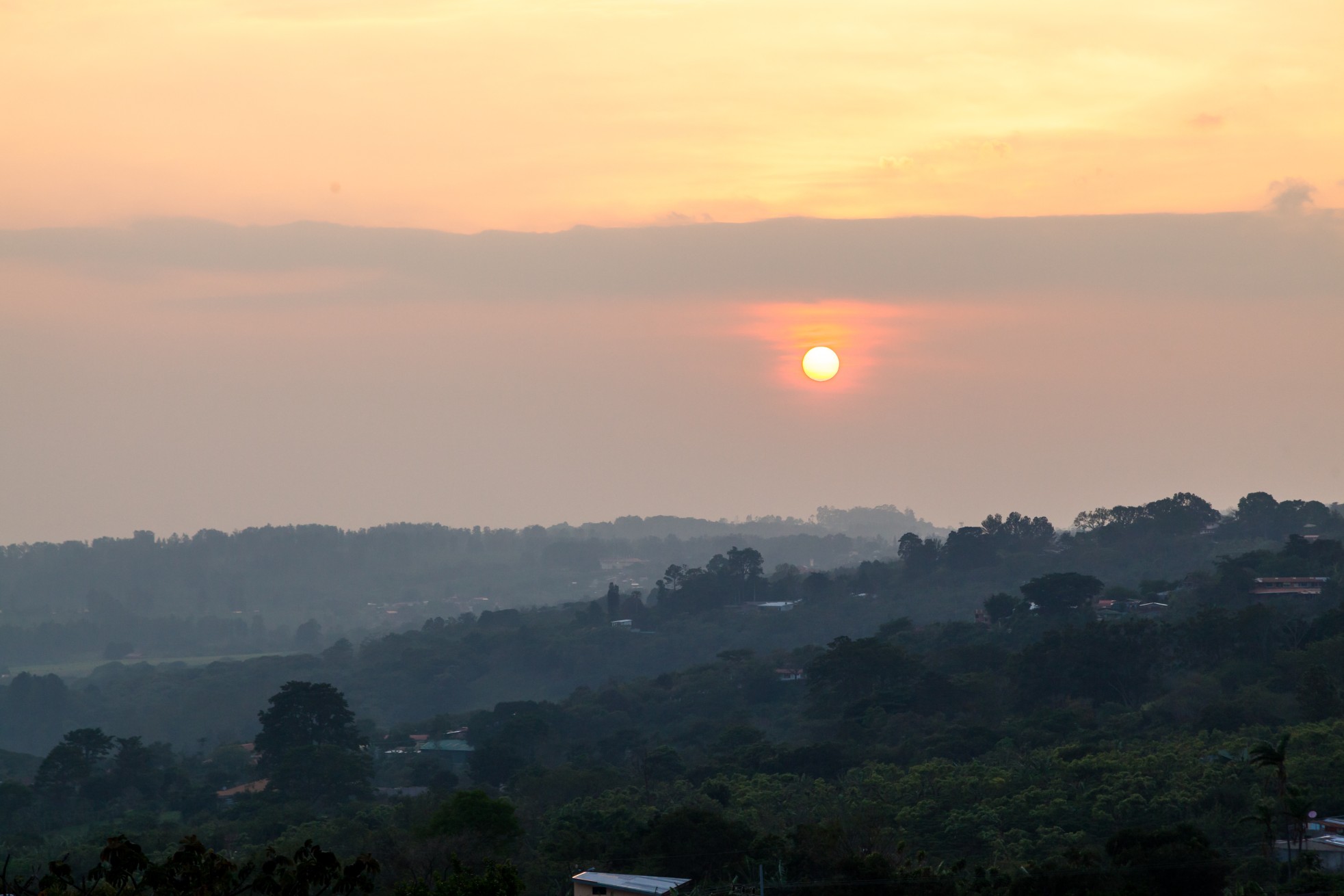
Most people will notice the hazy skies and the creation of colorful sunsets and sunrises reminiscent of the same conditions triggered by wildfire smoke. However, there is also the chance that the dust particles may be so thick that they cause health issues, particularly for individuals with underlying medical conditions such as asthma or COPD. Children are also more vulnerable to this particulate matter.
The particles created by the dust plume tend to congregate about one mile over the surface. These particles typically form a layer of dust that measures approximately 2 to 2.5 miles thick. It is when the particles travel down to the ground level that they pose a health risk.
In addition to aggravating breathing, the particles can also lead to sore throats along with eye, ear, and nose irritation. If you know that you are sensitive to dust and other allergens, it may be a good idea to wear your facial mask when outdoors this weekend. If you are particularly sensitive or suffer from a chronic health condition that impacts your breathing, it is recommended to avoid spending long periods of time outdoors.
The presence of SAL can also hinder the development of clouds, rain, and thunderstorms. This is not good news for areas dealing with ongoing drought conditions or people looking for some relief from the heat wave currently over the southern Plains.
The dust cloud moving over the Caribbean may deter the development of tropical weather events due to the extremely dry air present within the plume. According to the National Oceanic and Atmospheric Administration (NOAA), the air associated with an SAL system contains approximately 50% less moisture when compared to air that is typically present in the tropics during this time of the year.
In addition, the SAL is also distinguished by its strong winds. These winds work to increase vertical wind shear, mitigating the formation of tropical weather systems. Hurricane watchers have been keeping a close eye on the Atlantic basin in recent weeks as the official start to the season is less than two weeks away.
Sharing is caring! Did you find this content useful? Feel free to bookmark or to post to your timeline for reference later!

January 21, 2024

January 19, 2024

January 18, 2024
