
Heavy Rain, Flooding, and Chance of Severe Weather Staring Down the Southern U.S.
January 22, 2024
Posted: September 22, 2023 9:51 am


A rash of severe weather is lighting up the Plains states. How long will the threat of storms linger? Here are the details that you need to know heading into the weekend.
Outdoor plans across the nation’s heartland could be in jeopardy in the coming days as a severe weather outbreak sets up over the region. It has been a fairly docile start to the meteorological fall for this part of the county, however, that is all about to change thanks to a multi-day severe weather event that will impact at least 10 states.
A number of major metropolitan areas will be under the gun for these severe weather impacts, including Omaha, Kansas City, Des Moines, Wichita, Oklahoma City, and Dallas. The storm cells will pack the potential of strong winds, hail, and isolated tornadoes.
The stormy conditions will be fueled by a large area of low pressure that has been bringing rain, snow, and other impacts to the Pacific Northwest and Rocky Mountain region this week. This weather maker will merge with the warmer conditions in place over the Plains to ignite these storms.
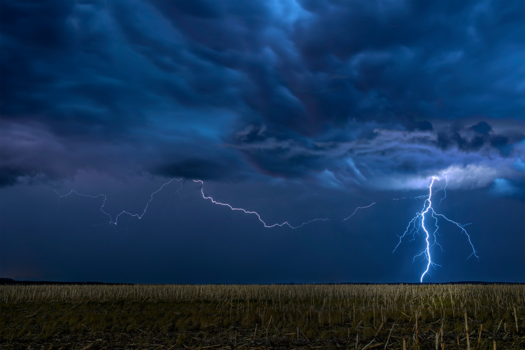
Some parts of this region have already experienced severe weather this week. On Tuesday, storms erupted in Oklahoma and Texas, unleashing wind gusts that topped 70 mph and hail the size of tennis balls. While Wednesday was a relatively quiet day, Thursday brought more stormy conditions to the region.
Thursday’s storms were mild compared to what is in the forecast for Friday and Saturday. This is when the area of low pressure is expected to move in from the west. The greatest threat of severe weather on Friday will be centered over portions of Nebraska and South Dakota. The primary risks will be strong winds and isolated tornadoes in the eastern half of Nebraska and up into South Dakota. Motorists on Interstates 29, 80, 90 in this area will want to take caution when heading out on the roads.
Friday night high school football games could see delays as frequent lightning fires up across this region. You will want to have a place to seek shelter if your Friday night plans are outside.
The severe weather is forecast to become more widespread on Saturday, potentially ruining the plans of tailgaters headed out for a college football game. For instance, Iowa State University is set to host Big 12 rival Oklahoma State at 3 pm local time. The forecast in Ames, Iowa is calling for You will find similar risks in both Lawrence and Manhattan, Kansas as the hometown teams open up conference play. Be sure to check the hourly forecast if you are headed out to any of these big football games.
Saturday night will bring the risk of severe weather down into the central portions of Oklahoma and up into southern Minnesota. The highest risk of serious impacts will be across the Missouri River Valley, including Omaha, Kansas City, and Sioux Falls, South Dakota. Forecasters are warning that wind gusts could hit as high as 90 mph in this zone, pairing with large hail to knock down trees and power lines. Winds of this magnitude will also be enough to cause minor structural damage.
Looking ahead to Sunday, there is the chance that the severe weather could linger in the central U.S. The most likely zone to experience these impacts will be across the southern Plains, expanding into portions of Louisiana and Arkansas.
The Midwest will finally get a break from the storm action to close out the weekend thanks to an area of high pressure setting up across the region. This area of high pressure will also bring sunshine and pleasant conditions to much of the Great Lakes.
While the rain will certainly hamper some outdoor plans this weekend, the moisture will prove to be beneficial for a part of the U.S. that is grappling with ongoing drought conditions. The U.S. Drought Monitor released its latest set of data on Thursday, indicating that over 15% of the state of Nebraska is under the designation of an extreme or exceptional drought, the two most severe categorizations by this agency.
The rain will also help to fill some of the tributaries that lead into the Mississippi River. This river has been dealing with record low water levels in recent weeks, raising concern that the fall harvest season will be impacted due to crop transport issues.
Did you find this content useful? Feel free to bookmark or to post to your timeline for reference later.

January 21, 2024

January 19, 2024

January 18, 2024
