
Heavy Rain, Flooding, and Chance of Severe Weather Staring Down the Southern U.S.
January 22, 2024
Posted: November 29, 2022 9:49 am


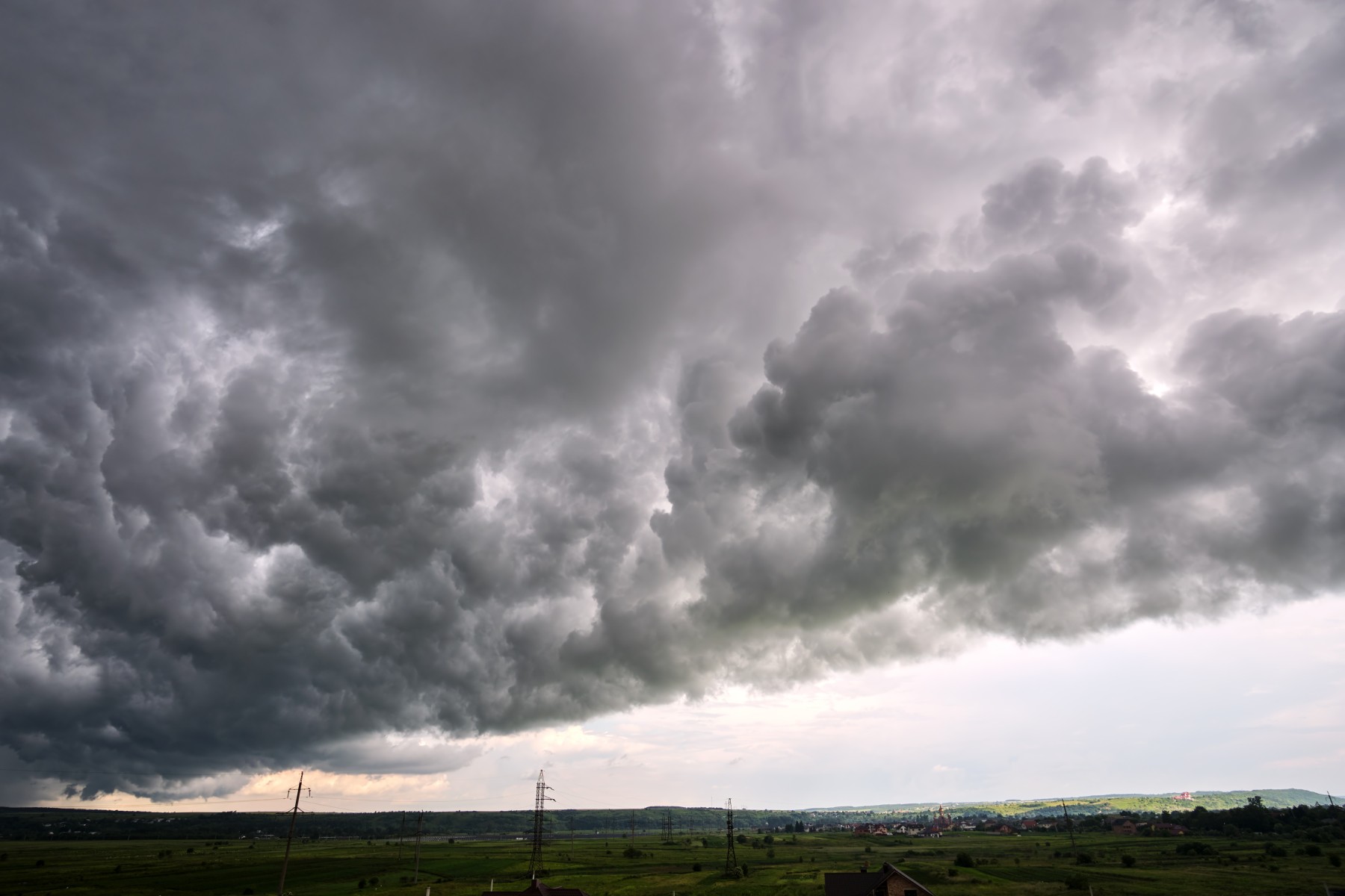
It is setting up to be a potentially stormy Tuesday for a large swath of the nation stretching from the northwestern Gulf Coast up into the Mississippi Valley. Approximately 30 million Americans living in the south central portions of the U.S. will be under the gun for severe weather as a large storm system comes down from the Rockies and clashes with warm and moisture-rich air coming up from the Gulf of Mexico.
Forecasters are warning that there is a good chance of several tornadoes spinning up out of this weather maker on Tuesday afternoon and into early Wednesday. The day will also bring a high risk of strong winds and thunderstorms. The storms will fire up as the energy circulating within the jet stream moves into the region.
Damaging winds will be the most widespread concern of this system. Wind gusts of up to 70 mph are forecast, enough to bring down power lines and trees while also damaging structures. The storms will move to the east as the day goes on along with a blast of cold air. The system will eventually move to the north, impacting the southeastern corner of Missouri and southern Illinois as well as the western portions of Kentucky and Tennessee by the time that the sun goes down.
It has been almost one year since a deadly tornado outbreak killed over four dozen people in this same general part of the U.S. While this impending storm system has the potential of creating tornadoes, forecasters say that the colder air associated with this Tuesday’s storm will not likely equal the ferocity of the December 2021 outbreak. During the December event, temperatures were hovering in the mid 70s and low 80s. Tuesday’s forecast is calling for the mercury to land in the range of the upper 50s to the upper 60s.
A high amount of wind shear is forecast to be swirling in the upper levels of the atmosphere on Tuesday, providing the fuel for intense thunderstorms. This risk will translate to a greater threat of tornadoes to spin up.
The greatest risk of tornadic activity on Tuesday will be across parts of Arkansas, Louisiana, and Mississippi. There is also the potential of what is known as long tracked tornadoes, impacting a large area of land.
Local officials are also concerned that tornadoes may develop in the overnight hours under the cover of darkness. The heavy rains expected to accompany this storm system may also work to conceal twisters. For these reasons, forecasters are advising those in the potential impact zone to enable all smartphone alerts.
The rain will likely be significant enough to trigger urban flooding in some locations. Major cities in the line of fire for these severe storms include Little Rock, Memphis, Nashville, and Houston
The threat of stormy conditions will move to the east on Wednesday. The areas most likely to see severe weather include the central Gulf Coast moving northward into eastern Tennessee and western portions of North Carolina. The storm cells could be positioned over central Georgia and the Carolinas by the end of the day Wednesday. This day’s primary impact zone will focus on cities such as Atlanta, New Orleans, and Mobile.
The good news is that this particular system is expected to move at a fast clip. This swift movement will likely limit the duration of any storms.
Travelers taking to the skies on Tuesday afternoon through Wednesday night should be prepared for the chance of delays and ground stops. The locally heavy bouts of lightning and strong winds may force these delays. In addition to the target of the storms, the delays may extend well north of the severe weather.
Did you find this content useful? Feel free to bookmark or to post to your timeline for reference later.

January 21, 2024

January 19, 2024

January 18, 2024
