
Heavy Rain, Flooding, and Chance of Severe Weather Staring Down the Southern U.S.
January 22, 2024
Posted: May 8, 2023 3:00 pm


The severe weather that fired up on Sunday across the Midwest and down through Texas will continue over the next few days.
Forecasters predict that over a dozen states across the Midwest and across to the Atlantic Seaboard will be under the threat of a variety of stormy impacts this week. Here is what you can expect with this developing weather event.
The end of the weekend saw the most active weather day of the last week. According to the National Weather Service (NWS) Storm Prediction Center (SPC), Sunday recorded over 400 reports of strong winds and hail.
Sunday’s stormy conditions first started up during the morning hours in Indiana and Ohio. By the afternoon, the storms had progressed to Iowa, Kentucky, and beyond. Central portions of Texas also saw a rash of severe weather to close out the weekend.
The big weather story of the weekend happened in Nashville on Sunday night when heavy rain and thunderstorms forced the postponement of the much-anticipated Taylor Swift concert.
The concert was delayed for over three hours with the opening acts scratched completely as fans were told to take shelter within Nissan Stadium.
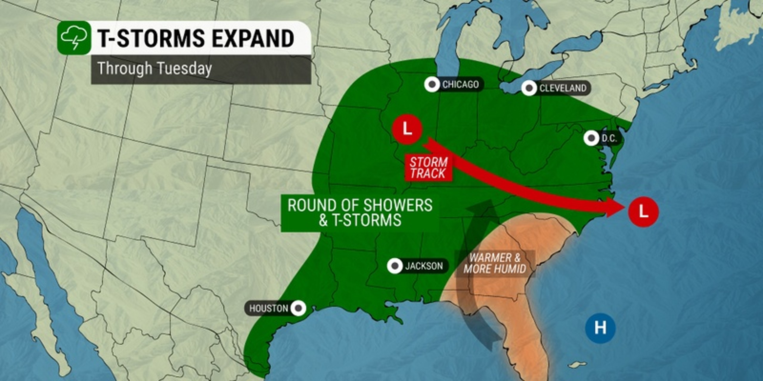
Monday has been a relatively tranquil day for much of the country, however, Tuesday is expected to bring more localized areas of storms that deliver severe impacts.
The line of storms is forecast to march eastward on Tuesday, bringing the severe weather to parts of the Ohio Valley, the mid-Atlantic, and down through the Southeast.

Areas in the impact zone for Tuesday’s severe weather include a pocket in the Midwest encompassing Kansas City and Wichita, Kansas. Two separate storm systems in the nation’s heartland will feed off of the moisture filtering upwards from the Gulf of Mexico.
The populated Kansas City metro area is most likely to see the impacts in the evening hours. Residents need to be mindful of damaging winds associated with this weather maker.
There will also be another pocket of potentially severe weather across southern Virginia and into the Carolinas, including the cities of Myrtle Beach, Raleigh, and Richmond. The most likely time period for storm development on Tuesday will be in the afternoon and evening hours.
Impacts for Tuesday’s weather pattern include large hail and strong winds. Heavy rain that impacts travel may also be a factor for motorists heading out on portions of interstates 44, 64, and 65.
More severe weather is in the cards for Wednesday and Thursday with the likely areas of impact stretching from the Front Range of the Colorado Rockies across into the Plains states.
This means that cities such as Denver, Amarillo, and Rapid City will once again be in the crosshairs for powerful thunderstorms. Wednesday’s severe weather could even produce tornadic activity.
Although these storms will undoubtedly ruin some outdoor plans, this part of the county is in dire need of the moisture.
Many of these locations are currently under the categorization of a severe, extreme, or exceptional drought as defined by the official U.S. Drought Monitor. That said, too much rain over a short period of time could also trigger flash flooding.
Another round of storms is possible by the end of the week and into the weekend. Forecasters are predicting that the pattern known as a “Rex Block” could develop by the weekend, creating wet conditions in the area between the southern portion of the Rocky Mountains into the southern Plains.
The clash of the high pressure system forecast for the Pacific Northwest and the low pressure across the Southeast will produce this pattern.
Did you find this content useful? Feel free to bookmark or to post to your timeline for reference later.

January 21, 2024

January 19, 2024

January 18, 2024
