
Heavy Rain, Flooding, and Chance of Severe Weather Staring Down the Southern U.S.
January 22, 2024
Posted: October 26, 2022 6:26 am


It has been a wacky few days of weather throughout much of the U.S. ranging from the first big snowfall of the season to tornadic activity.
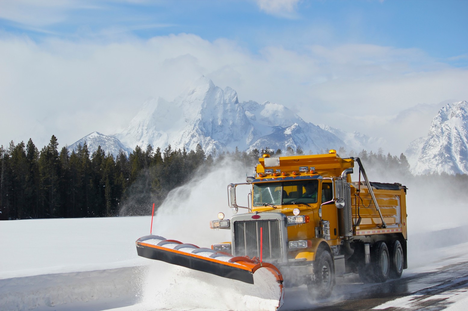
A potent storm system swept through the western U.S. beginning on Saturday, leaving behind a trail of heavy snow and freezing temperatures. The weather maker offered a direct contrast to the unseasonably warm and dry weather of the week before.
The mercury rose over 15 degrees above normal for many parts of Washington, Oregon, and Nevada prior to the storm rolling in from the Pacific Ocean to remind residents that winter is indeed on the way.
Temperatures plummeted across the Northwest over the weekend with the high falling to the 40s and 50s after hanging out in the 70s and 80s just a few days earlier. The temperatures were low enough to support snow development in many parts of Montana, Wyoming, and Colorado over the past few days.
The snow began falling late Saturday throughout Montana, hindering travel across some of the most used mountain passes. The snow measured over one foot in many of the highest elevations.
Snow accumulations climbed over 17 inches around the Big Sky ski area. Bozeman saw measurements of over 15 inches. West Yellowstone, Montana reported a whopping 29 inches out of this system.
The Wasatch Mountains in Utah were also hammered by the snowfall with Alta recording 25 inches of new accumulation. This total topped the typical average for the month of October of 24.4 inches. Summit Park and Solitude also saw over 10 inches of snow, helping the ski resorts to get a head start on the season. For instance, the Alta Ski Resort now has a base depth of 21 inches.
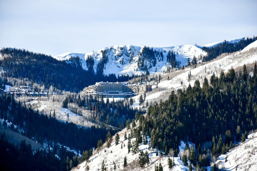
Residents of Salt Lake City will be happy to learn that nearby Park City Ski Resort saw over 8 inches of new snow in addition to what the snowmaking machines have already produced.
The snow did not start to fall in Wyoming until later Sunday. However, it created a mess on roads throughout the Black Hills region once it got started. Roads were slick and dangerous by Monday morning thanks to the cold overnight lows. The icy conditions stretched to Gillette, Wyoming and into the northwest corner of South Dakota.
The high country of Colorado was also blanketed by the significant snowfall. In addition to the snow, Wolf Creek Pass saw wind gusts of 90 mph as the front rushed through the state.
The heavily travelled Interstate 70 was packed with snow in the overnight hours of Sunday into Monday. Low visibility at Eisenhower Tunnel in Summit County hampered travel during these hours.
Colorado’s Western Slope also saw some small accumulation. While graupel fell in the Denver area as the overnight lows dropped into the 30s, the metropolitan area did not experience any accumulation. Graupel is defined as snowflakes that are coated in ice as they fall from the sky.
Unlike other parts of the nation that are dealing with record drought conditions, the high terrains of Colorado have been enjoying snowpack that is now 146% of normal after the weekend’s snow event. The Arapahoe Basin now has bragging rights as being the first ski resort in Colorado to open for the season after it fired up the lifts on Sunday.
Is more snow on the way? The Pacific Northwest is forecast to see a train of storms coming off the coast in the coming days. This weather pattern will increase the odds of even more snow accumulation for the region heading into the winter months.
While it was snow wreaking havoc in the Intermountain West to start the week, it were severe thunderstorms and a tornado causing the problems in Texas. A line of severe weather followed the quickly moving cold front, igniting thunderstorms on Monday throughout the east-central portions of the Lone Star State.
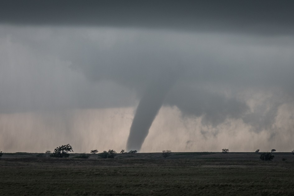
A tornado was confirmed south of Jarrell, flipping over cars and tractor-trailers while knocking out power to thousands of customers. The small town of Jarrell is located approximately 40 miles north of the capital city of Austin. Caught up in the tornado was an 18-wheeler that was sent tumbling into a ditch along Interstate 35.
The tornado hit at around 9 pm local time after the sun had gone down. According to local authorities, the twister was on the ground for several miles as it moved closer to Interstate 35. Although this part of Texas is no stranger to tornadic activity, it is typically limited to the spring season.
While the twister near Jarrell was the only confirmed tornado on Monday, a large part of northern Texas also saw torrential rainfall out of this line of storms. The Dallas-Fort Worth area saw over 4 inches of rain in some places. Minor street flooding was a problem as drainage systems were not able to maintain pace with the rate of rain.
Did you find this content useful? Feel free to bookmark or to post to your timeline for reference later.

January 21, 2024

January 19, 2024

January 18, 2024
