
Heavy Rain, Flooding, and Chance of Severe Weather Staring Down the Southern U.S.
January 22, 2024
Posted: October 12, 2023 1:33 pm


Thursday is setting up to be a day of multiple weather hazards across a large portion of the U.S. as a cross-country storm system continues to march to the east, bringing snow to the higher elevations of the Rockies and severe weather to the nation’s heartland. Here is the latest on this impactful weather maker.
Snow for the Mountains First Up
The Rockies are experiencing the first measurable snowfall of the year this week, creating slippery travel conditions and reminding residents that winter is right around the corner. The snow has been accompanied by a drastic drop in the temperatures with some areas experiencing readings around the freezing mark for the first time this season.
The flakes started flying on Wednesday and are expected to hang on through late Thursday across the northern Rockies. This is the same storm system that delivered heavy rain and cooler temperatures to the Pacific Northwest and into the interior West to start the week. This is also the same weather maker that will eventually produce yet another rainy weekend for the Northeast.
The drop in temperatures may have come as a surprise to residents of the Rockies after the region had been basking in unseasonable warmth just a few days ago. For instance, Denver hit a high of 80 degrees on Tuesday, a reading that is 12 degrees over the norm for this time of the year.
This warmth is coming to an end thanks to the intrusion of cooler air from the west. The mercury will struggle to climb out of the 50s for a high on Thursday and Friday in Denver with nighttime lows dropping into the 30s. This is a good time to make sure that your winter wear is ready to go.
While the Colorado Front Range will escape the snow this time around, the higher elevations of the Rockies will see the first measurable snowfall since last spring. This snow could trigger travel disruptions across some of the most heavily traveled mountain passes. For instance, Loveland Pass across Interstate 70 in Colorado is forecast to pick up to 6 inches on Thursday. Be sure to leave extra time if your travels are taking you over the Rockies this week.
Storm to Eject Out of Rockies and Impact Central U.S.
This powerful storm system will not be done after dumping snow across the Rockies. The central portion of the U.S. will be next in line to experience the heavy rain and cooler air associated with this system.
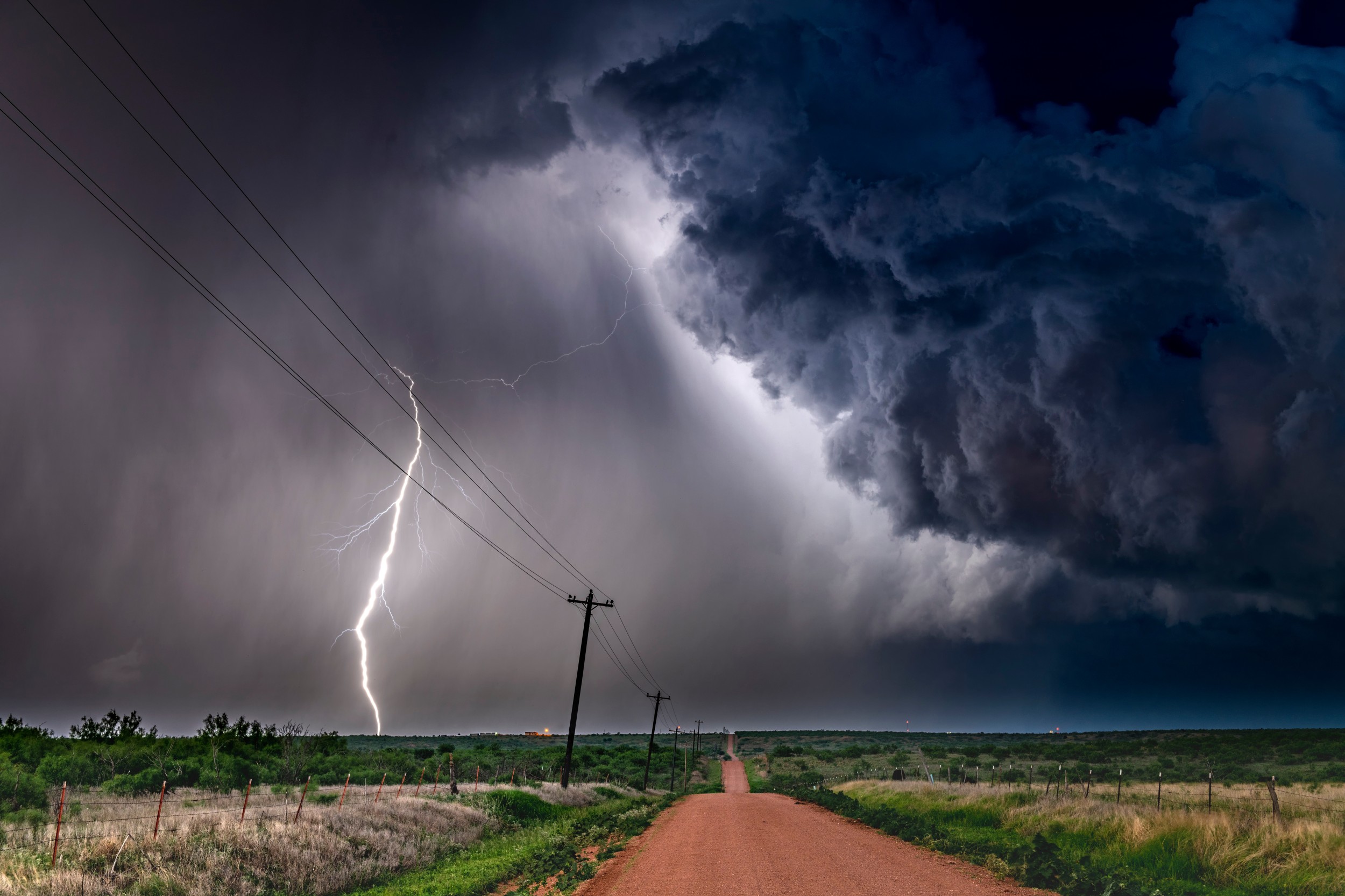
In addition to the drenching rain, the storm will also produce high winds, large hail, and the chance of isolated tornadoes for about one dozen states on Thursday and Friday. These severe impacts will be the result of the intrusion of cold air clashing with the warm air already in place over the region.
This is not the time of the year when residents of the central U.S. anticipate severe thunderstorms. However, forecasters are warning that this weather system will bring a good shot of severe impacts throughout the Plains.
Thunderstorms are predicted to ignite late Thursday afternoon in a zone from northeastern Oklahoma and into eastern Kansas and the southeastern corner of Nebraska. It could be a stormy commute for people in Wichita, Tulsa, and Oklahoma.
Thursday’s night’s NFL game between the Kansas City Chiefs and the Denver Broncos could also be at risk of experiencing severe weather as the storms move across the Kansas City metro area. Fans should expect the potential of game delays due to lightning as well as a rocky ride back home.
What is most concerning to forecasters is that these storms are likely to pop up after the sun has set. Residents in the potential impact zone are advised to enable all smartphone weather notifications.
Highs Winds Also a Key Concern to End the Week in the Plains
Motorists using interstates 29, 35, 44, 70, and 80 in this area should also be aware of potential delays or dicey travel conditions as the storms roll through. Windy conditions are also in the forecast for a large area from the Dakotas and Minnesota and down into northern Texas on Friday. These winds could produce dangerous crosswinds, another hindrance to motorists.
Gusts of over 40 mph are anticipated beginning Thursday night for much of the central Plains and into the Midwest. It will not be surprising if these winds are strong enough to trigger localized power outages.
The highest winds are predicted for eastern Colorado, western Kansas, and the southwestern edge of Nebraska. Gusts topping 50 mph are a possibility in this zone. Larger, high-profile vehicles will want to exercise extreme caution when out on the interstates in this area.
It is not unusual for storms coming down from the Rockies to produce winds at this level during the fall months. This happens because of the rapid speed that these storms rush down from the mountains, creating a quick pressure change that is able to allow gusty winds to develop.
These fall storms are also distinguished for the heavy rain that develops when the cold air coming down the mountains and from Canada collides with the warm and moist air set up over the Plains. This clash is the perfect setup for storms to form.
Looking ahead to Friday, the northern Plains and the Midwest will see the bulk of the storm activity. While this rain will be welcomed in areas of the Midwest still grappling with drought conditions and low water levels in rivers and streams, this much moisture at one time could also present flash flooding risks.
The severe weather will begin to subside by the weekend as high pressure builds across the middle of the country. However, this storm system will simply move to the east to impact the Northeast and beyond. Stay tuned as this forecast continues to develop.
Did you find this content useful? Feel free to bookmark or to post to your timeline for reference later.

January 21, 2024

January 19, 2024

January 18, 2024
