
Heavy Rain, Flooding, and Chance of Severe Weather Staring Down the Southern U.S.
January 22, 2024
Posted: December 28, 2022 8:10 am


There is good news and bad news for the South. While the New Year’s holiday weekend will certainly be warmer than what the Christmas holiday brought last week, the weather pattern will also bring along a significant amount of new moisture to the region. Here is what you can expect in the South and beyond as the year comes to an end.
The South has been the beneficiary of an area of high pressure that has been anchored over the area in recent days. This high pressure is forecast to slowly drift out to sea this week, bringing in a warm wind from the south that originates in the Gulf of Mexico. As a result, the region will see an influx of warmer temperatures and moisture-rich air.
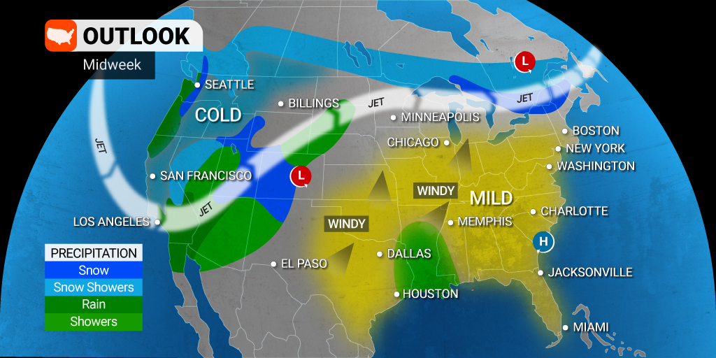
Temperatures throughout the South may soar as much as 60 degrees higher than when they were at their lowest point during last week’s exceptionally cold weather. However, the warm air will come at a price. The latest weather pattern will also bring in a good chance of heavy rain to close out the year 2022. In addition to heavy rain, you can expect to see scattered thunderstorms with this weather maker.
The southeast corner of Texas, including Houston and Galveston, are forecast to see the beginning of the rain by Wednesday. It will remain dry and seasonable across the bulk of the Gulf Coast and into the Southeast on this day before the weather pattern changes dramatically.

The steady rain will reach as far north as Arkansas and Missouri by Thursday as the moisture moves to the north and the east. Another storm system moving out from the Four Corners area late Wednesday will serve as the energy source for thunderstorms in eastern Texas and into Arkansas and Louisiana to close out the work week.
Forecasters will continue to monitor this system as it spreads to the east on Friday and Saturday. While the exact track and strength are still unknown, it is setting up to be a soggy New Year’s Eve for much of the South and beyond. It is possible that the rain may eventually move as far as the mid-Atlantic and into the Northeast.
At this time, the region most likely to see the heaviest of the rain lies north of the Gulf Coast. Rainfall amounts of 1 – 2 inches will not be a surprise if this forecast comes to fruition. This could translate to another round of travel headaches in the air and on the roads for cities such as Atlanta, Nashville, New Orleans, and Charlotte.
By the weekend, the rain will likely shift to the north, impacting the Ohio Valley, the Great Lakes, and even the Northeast. The good news is that the influx of warmer air from the Gulf of Mexico should be enough to ensure that the moisture falls as rain rather than snow to this region.
It is still too early to pinpoint what kind of weather New Year’s Eve revelers in Times Square in Manhattan can expect to find. One thing is certain is that it will almost certainly be warmer than what the weekend prior brought. This is good news for those residents tired of the cold.
However, the rapidly warming conditions will bring a whole new set of complications to the area of the Great Lakes that saw historic lake effect snow over the Christmas weekend. The arrival of rain could trigger flooding in area rivers and streams, particularly as the massive amounts of snow begins to melt.
Did you find this content useful? Feel free to bookmark or to post to your timeline for reference later.

January 21, 2024

January 19, 2024

January 18, 2024
