
Heavy Rain, Flooding, and Chance of Severe Weather Staring Down the Southern U.S.
January 22, 2024
Posted: March 16, 2023 3:22 pm


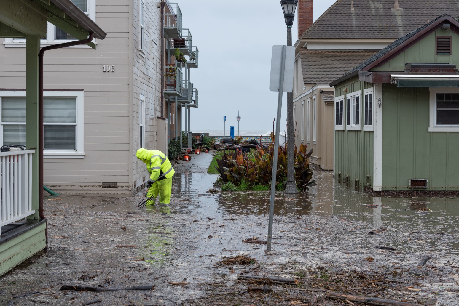
Record-setting rainfall has slammed the state of California in recent weeks, leaving residents to clean up the mess before the next weather system approaches the region. Here is a look at what Californians are dealing with this week.
The eleventh atmospheric river of the winter season moved over the Golden State this week, bringing record rainfall to much of the region. Local officials were forced to launch hundreds of water rescues to help stranded residents as the rain continued to inundate the vulnerable area.
The latest weather maker impacted the state from Monday through Wednesday. This system roared into the area just a few days after a rainstorm hit the Sierra Nevada, quickly melting the existing snowpack and aggravating flooding issues.
Tuesday was a particularly wet day across the region. Daily maximum rainfall records were shattered in many communities in Southern California. For instance, downtown Los Angeles recorded 1.89 inches of rain, eclipsing the previous record of 1.74 inches that dated all the way back to 1930.
The City of Angels is now sitting at its 14th wettest year in history. The official gauge downtown has measured 23.99 inches. Just a half of an inch more will bring this total up to 12th place. It was even rainier on Tuesday at Los Angeles International Airport, notching 1.97 inches of rain, obliterating the previous record of 0.43 of an inch.
Other locations that saw record rainfall amounts on Tuesday included Long Beach Airport coming in at 1.53 inches, Oxford with 2.25 inches, Camarillo Airport and its 2.04 inches, and a whopping 2.54 inches for Santa Barbara Airport. When it came to 72-hour rainfall totals, Northern California saw the greatest amount of rain with some communities hitting the 9-inch mark over that time period.
Not surprisingly, the immense moisture triggered a host of travel issues throughout the state. A long portion of State Route 33 in Ventura County was closed because of rockslides.
It was a precarious situation in the town of Parajo, located about one hour south of San Francisco. The Parajo River could not contain all of the incoming water, breaking the levee and creating flooding. The levee break forced the evacuation of thousands of people in Monterey and Santa Cruz counties. Hundreds of water rescues were performed because of the rising floodwaters.
There are also still hundreds of families still displaced from their homes. Crews are working overtime to repair and secure the levee.
Strong winds were also causing problems throughout California this week. Gusts hit nearly 100 mph in the Bay Area. These winds contributed to widespread power outages in Northern California. By Wednesday morning, there were about 200,000 customers in the dark in this part of the state. This number had fallen to about 50,000 by Thursday morning.
A truck was flipped over on the Richmond-San Rafael Bridge located just outside of San Francisco. According to the National Weather Service (NWS), gusts reached the 70 mph benchmark in and around San Francisco on Tuesday.
The good news is that the forecast for the end of the week and the weekend shows a drying pattern. This will give residents time to get out and clean up the mess left behind by the latest weather event. It will also give swollen rivers and other waterways the opportunity to recede.
However, more rain and strong winds are back in the forecast to start the work week as another system moves onshore from the Pacific Ocean. While it is not much of a consolation during this dreary weather spell, the constant stream of precipitation has nearly erased the drought in California. This is welcome news heading into the dry summer season.
Did you find this content useful? Feel free to bookmark or to post to your timeline for reference later.

January 21, 2024

January 19, 2024

January 18, 2024
