
Heavy Rain, Flooding, and Chance of Severe Weather Staring Down the Southern U.S.
January 22, 2024
Posted: March 14, 2023 10:51 am


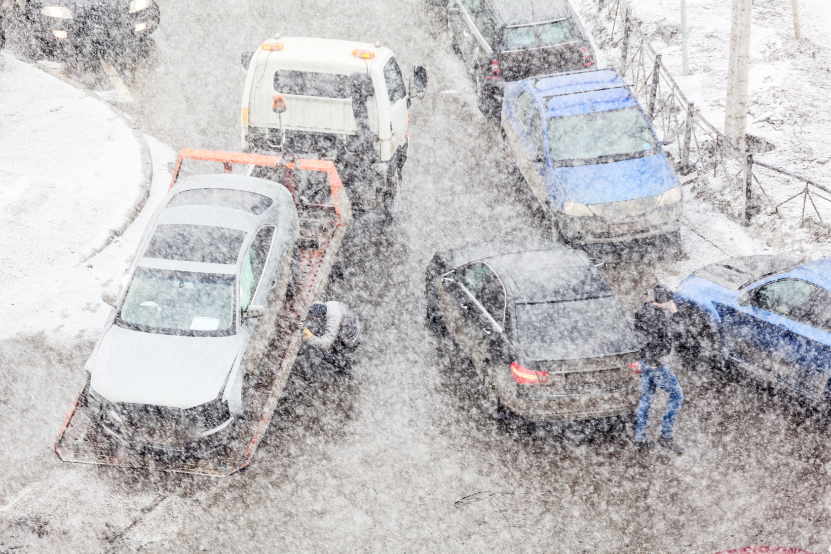
Many residents of the Northeast woke up to a winter wonderland on Tuesday thanks to a quickly intensifying nor’easter that is churning up the Atlantic Seaboard. Although the storm stayed off the coast on Monday, it began to make its approach closer to land on Tuesday. Forecasters warn that this storm may end up being the most significant weather event of the winter season for the Northeast. Here is what you need to know about this late-season winter storm.
A robust nor’easter making its way into the Northeast, creating rapidly deteriorating conditions across much of the region. Up to 6 inches of snow will fall in an area stretching from western New York state and into the northern reaches of New England. The hardest hit areas of eastern New York and Massachusetts, northwestern Connecticut, and up into Maine, New Hampshire, and Vermont will see a widespread 6 – 12 inches of snow by the time the system dissipates.
The higher elevations of the Catskills, Berkshires, Adirondacks, and Green and White Mountains will see snow that falls at a rate of 2 – 3 inches per hour with snowfall measurable in feet. By Tuesday, snow may be falling at a rate of 1 – 2 inches per hour across a large portion of the interior Northeast.
Widespread power outages will be a problem even in areas that do not see snow of this magnitude. This is because snow that falls this late in the season tends to be heavy and wet in composition, making it more likely to weigh down trees and power lines.
It has been a weak winter for snowfall in New York City. The Big Apple has only recorded a total accumulation of 2.3 inches, spread out over four separate snow events. While this nor’easter will not pad that number by much, it could bring a slushy accumulation of up to an inch in the city. The rain that began to fall late Monday will continue to transition to snow on Tuesday. The high Tuesday will likely happen in the morning hours with the mercury dropping as the day continues.
The suburbs along the coast of Connecticut and into New Jersey will see a bit more accumulation, ranging from 1 – 3 inches of snow. Those living west and north of Interstate 287 should be prepared for 3 – 6 inches of wet snow.
The coastal areas of this corner of the country will be at risk of flooding during high tide. The winds will also begin to pick up in intensity on Tuesday, hitting as high as 40 – 50 mph in New York City and up to 60 mph near the coast. These gusty conditions will hang on through Tuesday night before finally dying down.
New York Gov. Kathy Hochul is warning residents to take this storm seriously. The governor declared a state of emergency that went into effect at 8 pm Monday. She called in 100 members of the National Guard to assist with the state’s response to the storm and its impacts.
Hochul also issued a number of travel restrictions in response to the conditions. For instance, the New York State Thruway Authority said that all tandem and empty tractor-trailers cannot be out in specific locations, including a stretch of Interstate 87 near Newburgh through Interstate 90 to outside of Syracuse.
New Jersey Gov. Phil Murphy also took action on Monday, declaring a state of emergency for multiple counties in the northern portion of the state. This emergency declaration includes Morris County, Sussex County, Warren County, Passaic County, and Bergen County. Like New York, portions of New Jersey are also under commercial travel restrictions.
This nor’easter is still developing and changing as it churns onshore. This makes it important to stay tuned to the forecast so that you can take any necessary precautions.
Did you find this content useful? Feel free to bookmark or to post to your timeline for reference later.

January 21, 2024

January 19, 2024

January 18, 2024
