
Heavy Rain, Flooding, and Chance of Severe Weather Staring Down the Southern U.S.
January 22, 2024
Posted: March 21, 2022 12:43 pm


Severe Weather Expected to Hit Southeast by Wednesday
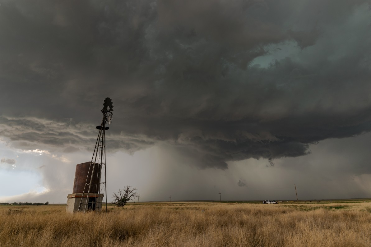
Spring has sprung, translating to a higher risk of severe weather. This is going to be particularly true early this week throughout the South as forecasters are growing increasingly confident that the incoming system has the potential of spurring a number of severe weather events.
Forecasters are cautioning residents throughout the region to stay on top of changing weather conditions over the next few days, warning that this may be one of the strongest weather makers of the year. In addition to traditional thunderstorms, the system may also produce potent tornadoes that have the ability to stay on the ground for a significant amount of time.
What is most worrisome is that the timing of these storms may mean the possibility of the especially dangerous nocturnal tornadoes. Being aware of the changing weather conditions also means identifying potential storm shelters should tornado sirens begin to wail.
These anticipated severe weather outbreaks will be a part of a much larger weather system set to impact the majority of the nation this week, starting with blizzard conditions throughout some parts of the Rocky Mountains.
The system is already gearing up in the Mountain West. The storm came onshore of the Pacific Coast on Saturday, making its way to the east where it is expected to impact the Rockies and Plains states before moving through the Midwest and onto the East Coast.
The storm will intensify on Monday as it picks up the necessary ingredients needed for thunderstorm development. Areas most at risk of experiencing severe weather on Monday include the central and eastern parts of Texas and Oklahoma and into some portions of Arkansas and Louisiana as the sun goes down Monday.
The strongest storms are forecast to fire up south of Oklahoma City, impacting the populated areas of Dallas and Houston. Monday’s storms may also drift as Far East as Shreveport, Louisiana. This system can bring nearly anything to the table, including strong winds, hail, heavy downpours, and tornadoes.
The heat of the day will fuel the development of severe thunderstorms in the later afternoon hours, particularly along the Interstate 35 corridor stretching through Texas. Forecasters are also warning that these storms will be moving at a fast clip, giving residents less warning time should volatile storms erupt.
According to the Storm Prediction Center (SPC) of the National Weather Service (NWS), almost 2 million people are under a moderate risk of seeing severe weather on Tuesday. This risk designation means that it is likely that at least part of the warning area will see widespread severe storms during this time period.
The areas with the highest risk of severe weather on Tuesday include cities such as Jackson, Mississippi, New Orleans, and Birmingham. This line of storms has the potential of stretching across the Gulf Coast and into the Florida Panhandle as the day continues. Not only do motorists need to be mindful of heavy rain, but they also need to be aware of the potential of fallen trees and other debris due to the presence of gusty winds.
The late Tuesday timeframe is when forecasters believe that there will be the highest chance of tornadic activity. Because these tornadoes may form during the overnight hours, it is important to enable all smartphone weather alerts before going to bed. The dark of the night makes it much more difficult to spot the funnels, increasing the odds that warning systems may not be activated in time.
Although most people will be focusing on the volatile weather from this system, there is also a substantial flood risk present throughout the week. The consistent rainfall over the next several days will heighten this risk, particularly to the areas of the country that have already been dealing with swollen waterways. This includes much of the Tennessee and Ohio valleys. Residents in these areas need to be prepared for the potential of urban, flash, and small stream flooding.
The areas most likely to see heavy rainfall include northeastern Texas and eastern Oklahoma expanding into Alabama. It will not be unexpected if 2 -4 inches of rain falls during the first few days of the week as this storm sets up over the region.
The threat of strong storms will shift to the east on Wednesday, impacting the mid-Atlantic and Southeast as the system chugs along. While it is still too early to pinpoint with certainty, a large swath of land stretching from the Florida Panhandle up through the Delmarva Peninsula may be impacted by severe storms, strong winds, and isolated tornadoes throughout the day Wednesday and into the overnight hours.

January 21, 2024

January 19, 2024

January 18, 2024
