
Heavy Rain, Flooding, and Chance of Severe Weather Staring Down the Southern U.S.
January 22, 2024
Posted: March 17, 2023 10:32 am


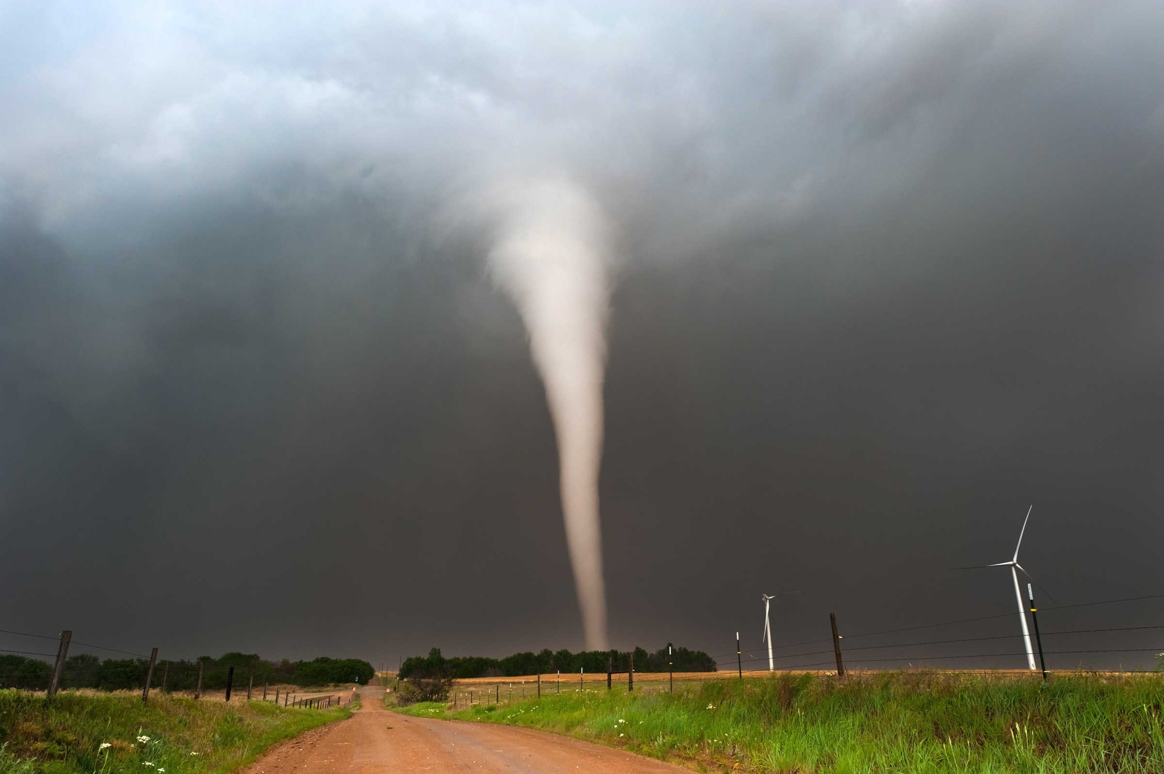
The nation is heading into what is traditionally the peak of severe weather season. The year 2023 has already seen a historically high number of severe weather events, including the second-most active January for tornadic activity. Here is what you need to know about what forecasters are predicting for the 2023 spring severe weather season.
It has already been a busy few months for storm chasers. January 2023 recorded 168 preliminary tornado reports, landing it behind only January of 1999 for the highest number of twisters reported during the first month of the year. The unusually high number of severe weather outbreaks continued through February and into early March. An outbreak in the South on March 2 and 3 was responsible for the deaths of at least 13 people.
March, April, and May are typically the most active months of the year for severe weather and this year is expected to be no different. The warm and moist air coming up from the Gulf of Mexico into the central U.S. will merge with the cold air dipping down from the north to create an active storm track.
The winter storms were fueled by unseasonably warm sea surface temperatures in the Gulf of Mexico over the past several months. This trend will continue in the coming weeks, providing the energy needed for storm development in the eastern and central portions of the country. In addition, the official end of the La Niña phase will change overall weather patterns in a way that sets the stage for a greater number of storms to take root.
Forecasters are predicting that the upcoming spring will see a series of surges in stormy activity. This includes the prediction of a handful of strong events across the Tennessee and Ohio valleys and the eastern Plains in March.
Cities under the threat of abnormally strong severe systems in March include Dallas, St. Louis, and Kansas City. These storms will bring a variety of threats, including strong winds, large hail, and tornadoes.
There will also be long periods of quiet and calmness in early April that may lull residents in Tornado Alley into a sense of complacency. However, forecasters are predicting that the severe weather will fire up again late in April and into early May. The threat of stormy conditions will expand into the far reaches of the Southeast, the Midwest, and the northern Plains.
The arrival of more widespread severe weather will include the risk of thunderstorm cells that can evolve into derechos. This weather event is more common in the last spring and early summer. While these derechos have typically hovered in the midwest and northern Plains, experts are predicting a higher number of these risks farther south than in the past.
How many twisters can you expect to spin up in 2023? Most experts are predicting that the number of tornadoes in 2023 will fall slightly below the historical average. The long-range forecast is calling for cooler and more stable air in place throughout the central U.S. in early April. This will limit the development of these twisters during the time of the year that traditionally sees a heightened amount of activity.
You can expect more widespread storms during the latter part of April as the temperatures begin to heat up. This risk will linger throughout May with about 225 to 300 twisters predicted for the U.S. this month. This number will likely hover in the average range for this time of the year.
The worst of the severe weather in the waning months of spring is predicted to unfold across the eastern Plains, through the Gulf Coast, and into the Tennessee Valley. It is notable that this is outside of what has always been Tornado Alley. The trend in recent years has been an eastward shift in the highest danger zone.
The shift in the worst of the activity has been blamed on the ongoing drought in the central and southern Plains states. According to the latest data from the U.S. Drought Monitor, the High Plains is currently under the worst drought conditions in the nation. This is especially true now that California has seen most of its drought erased because of a series of persistent winter storms.
The dry air and lack of humidity over this part of the country will hinder the development of severe storms, thereby also mitigating the threat of tornadoes. Storms that do fire up over the drought-stricken part of the country will produce beneficial rain, however, the strong winds and hail associated with these cells may also cause damage to crops.
As is typical for this time of the year, the stormy conditions will decrease in the central portions of the U.S. heading into the summer. However, the risk of summer storms will spread to a greater portion of the country.
Did you find this content useful? Feel free to bookmark or to post to your timeline for reference later.

January 21, 2024

January 19, 2024

January 18, 2024
