
Heavy Rain, Flooding, and Chance of Severe Weather Staring Down the Southern U.S.
January 22, 2024
Posted: September 11, 2023 2:00 pm


The temperatures are going to take a nosedive across the Plains states this week, ushering in weather that is more typical of the middle of October. It will feel particularly cool when compared to the unseasonably warm weather of the last few weeks. Here is what you can expect as you start the new week.
Temperatures Taking a Tumble Across Central Plains
In addition to the noticeably cooler temperatures, the shift in the weather pattern will also translate to greater chances of rain and thunderstorms for the central U.S. The mercury will fall between 10 and 25 degrees when compared to what the region saw this weekend.
The change will be the most noticeable across some areas of the southern Plains. The afternoon highs will top out in the 70s for areas such as Oklahoma City and Wichita. For instance, Wichita will see a high of just 71 degrees on Monday, pairing with intermittent rain showers. The temperatures may struggle to get out of the upper 60s by Thursday with a return to the 80s not expected until the weekend.
You will find a similar weather pattern in Oklahoma City with temperatures bouncing around in the upper 60s and 70s throughout the week. It will likely be next Sunday for the temperatures to reach the 80-degree mark again.
This will be the first time since the middle of June that these communities have seen daytime high readings plateau in the 70s. Instead, the temperatures will land in the range most typically seen during the middle of October.
It has been an unseasonably hot and long summer season for a large swath of the South Central U.S. Temperatures routinely eclipsed the century mark for days at a time in places such as Tulsa and Dallas. This past week brought heat advisories for much of central and southern Texas.
What is Behind the Drastic Shift in the Weather Pattern?
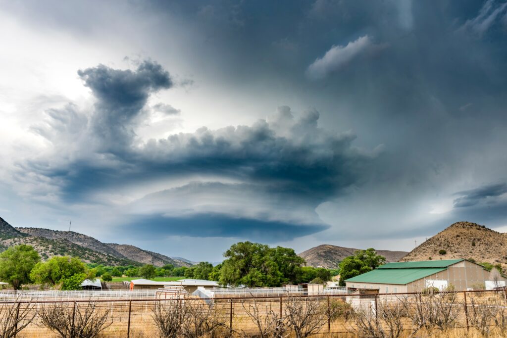
The upper-level air pattern circulating over the southern U.S. is beginning to break down, triggering the change in the weather. A small pocket of high pressure coming down from Canada is ushering in the cooler temperatures to start the week. The change will also increase the odds of rain for this drought-stricken region.
The rain first got started on Sunday as a disturbance pushed down from the Rocky Mountains in Colorado. This disturbance raised the risk of thunderstorm development for a large area stretching from Nebraska and down into the Texas Panhandle heading into the beginning of the new work week.
The threat of severe weather will be in place for the entirety of next week. This is good news for the portions of the Plains states that are dealing with moderate to exceptional levels of drought according to the latest data release from the U.S. Drought Monitor.
Unfortunately, the much-needed moisture may also come with the risk of strong winds and large hail. The immense moisture associated with this weather pattern could also be enough to trigger flash flooding through the southern Plains by the middle of the week. Be sure to enable all severe weather alerts if you live in this part of the country.
A secondary front moving to the southeast will create a higher chance of severe weather for a pocket in Kansas, Oklahoma, and Texas. Meanwhile, the warmest temperatures will remain in southern portions of Texas and across the Gulf States this week.
Even after the rain moves out of the central Plains later in the week, the cooler temperatures will remain through the start of the weekend. However, you can count on the mercury to trend upwards by Sunday.
Did you find this content useful? Feel free to bookmark or to post to your timeline for reference later.

January 21, 2024

January 19, 2024

January 18, 2024
