Heavy Rain, Flooding, and Chance of Severe Weather Staring Down the Southern U.S.
January 22, 2024
Posted: April 26, 2023 2:46 pm


An active storm track is setting up over the southern tier of the country this week, bringing with it a number of different weather events. These threats will track eastward into the weekend with a different part of the region seeing the impacts each day.
Here is a more detailed look at this forecast.
The Midwest and the Northeast will be under a mass of cooler air this week, helping to tame any potential storm development. However, it will be a different story over the southern U.S. where plenty of warm and moist air is available to fuel these storms.
The ingredients in place for these storms are not likely to be enough to fuel a significant amount of tornadic activity. But forecasters warn that it just takes one twister to touch down in an urban area to cause severe damage and deaths.
As always, be sure to have a storm plan in place prior to severe weather moving into your community.
It has already been a rocky week for weather over the southern Plains and across the Gulf Coast and into Florida. Many areas in Texas and in Florida reported hail up to the size of baseballs on Tuesday.
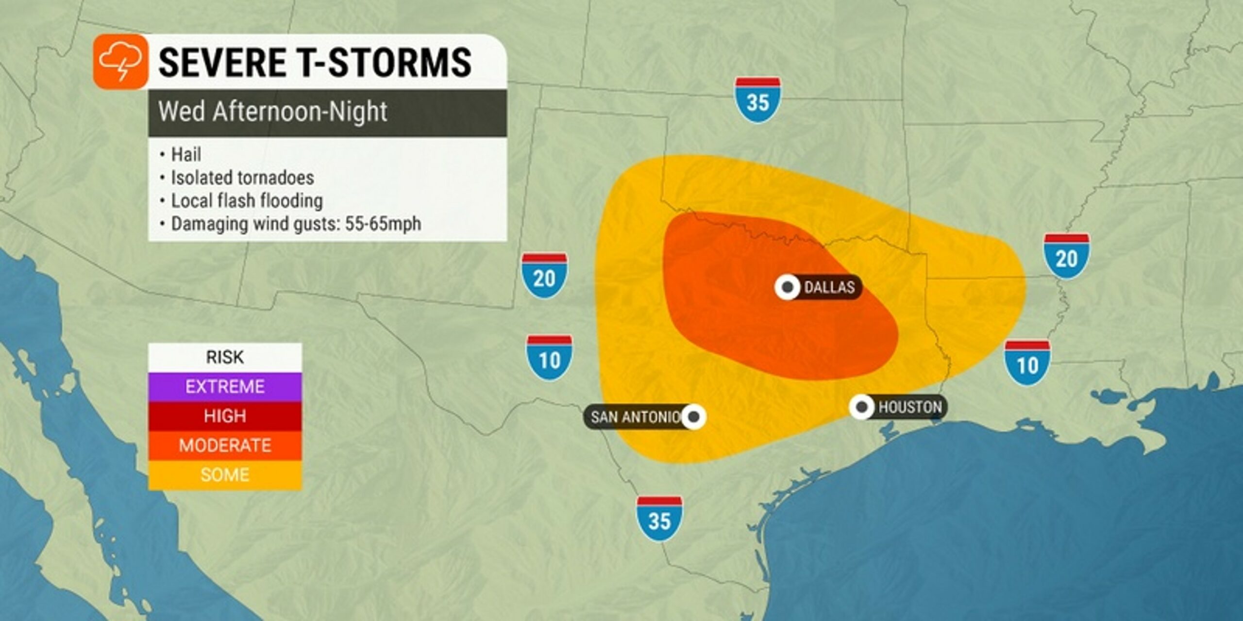
While it has been mostly calm on Wednesday morning, more severe weather is on tap for the afternoon and evening hours and into Thursday. The state of Florida is bracing for the potential for severe storms that bring frequent lightning strikes to the peninsula.
The Dallas/Fort Worth metroplex is also an area of concern late Wednesday. Forecasters are predicting that the worst of the storms may arrive just in time for the evening commute.
This line of storms could stretch to the northern suburbs of Houston, encompassing the major cities of Austin and San Antonio along the way.
By Thursday, the storm cells will push into the Gulf Coast, putting the states of Alabama, Louisiana, and Mississippi in the line of fire. These storms are forecast to develop early in the day and intensify later in the afternoon and evening.
Thursday’s weather forecast across the Gulf Coast is calling for the chance of strong winds, hail, lightning, flash flooding, and isolated tornadoes and waterspouts. The impact zone for Thursday’s severe weather includes New Orleans, Biloxi, Jackson, and Birmingham.
For instance, New Orleans is forecast to be under a constant threat of storms on Thursday with rainfall amounts that total about an inch.
The good news for the Sunshine State is that Thursday’s activity should mostly avoid that corner of the country. However, you cannot rule out the chance of an isolated afternoon thunderstorm.
Friday’s activity will focus on the Carolinas with more storms firing up again in Florida. This zone will also include cities in the Southeast such as Atlanta. Like the previous storms of the week, the primary hazards will be flash flooding and damaging winds.
As this weather maker is pounding the Southeast, a new storm system will come together in the southern Plains to end the work week. This will put central and eastern Texas back in the bullseye for potentially disruptive weather.
After seeing a brief respite from the severe weather on Thursday, soggy conditions are back in the forecast heading into the weekend for Dallas and its environs. Tornadic activity will also be possible with this weather event.
This line of storms will move to the east across the South over the weekend. Residents in this part of the country will want to keep tabs on this developing situation if they have outdoor plans on Saturday or Sunday.
Forecasters are still unsure how widespread this weather event will be.
Did you find this content useful? Feel free to bookmark or to post to your timeline for reference later.

January 21, 2024

January 19, 2024

January 18, 2024