Heavy Rain, Flooding, and Chance of Severe Weather Staring Down the Southern U.S.
January 22, 2024
Posted: May 18, 2023 6:00 am


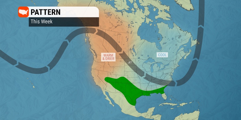
Multiple rounds of severe weather will bear down on the south-central U.S. through the end of the work week, bringing much-needed rainfall along with negative weather impacts to the region.
Here is a detailed look at what parts of the area will see the severe weather and when you can expect it to fire up.
According to the latest round of data from the U.S. Drought Monitor, much of the Plains states still remain under the designation of a moderate to exceptional drought. This will make any moisture this week a welcome sight. However, this rain will also come along with the typical severe weather risks.
A cold front is currently making its way from the northwest to the southeast across the central U.S. The cold front will merge with warm and moist air coming up from the Gulf of Mexico to usher in the possibility of afternoon and evening thunderstorms.
While Wednesday’s storm action came down from the Front Range of the Colorado Rockies to impact eastern Colorado and beyond, the risk of storms on Thursday will move farther into the nation’s heartland as the cells track to the south. West Texas will be in the primary impact zone for Thursday.
The storm cells will bring a number of weather hazards to this region on Thursday, including strong winds, large hail, torrential downpours, and isolated tornadoes.
The hard and dry ground present in this part of the country will not be able to take on heavy amounts of rain, creating the risk of excess runoff and localized flooding. The highest risk of flooding will be in low-lying areas of Oklahoma on Thursday evening.

The cold front will advance to the south and east by Friday, putting the Big Bend of Texas up through the lower Ohio Valley in the line of fire. Friday’s threat will encompass the heavily populated Dallas-Fort Worth metro area as well as Oklahoma City and Little Rock.
For instance, Dallas is forecast to see thunderstorms ignite in the latter part of the day. It will be steamy with a high approaching the 90-degree barrier.
Just a few hours up the road, the position of the cold front will bring cooler conditions to Oklahoma City. The state capital will see a high of only 73 degrees with overnight lows falling into the mid 50s.
Motorists traveling on portions of interstates 30 and 35 will want to be aware of potentially dangerous driving conditions such as ponding and reduced visibility on the roads. Anyone with outdoor plans will also want to stay informed about any storm development.
This is a good time to remind people that lightning strikes can quickly turn deadly. A 34-year-old man lost his life after being struck by lightning in Bosque County on Monday afternoon. His six-year-old son was also critically injured as he was holding his father’s hand when lightning struck.
The only silver lining of the inclement conditions will be the possibility of meaningful rainfall. This part of the country could certainly use the moisture, particularly heading into the hot and dry summer months. Although this rain will not erase the drought, it could go a long way in getting a head start on mitigating the dryness.
The long-range forecast indicates that this pattern of intermittent rain and thunderstorms will continue through the end of May. However, the bulk of the rain will come from localized thunderstorms rather than widespread soakers. This means that some areas could completely miss out on the beneficial moisture.
Did you find this content useful? Feel free to bookmark or to post to your timeline for reference later.

January 21, 2024

January 19, 2024

January 18, 2024