Heavy Rain, Flooding, and Chance of Severe Weather Staring Down the Southern U.S.
January 22, 2024
Posted: September 9, 2022 10:03 am


Tropical Storm Kay to Cool Down the Mercury and Bring Widespread Rain to Southern California and the Southwest
While most of the attention has been on the rapidly intensifying Hurricane Earl in recent days, two more tropical features of note are also on the radar of the National Hurricane Center (NHC). Western Europe is bracing for the impacts of what was once Hurricane Danielle while Southern California may see a significant amount of moisture from the remnants of Tropical Storm Kay.
Danielle was distinguished as the first hurricane of the 2022 Atlantic hurricane season after it formed in the open waters of the Atlantic on September 1. Since that time, the storm has meandered around the Atlantic without threatening any major land masses. However, that is all about to change in the coming days as Danielle moves closer to Western Europe.
The feature is now a tropical rainstorm and is not expected to intensify further at this point. Despite falling apart as a hurricane, Danielle is still boasting a large amount of moisture that could wreak havoc on Portugal, Spain, the United Kingdom, Ireland, and France beginning on Sunday and continuing into next week.
The storm is currently located about 700 miles from the Azores and 800 miles west of Portugal. While Danielle was packing sustained winds of 65 mph on Thursday, it is forecast to weaken as it meets unfavorable environmental conditions that will hinder its development. For instance, Danielle is now moving into colder water and is encountering higher amounts of wind shear to break it up.
Danielle is predicted to keep its status as a tropical rainstorm as it moves closer to the coastal areas of Portugal by Sunday. The storm will be capable of dumping a large amount of widespread rain throughout Western Europe.
While it is still too early to predict with certainty, forecasters expect that the heaviest amounts of rain will fall in central and northern Portugal and into the far northwestern corner of Spain. Southern Ireland may also be the target of this significant precipitation through at least Monday.
Much of Western Europe is in the throes of some level of drought, making the rain a welcome sight. However, the dry ground could repel the rain and trigger flash flooding. Danielle may also produce damaging wind gusts of up to 60 mph along the coastal portions of Spain, Portugal, and France.
The storm is expected to break apart by Tuesday as it moves farther inland. However, the remnants of the system could bring the chance of rain and stormy conditions throughout the bulk of Europe for a longer time period.
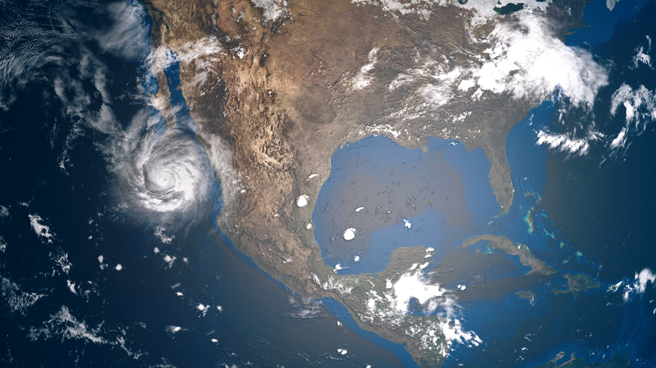
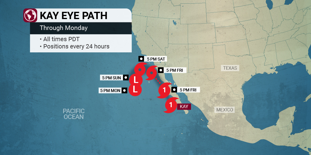
The East Pacific is also heating up lately. What was once Hurricane Kay is now Tropical Storm Kay bearing down on Southern California. Kay is currently located near the coastal region of Baja California, Mexico. Although the storm system will not make a direct hit on the U.S., it will skirt close enough to deliver some much-needed relief from the dry conditions and ongoing heat wave.

As of late Thursday, Kay was featuring sustained winds of 70 mph as it moved to the north and northwest at 14 mph. Tropical storm warnings were issued for the Mexico coastline stretching from north of Punta Abreojos to San Jose De Las Palomas. Some portions of both the west and east coasts of the Baja California Peninsula were also put under these warnings.
Some of the outer bands of Kay were already hitting the southern tier of California. This rain is forecast to become more widespread as Kay continues its track to the north. The tropical moisture will bring relief to areas as far as central Arizona and southern Nevada. This could spell a soggy weekend for vacationers in Las Vegas and Phoenix.
Southern California will take the brunt of the rain with cities such as San Diego and Los Angeles forecast to see 1-2 inches of precipitation. To put that amount into perspective, both of these cities typically average less than a quarter of an inch of rain in all of September.
The higher terrains of Southern California can expect to see measurements totaling 2-4 inches with localized amounts of up to 8 inches in the picture. The mountainous areas will also be the most likely to see the damaging wind gusts.
The thunderstorms paired with the strong winds could elevate the wildfire risk in a region of the West that is already under immense drought conditions. According to the U.S. Drought Monitor, over 97% of the Golden State is under the designation of a moderate drought or worse. While the moisture will certainly help the crews currently battling fires, lightning strikes combined with wind gusts are never a good pairing when the vegetation is already so dry.
Did you find this content useful? Feel free to bookmark or to post to your timeline for reference later.

January 21, 2024

January 19, 2024

January 18, 2024