
Heavy Rain, Flooding, and Chance of Severe Weather Staring Down the Southern U.S.
January 22, 2024
Posted: August 28, 2023 12:52 pm


A hurricane warning is in effect for a portion of the west coast of Florida as Tropical Storm Idalia is forecast to quickly strengthen into a major hurricane before it makes landfall. Here is the latest on this developing tropical weather situation that is taking place in the Gulf of Mexico.
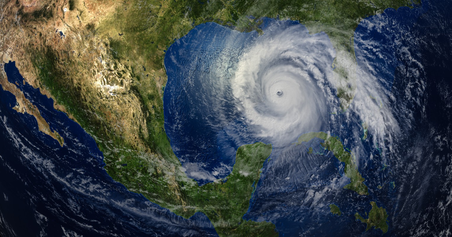
Residents of Florida are being warned of the good possibility of a major hurricane landfall on Wednesday. Tropical Storm Idalia is currently churning to the west of the extreme western portion of Cuba. Idalia is sporting maximum sustained winds of 65 mph as it moves in a slow motion. The storm is predicted to begin to intensify as it starts its journey to the north and finds the warm waters of the eastern Gulf of Mexico.
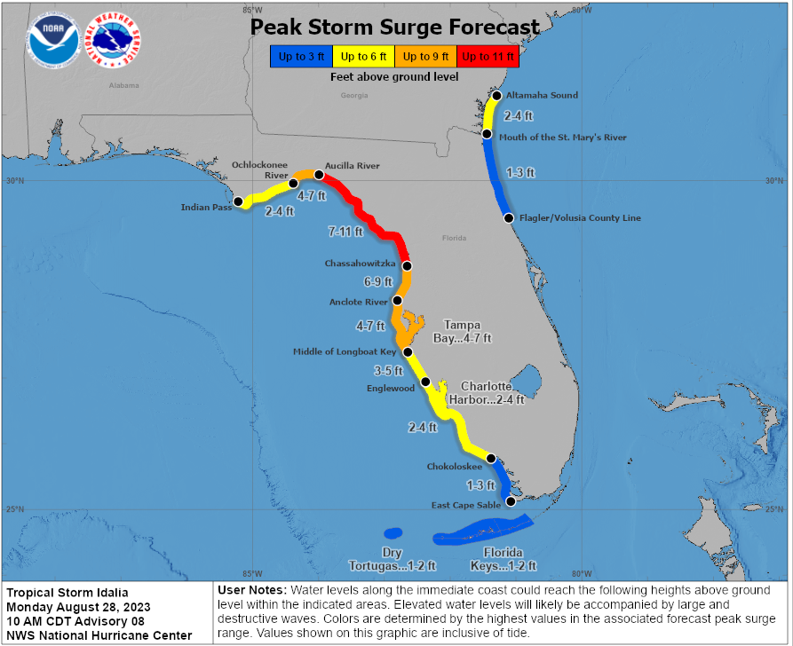
The current models indicate a landfall around the Big Bend area of the Sunshine State. Communities in this impact zone include Panama City, Apalachicola, Steinhatchee, and Cedar Key. This part of the state will be at risk of life-threatening storm surge, heavy rain, and destructive winds.
The hurricane warning encompasses the west coast of Florida stretching from the eastern edges of the Panhandle to just south of the Tampa Bay area. The other portions of the state’s Gulf Coast are under tropical storm warnings or watches. This includes all of the Florida Keys.
Hurricane watches are in effect for the metropolitan areas of Jacksonville, Tallahassee, and Punta Gorda. In addition, Idalia is predicted to impact the southeastern U.S. later in the week. States under the gun include Georgia, the Carolinas, and Virginia.
While the exact landfall location is still unclear, forecasters are growing more certain that Idalia will bring some level of significant threat to Florida. Once Idalia begins moving through the Gulf, it will not be able to exit this part of the ocean without moving onto land. The bathwater-like sea surface temperatures in this part of the Gulf will pair with low amounts of wind shear to provide fertile growing conditions for Idalia in the coming hours.
Experts at the National Hurricane Center (NHC) are warning that Idalia could undergo a period of rapid intensification before landfall. This process is defined as an increase in maximum winds of at least 35 mph over a time period of just 24 hours or less.
Idalia is already bringing heavy rain and strong winds to Mexico’s Yucatan Peninsula and western Cuba. Gusts of up to 75 mph are a possibility. Rainfall amounts of 4 to 8 inches are in the forecast for this part of the Atlantic basin.
Florida is forecast to see the worst of Idalia’s impacts. In addition to the torrential rain and damaging winds, the storm will also usher in a high threat of flooding and storm surge.
While there is still time for the models to change, the current prediction is estimating that Idalia will hit Florida as a major Category 3 hurricane. This categorization translates to winds of 111 to 129 mph.
The immense moisture associated with this feature will bring an expected 4 to 8 inches of rain in northern Florida and up into the southeastern U.S. There is also the threat of isolated tornadoes spinning up to the east of the hurricane’s eye.
Idalia is not expected to be done once it moves through Florida. While it will gradually begin to lose steam as it moves over land, the storm will still bring notable impacts to the Southeast. The feature is forecast to interact with a stalled frontal boundary over this corner of the country.
A large swath of land into eastern Georgia and the Carolinas could see up to 8 inches of rain pairing with winds of 40 mph through the last part of the week. This forecast could spell trouble for those hoping to get outside and enjoy the long Labor Day weekend.
Beachgoers along the Gulf Coast of Florida and the southeastern Atlantic coast will need to pay attention to any applicable warnings. The storm will likely generate rough surf conditions and dangerous rip currents in the days surrounding its arrival.
The impacts of Hurricane Franklin spinning out in the central Atlantic Ocean will also bring the chance of less than ideal beach conditions up and down the East Coast through the week. There is also the chance that the tracks of Franklin and Idalia could cross as they both move out into the Atlantic.
With the formation of Tropical Storm Idalia on Sunday, there have now been 10 named storms forming during the 2023 Atlantic hurricane season. The statistical peak of this season is September 10, meaning that the activity is likely to increase further in the weeks to come.
Did you find this content useful? Feel free to bookmark or to post to your timeline for reference later.

January 21, 2024

January 19, 2024

January 18, 2024
