Heavy Rain, Flooding, and Chance of Severe Weather Staring Down the Southern U.S.
January 22, 2024
Posted: November 2, 2022 10:10 am


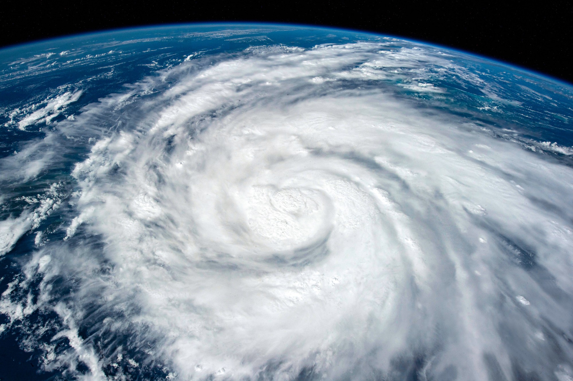
Tropical Storm Martin sprung to life over the open waters of the Atlantic Ocean to the northeast of Bermuda on Tuesday. Martin is now the second active tropical storm in the Atlantic basin, pairing with Lisa as the 2022 season heads into its last month.
Tropical Storm Martin formed with the leftover energy and moisture from the storm system that hammered Puerto Rico and parts of the U.S. Virgin Islands last week. In addition to the strong winds, this group of islands also saw torrential rain out of this disturbance. The weather maker almost disappeared over the weekend when it encountered strong wind shear in the atmosphere. However, the feature was able to find the strength to reorganize on Monday into Tuesday.
The National Hurricane Center (NHC) named the feature Tropical Storm Martin after its associated showers and thunderstorms were able to form around the area of low pressure in the center of the system.

As of Tuesday, the storm was positioned about 550 miles northeast of Bermuda and moving to the east at 12 mph. Tropical Storm Martin is packing sustained winds of about 50 mph.
Despite its rapid growth in intensity, the storm is not likely to hang around for long. Forecasters are predicting that it will devolve into a non-tropical feature by the middle of the week. In the short term, it could potentially strengthen into a Category 1 hurricane before it breaks apart.
Tropical Storm Martin is not expected to threaten any landmasses. However, that does not mean that the U.S. is out of the woods. Hurricane experts are zeroing in on the waters located along the southeastern coast of the U.S. as an area of potential development.
This area has historically been a hotbed of tropical activity action over the month of November. The western parts of the Atlantic Ocean and the Caribbean Sea are also areas to keep an eye on moving into the tail end of hurricane season, officially ending on November 30.
Forecasters are predicting that a storm will form over the central and western Caribbean into the Bahamas later this week and into the weekend. A series of showers and thunderstorms are likely to develop due to the low pressure and rich moisture in this area of the basin. Any of these clusters of storms could then take on tropical characteristics.
Should a named storm form out of this cluster, it would take on the name Nicole. This feature is forecast to move to the northeast in the direction of Florida and the southeastern U.S. coast. The system will likely bring heavy rain to the Atlantic coast by next week even if it never forms into a named storm.
In addition, the feature is predicted to churn up the seas throughout the western Atlantic and into the Caribbean. This could impact the global shipping business and leisure cruisers. Coastal areas up and down the East Coast from the mid-Atlantic toward New England may experience beach erosion and flooding due to the combination of the moisture with this system and the easterly winds.
With the formation of Tropical Storm Martin, the 2022 Atlantic hurricane season now has 13 named storms on its list. Five of the storms evolved into hurricanes with two major hurricanes in Fiona and Ian, both Category 4 storms. Hurricane Ian came within 2 mph shy of reaching the status of a Category 5 storm, bringing billions of dollars of damage to Florida and beyond.
With one month left to go, the system has been quieter than forecasters had predicted earlier in the year. An uncharacteristically quiet period in July and August contributed to the lower amount of storms this year.
Things have been heating up as of late with two tropical storms now spinning in the basin, making it the only the third time in recorded history that there has been more than one storm in the Atlantic at one time. In addition to Tropical Storm Martin, Tropical Storm Lisa is now churning closer to the coast of Central America. Meteorologists are predicting that it will likely hit hurricane status prior to an anticipated landfall in Belize on Wednesday night.
There is also the chance that Lisa could change direction slightly and run into Honduras instead. Should this happen, the storm would likely strike about 10 – 12 hours earlier on Wednesday.
Did you find this content useful? Feel free to bookmark or to post to your timeline for reference later.

January 21, 2024

January 19, 2024

January 18, 2024