
Heavy Rain, Flooding, and Chance of Severe Weather Staring Down the Southern U.S.
January 22, 2024
Posted: June 2, 2023 9:00 am


The U.S. is currently at the peak of tornado season. These often deadly funnels have been confirmed in all 50 states at various times of the year, peaking from late April through June. As one of the most violent forces of nature, tornadoes have fascinated meteorologists for years.
While there is still a lot to learn about this extreme weather event, scientists have a good understanding about how a tornado forms. Here is a look into the formation of tornadoes.
The most important thing to know about tornadoes is that every twister is unique. There is no proven formula to ascertain what types of storms will definitely spin up tornadoes.
Some tornadoes form in conditions that would not necessarily appear to be conducive environments for storm development. This unpredictable nature is what makes tornadoes so inherently dangerous.
To learn about tornado development, you have to first understand thunderstorm development. Air rises as thunderstorms take root, sending the clouds higher and higher.
The warm air rising within the cell sends these clouds higher into the sky, forming the fluffy white cumulus clouds associated with thunderstorms. The clouds will continue to soar higher prior to rain forming.
One of the last steps in thunderstorm development is when the bottom of these tall clouds begin to become darker. This is when you also may notice the top of the clouds flattening, producing the shape of an anvil that signals that the cold air located in this portion of the sky could produce hail.

The most severe thunderstorms are known as supercells. This happens when warm air rises, sending the cold air down toward the ground. The movement of this air creates greater winds within the storm, a term known as wind shear.
The wind shear is what encourages the storm to rotate and intensify into a supercell. Wind that is able to switch directions at different heights lays the groundwork for the spin that fires up within a thunderstorm cloud.
In addition to wind shear, a supercell is distinguished by the presence of instability in the atmosphere, supporting the development of the severe weather elements. A supercell is known for its ability to produce torrential rain, lightning, strong winds, and hail.
Many people are familiar with what weather experts refer to as a gust front. This is the wind that picks up just before the rain begins to fall. A gust front happens when cooler air is pushed down from the storm cloud prior to the rain’s arrival.
If a supercell is in your area, you can count on some type of severe weather in its vicinity. However, the National Oceanic and Atmospheric Administration (NOAA) says that only 30% or less of all supercells produce tornadic activity.
The downdraft within the supercell is what works to form the actual tornado. This force of drier air is pushed downward, wrapping around the backside of the storm in the process.
While an updraft lifts the horizontal air column as the warm air rises, the downdraft pushes the dry air down from the storm in a vertical motion.
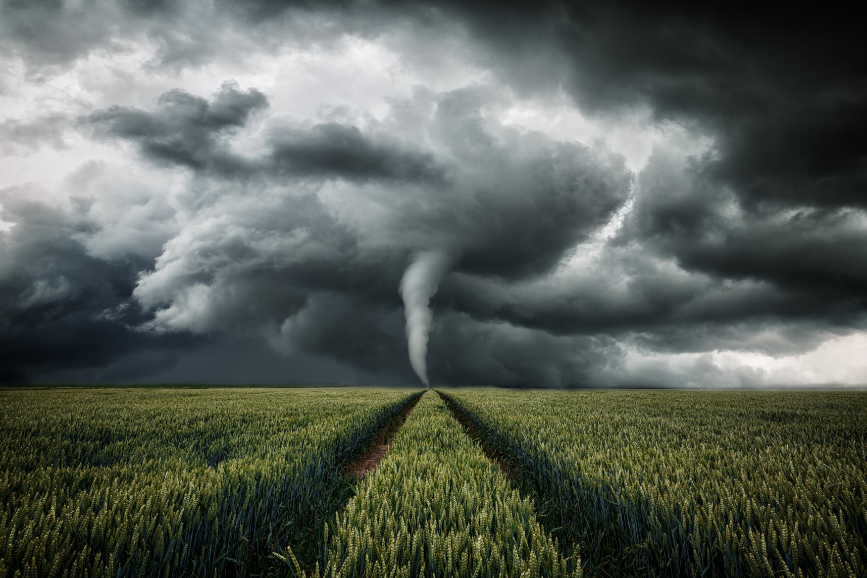
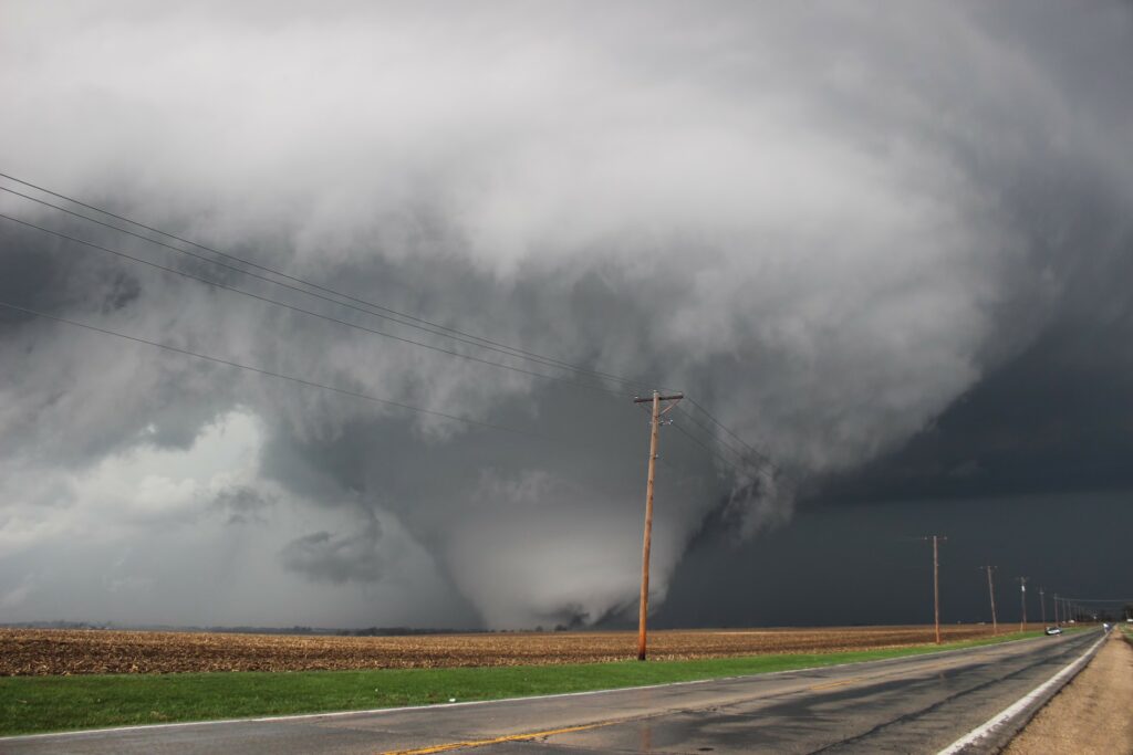
These two types of drafts work together to pull down the horizontal column of air to make the tornado. In scientific terms, meteorologists call the vertical cloud of air a funnel cloud. Once it touches the ground, it takes on the tornado name.
Tornadoes can be spotted by looking for what is known as a wall cloud. This forms when the cloud base lowers and turns into the spinning vortex of air. Wall clouds hover lower than the rest of the storm cell, rotating in a circular motion as it moves.
One of the most perplexing aspects of tornadoes is how they can disappear just as quickly as they form. A tornado typically dies out once it is removed from its source of moist and warm air that serves as its fuel. This air can come and go quickly as the originating thunderstorm changes its behavior.
These supercells can also merge with other nearby storms and form a squall line. This formation typically leads to the end of any tornadic activity within that supercell.
That said, squall lines should still be taken seriously as they also can produce a number of life-threatening hazards. Additionally, squall lines can go on to produce their own separate tornadoes.
Did you find this content useful? Feel free to bookmark or to post to your timeline for reference later.

January 21, 2024

January 19, 2024

January 18, 2024
