Heavy Rain, Flooding, and Chance of Severe Weather Staring Down the Southern U.S.
January 22, 2024
Posted: April 19, 2023 8:54 am


The spring season has been off to a typically tumultuous start for the eastern half of the country. The Northeast will continue to see this weather whiplash into the weekend with greatly fluctuating temperatures and the arrival of yet another storm system.
Here is an update on the upcoming forecast for this corner of the U.S.
The record-breaking warmth of late last week in the Northeast was quickly erased over the weekend when a new cold front moved into the region. The arrival of the front sent the mercury plummeting up to 40 degrees in a period of just a day or two in some communities.
Tuesday brought more chilly weather to the area, however, warmer temperatures are on the way for the remainder of the work week.
After seeing temperatures cold enough to support the development of snow in some parts of the northern U.S., the mercury will begin to inch up again on Wednesday. Residents can expect temperatures that hover right around normal for the middle of April in most portions of the Northeast.
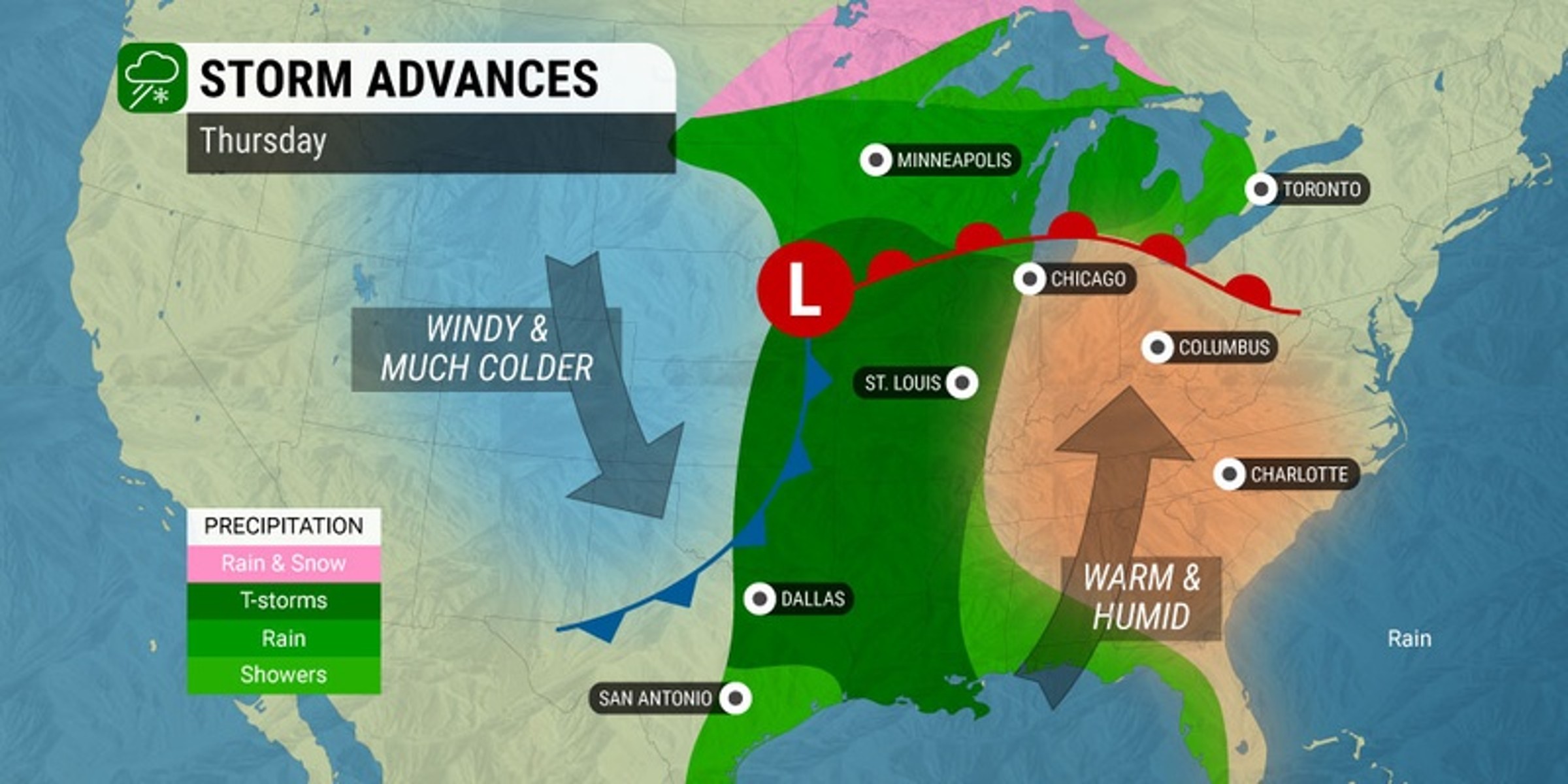
A more robust warmup is in the cards for Thursday. While it is unlikely that any high temperature records will fall with this next surge of warmth, it will be noticeably warmer than the previous two days.
For instance, temperatures will land in the mid 80s in western Pennsylvania after seeing highs in the 40s just 48 hours earlier.
Residents in the Northeast can look forward to one more day of unseasonable warmth on Friday. It will likely be late Saturday before the Northeast experiences the effects of this frontal boundary.
The first sign of the front’s arrival will be increasing winds across parts of the Ohio Valley and into the interior Northeast.
New York City will see highs in the mid 70s to close out the work week with mostly sunny conditions. The pleasant conditions will stick around for most of Saturday before the change begins with the arrival of rain in the evening and overnight hours.
The cooldown will happen earlier in Pittsburgh with temperatures falling from the low 80s on Friday to the low 70s on Saturday. High readings will plummet into the upper 40s by Sunday.
The Great Lakes will begin to see the impacts of the cold front by later in the day Friday. For instance, Detroit will head from a forecast high of 82 degrees on Thursday followed by a high of just 60 degrees on Friday.
Saturday’s forecast is calling for rain and a high of 51 degrees with the temperature falling into the upper 40s for a high on Sunday.
The mercury will continue its downward trajectory on Sunday into the coastal Northeast. Do not be surprised to see readings that fall as much as 20 to 30 degrees from Friday to Sunday across the Northeast and beyond.
The unsettled weather pattern across the eastern half of the U.S. also resulted in two tragic fatalities last weekend as a result of lightning strikes, marking the first known deaths attributed to lightning this year in the country.
The first incident happened on Saturday in Chester, Pennsylvania. Authorities report the lightning struck a tree, sending a large branch on top of a vehicle. The driver was killed while a passenger was treated for minor injuries.
A 39-year-old man lost his life in Brevard County, Florida on Sunday when lightning struck a boat on the Indian River. Another passenger on the boat was taken to a hospital for treatment.
In addition to being distinguished as the first lightning deaths in 2023 in the U.S., the tragedies were also the first known fatalities blamed on lightning in April since 2018.
The National Oceanic and Atmospheric Administration (NOAA) said that lightning strikes kill between 20 to 30 Americans each year. The year 2022 recorded 19 deaths due to lightning with the bulk of these happening in Florida.
This is a good time of the year to enable all smartphone notifications so that you know when severe weather is approaching your community.
Did you find this content useful? Feel free to bookmark or to post to your timeline for reference later.

January 21, 2024

January 19, 2024

January 18, 2024