Heavy Rain, Flooding, and Chance of Severe Weather Staring Down the Southern U.S.
January 22, 2024
Posted: December 21, 2022 11:55 am


Millions of Americans are anxiously checking out the weather forecast wondering if it will impact travel plans ahead of the Christmas holiday. The news is not good for those across the central and eastern U.S. A cross-country storm that began to dump snow in the Pacific Northwest on Monday is now moving through the central U.S. on its way to the East Coast.
Next up to see the weather impacts will be the central U.S. A host of winter storm watches have been issued in advance of the system, threatening to make it difficult for people to get out on the roads for that last-minute holiday shopping. Travelers will also be impacted by the storm. According to the American Automobile Association (AAA), well over 112 million Americans are predicted to travel more than 50 miles from their homes in the time period between December 23 and January 2.
The storm system picked up steam while out in the Pacific Ocean before moving onshore late Monday. Seattle woke up to a winter wonderland on Tuesday with several inches falling in some of the city’s suburban areas and surrounding foothills. The snow then pushed into cities such as Spokane.
The snow line will continue to move to the east in the coming days, bringing the chance of significant accumulation to the Rocky Mountains, the northern Plains and the Upper Midwest. Minneapolis will be under the gun for more snow with the precipitation being significant enough to impact travel through major airline hubs. Even areas not seeing any snow may feel the ripple effects of this storm system.
The storm will eject out of the Rockies by Wednesday night before moving to the south by early Thursday morning. Flakes may fly as south as Kansas by the time the sun comes up Thursday.

Winter storm watches were issued for over 10 states in the nation’s heartland with many major cities in this potential zone of impact. This includes the metropolitan areas of Kansas City, St. Louis, Des Moines, Minneapolis, and Chicago. There is also the chance that these watches may be upgraded to warnings in the hours ahead.
The wintry precipitation is forecast to shift into the Great Lakes and the Ohio Valley as the day continues Thursday. The north and west sides of the storm’s trajectory could see 6 to 12 inches of snow. Even more snow may fall downwind of the Great Lakes.
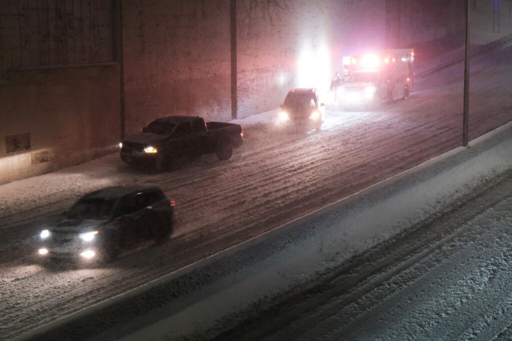
Americans hoping to get an early start on the holiday weekend by heading out on the roads may encounter difficult travel conditions across portions of interstates 55, 70, 80, and 90. In addition to snow, some of these roadways may turn icy in the days ahead.
Forecasters are warning that the swift intensification of this massive weather maker will likely fall under the designation of a bomb cyclone. A storm undergoes the process known as bombogenesis when the low pressure area strengthens so quickly that the barometric pressure within the center of the system falls at least 0.71 of an inch in a period of just 24 hours.
The rapidly dropping pressure ushers in high winds that swirl around at the center of the system. These strong winds are predicted to churn up along the back side of the storm, measuring over 40 mph in an area stretching from the northern Plains down to the coastal areas of Texas.
This snow and wind will pair to create the possibility of blizzard conditions across several states in the Midwest, including Kansas, Iowa, Nebraska, Missouri, Indiana, Illinois, Michigan, and Wisconsin.
A blast of frigid air will also be a distinguishing feature of this storm system. This means that any moisture that falls is not likely to melt for some time. Roads will continue to be dicey on Christmas Eve and Christmas Day throughout much of the Midwest.
Real feel temperature readings will drop below zero in any areas with the wind blowing. The southern edge of the storm will likely see precipitation in the form of ice rather than snow. For instance, cities such as Little Rock, Louisville, Nashville, and Atlanta may see rain that freezes up on the roads after the temperature drops in the overnight hours Thursday and Friday.
This rapid freezing will undoubtedly make travel challenging across a significant section of Interstate 40 and potentially Interstate 20 in the Southeast. Even a small amount of snow can turn treacherous if the Arctic air gets a hold of the region and causes moisture on the roads to freeze. This intrusion of bitterly cold air is forecast to begin to march through the central U.S. and into the Southeast beginning late Wednesday.
Areas of ice and patchy snow will be a possibility to close out the week in parts of Oklahoma, Arkansas, Tennessee, and Kentucky. The wintry precipitation may reach as far south as the northern tier of Mississippi, Alabama, and Georgia. By the end of the week, it could be messy along the western edges of North Carolina and Virginia.
Be sure to be diligent about regularly checking the weather forecast in your area as well as at the destination of any of your travel plans. You may need to pack your patience to reach your final destination.
Did you find this content useful? Feel free to bookmark or to post to your timeline for reference later.

January 21, 2024

January 19, 2024

January 18, 2024