
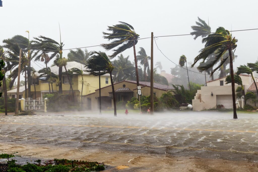
Heavy Rain, Flooding, and Chance of Severe Weather Staring Down the Southern U.S.
January 22, 2024
Posted: May 5, 2023 1:03 pm


Millions of Americans have already got their first taste of summer with temperatures that soared well above normal throughout much of the eastern half of the country.
Will this unseasonably early start to the season be a harbinger of things to come? Here is a look at the long-range summer forecast for different portions of the U.S.
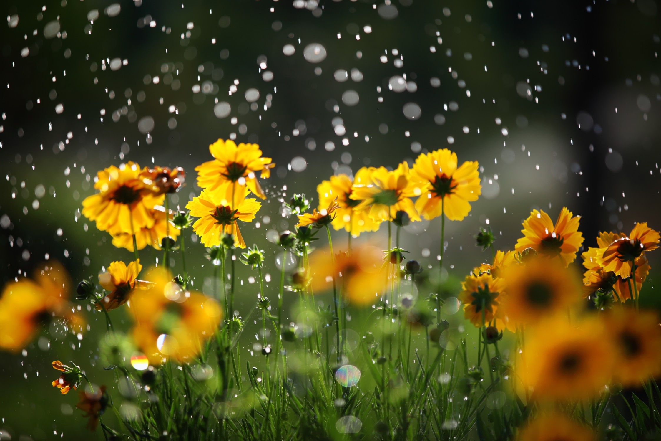
It will be a wet and muggy start to the summer in the Midwest and the Northeast. This is similar to the weather pattern that distinguished the start of the season last year. It may be August before dry and hot conditions become the widespread norm.
August will be the best bet to plan that outdoor-centric vacation or family reunion at the park. While you can never guarantee dry conditions, this month will feature the greatest chance of dodging rain.
On the flip side, it will also be the hottest at the end of the summer with the mercury forecast to take its time to climb in this part of the country.
The number of days that top the 90-degree threshold will be higher than the seasonal average in Midwest cities such as Chicago.
However, it will be the opposite situation in the Northeast with fewer days in the 90s in the long-range forecast for places such as New York City and Boston. This will be a change from 2022, a summer that saw more heat waves than normal.
Forecasters warn that the hotter and drier conditions predicted in the latter half of the summer for the East Coast could translate to drought conditions heading into the fall.
It was an unseasonably warm winter for the Southeast thanks in part to water temperatures across the Gulf of Mexico and the southwestern corner of the Atlantic Ocean trending higher than normal.
These warm sea surface temperatures could be enough to create what hurricane experts call “homegrown” tropical weather events.
Rather than originating off the coast of Africa like most tropical features, these homegrown events churn up on their own off the coast of the U.S. during times of conducive development.
Although most experts are aligned in their predictions for an average hurricane season, it could get an earlier start in the Southeast thanks to these warmer than normal ocean water temperatures.
At the very least, these temperature levels will boost humidity levels and the chance of rain and severe weather during June and July for the Southeast.
Like the Midwest and the Northeast, the end of the summer will likely usher in drier conditions along with more heat.
Like last summer, an ongoing drought will likely mitigate the frequency of tornado activity across the southern Plains and the nation’s heartland. A severe drought in an area stretching from Texas up through Nebraska in 2022 also limited the development of storms.
These dry conditions are even more widespread this year, leading to the prediction of a relatively calm storm season for the central Plains.
So what part of the country will see the greatest risk of severe weather? It has already been a stormy start to 2023 across a large zone of the U.S., including a record number of confirmed tornadoes for the first three months of the year.
The areas most likely to see frequent rounds of severe weather include the Midwest, the Northeast, the Great lakes, the Ohio Valley, and the north-central Plains.
This prediction for widespread storm activity will put a number of major metropolitan areas on high alert during June and July. This includes the cities of St. Louis, Chicago, Kansas City, Des Moines, and Minneapolis.
While the risk of thunderstorm development is predicted to be slightly lower in New England this summer, some parts of the mid-Atlantic are predicted to see a higher incidence of storms. This includes the Washington, D.C. and Baltimore area.
It may take longer for summer to arrive in full force across the western U.S. It was an unusually wet winter for most of California. The leftover moisture sitting in the ground will combine with the cooler than average water temperatures in the coastal Pacific to slow down the arrival of summer for the West Coast.
It will be a particularly slow launch to summer along the coast of California where clouds and fog will keep the temperatures suppressed.
The northern Rocky Mountains and the interior portions of the Northwest will see some bursts of warmth in the early part of the season, however, it will take time for the heat to truly set in across the region.
The slow start to summer will pair with a slow start to the annual North American monsoon season across the Southwest. The monsoon season fired up during the middle of June the past two years. Forecasters are predicting that the widespread rain and wind will not get going in earnest until July this year.
As always, the biggest concern with monsoon season will be the dry lightning that these storms produce. The timing of a later monsoon season is not necessarily good news as the peak of wildfire season kicks into high gear at about the same time.
The La Niña phase is coming to an end after three years in charge of the weather patterns around the globe. While its counterpart El Niño is not yet fully entrenched, its impacts will begin to be felt starting this summer.
How quickly the El Niño pattern develops and strengthens will determine its influence on the summer weather patterns.
Forecasters are expecting the El Niño phase to dominate the weather patterns in North America into at least early 2024. Stay tuned to see how this develops in the coming months.
Did you find this content useful? Feel free to bookmark or to post to your timeline for reference later.

January 21, 2024

January 19, 2024

January 18, 2024
